Why do poor school kids have to clean up rich commuter’s pollution?

The fundamental injustice of pollution from urban freeways

Item:  In the past two years, Portland Public Schools has spent nearly $12.5 million of its scarce funds to clean up the air at Harriet Tubman Middle School.  This money will buy an expensive state-of-the-art air filtration system that will make the air inside the school safe for students to breathe.  Scientists from Portland State University, who conducted an air quality assessment of the site–at a cost of an additional half million dollars–have warned the students against exercising outside because of poor air quality.

And make no mistake, pollution from cars is a threat not just to the health of students, but to their ability to learn as well. A recent study shows that pollution from cars and trucks lowers student performance in schools near highways.  Students attending schools located near and downwind from busy highways had lower rates of academic performance, higher absenteeism and higher rates of disciplinary problems than those attending less polluted schools. The more traffic on nearby roads, the larger the decline in scores on state standardized tests.

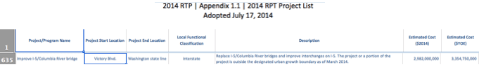
Tubman School faces a further increase in air pollution from the proposal of the Oregon Department of Transportation to spend a half billion dollars to widen the portion of Interstate 5 that runs right by the school.  The freeway-widening project will cut away a portion of the hillside that now separates the freeway from the school, moving the cars and trucks still closer to the building, and also increasing their volume—and the volume of pollution they emit.

This video shows how the freeway would be moved closer to Tubman Middle School.

So, here’s a question:  Why is the school district paying for the pollution controls?  Why aren’t the 120,000 vehicles that drive past the school every day paying for it?  They’re the ones creating the pollution and benefitting from the freeway.

As we pointed out earlier at City Observatory, the gravity of this question is underscored by the huge disparity in the demographics of those who use the freeway, especially at peak hours, and those who attend Tubman Middle School.  Peak hour, drive-alone commuters from Clark County, Washington have average household incomes of $82,500; and 75 percent of them are white, non-Hispanic.  More than two-thirds of Tubman students are people of color; and half the student body is poor enough to qualify for free or reduced price meals.

In a very real sense, what this does is make students pay for the costs of pollution.  The millions and millions of dollars being used to pay to install and operate air filters is money that isn’t available to pay for books and teachers. Meanwhile, freeway users get a free ride. This is plainly unfair.

Who was here first?

So why did Portland Public Schools build a school next to a freeway in the first place?  If they did so, then clearly, they must bear a big part of the blame for the fact that kids have to breathe here.  What makes this whole situation even more unfair is that, actually, the school was here first.  Lest there be any doubt, take a look at this aerial photo showing the construction of Interstate 5 in 1962.  (The Tubman School is outlined in red).

Source: City of Portland Archives, 1962.

When it was built, Tubman School stood on a bluff, overlooking the city of Portland.  The Oregon State Highway Department, following the advice of Robert Moses, cut away the hillside and dropped the freeway right next to the school.  So if the school was there first, why isn’t ODOT paying to clean up the air its students have to breathe?

Well, back in the 1960s, highway departments, Oregon’s included, seldom paid for any of the damage they did to cities.  As we’ve noted, the Oregon Department of Transportation obliterated hundreds of homes in this neighborhood and did nothing to replace the lost housing. Back then, air pollution was a greatly under-appreciated problem. Years after I-5 was built, ODOT did install some concrete walls to attenuate freeway noise in North Portland, but as to air pollution, nothing.

The Coase Theorem

Here’s where things get a bit wonky, at least for economists. There’s a famous conjecture in economics called the Coase Theorem which at its root is based on a story very much akin to that of the the freeway and the school.  Coase’s story is about a farmer and a railroad, in this case, an old fashioned steam-powered railroad, with smoke-and-spark belching engines. Sparks from the steam engines would fly into the farmer’s field, burning her crops. Coase mulled over the economics of who should pay whom for the damages, and what would be an efficient and fair outcome. He concluded, that it didn’t actually matter, as long as either one party or the other had clear property rights. Let’s turn the microphone over to University of California economist Brad DeLong, who picks up the story, first summarizing Coase’s argument, then pointing up a huge flaw.

The brilliant Ronald Coase . . .  was interpreted to have argued that pretty much any arrangement of property rights will do about as well as any other and the government should simply step back.The canonical case adduced was the locomotive that occasionally throws off sparks that burn the nearby farmer’s crops. If the railroad has a duty of care not to burn the crops, Coase said, the railroad will attach spark-catchers if it is cheap and makes sense to do so – and the railroad will pay damages and settle in order to avoid being hauled into court on a tort claim if it is expensive and doesn’t make sense to do so. If the railroad has no duty of care, Coase said, then the farmer will offer to pay the railroad to install spark-catchers – and spark-catchers will be installed if the potential damage to the crops is greater than the cost of the spark-catcher and it makes sense to do so, and spark-catchers will not be installed if the damage to the crops is less than the cost.

Thus the same decisions will be made whatever the property rights – as long as there are settled property rights. If there are not settled property rights, then the crops burn and lawyers grow fat. But as long as there are property rights, the market will work fine. Maybe the widows and orphans who own railroad shares will be wealthier under one setup and maybe the farmers will be wealthier under the other, but that is rarely a matter of great public concern.

Now this argument has always seemed to me to be wrong. If there is no duty of care on the part of the railroad, it has an incentive not just to threaten not to install a spark-catcher, but to design and build the most spark-throwing engine imaginable – to make sure that the firebox is also a veritable flamethrower – and then to demand that the farmer bribe it not to set the fields on fire. What economists call “externalities” are rife, and call for the government to levy taxes and pay bounties over wide shares of the economy in order to make the incentives offered by the tax-and-bounty-augmented market the incentives that it is good for society that decision-making individuals have. Cutting property rights “at the joints” to reduce externalities is important. But it will never be efficient: what economists call Pigovian taxes and bounties make up a major and essential part of the business of government.

And in fact, while DeLong’s point about “a veritable flamethrower”  seems like hyperbole, that’s pretty much exactly what the Oregon Department of Transportation is doing here:  Having already polluted the air near Tubman, it is doubling down on its earlier transgression—in part because of the moral hazard:  coping with the pollution isn’t it’s problem—it’s neatly shifted all of the costs of pollution to others–in this case the students and Portland Public Schools.

As a matter of both justice and efficiency, the Oregon Department of Transportation–and through them, the users of Interstate 5—ought to be required to pay for cleaning the air at Tubman.  Failing to impose these costs on ODOT leads it to falsely and unfairly under-value the lungs of these students, and to make a further investment that will make this problem worse.  If ODOT had to bear these costs, it would likely look at the freeway widening project very differently, and instead, consider alternatives that produce smaller amounts of emissions (and might even consider ways to reduce traffic, rather than increasing it).

Making kids pay for freeway pollution—and in fact, pay twice, first by breathing polluted air, and then second, by having to pay for the cost of cleaning it–is both wrong and inefficient.  And like Coase’s example of the farmer and the locomotive, there’s actually a bigger issue here:  More generally, we should be insisting that car users pay the costs that they impose on others. The reason why pollution, sprawl and even traffic congestion are so bad is because we’ve radically under-priced car travel, in essence subsidizing people to do things that degrade our cities and communities. Assigning the responsibility correctly, and getting the prices right can improve fairness, and make our cities better places to live.

Editor’s note:  Commenters are puzzled that they can find no record of Harriet Tubman school prior to the 1980s.  The building now named Harriet Tubman was originally built as Eliot Elementary School in 1952.  Eliot Elementary was subsequently merged with Boise Elementary—due to declining population in the neighborhood, caused in major part by the construction of the freeway. The Eliot/Tubman building has been owned continuously by Portland Public Schools. (This note added on March 8, 2019).

How a freeway destroyed a neighborhood, and may again

Portland’s Albina neighborhood was devastated by the I-5 freeway; Widening it repeats that mistake

Freeways and the traffic they generate are toxic to vibrant urban spaces. The great lesson of the urban freeway building boom of the 1960s was that it served chiefly to destroy, devalue and depopulate city neighborhoods throughout the nation.  Freeways accomplished that in a variety of ways, first by demolishing homes and businesses for their right of way, then by flooding neighborhoods with traffic, and then further by facilitating flight to the suburbs. In essence, freeways re-prioritized urban spaces, not for the people who lived in them, but for the people who were traveling through them in automobiles.  We now understand that facilitating car traffic degrades the urban environment, with predictable consequences for the health of city neighborhoods.

Nowhere was that process more apparent in Portland than in the Lower Albina neighborhood, which at the time was, thanks to racial segregation, the most significant concentration of African Americans in the state.  In 1960, the Lower Albina neighborhood had a population of about 3,000 persons, about two-thirds of whom were black.  In 1962, the Oregon State Highway Department carved Interstate 5 through the heart of this neighborhood and through North Portland, and directly demolished more than 300 homes, which it did not replace. But the indirect effects of the freeway, and its attendant traffic were equally, if not more devastating. By injecting a flood of cars into the area, the freeway led to the collapse of the local neighborhood.

Just as elsewhere, freeway expansion and increased car traffic killed neighborhoods and crippled cities. In the aftermath of freeway construction, I-5 turned the Albina neighborhood from houses and shops to a collection of car dealers, gas stations and parking lots.  Humans were replaced as the dominant life form by metal boxes. This was obvious even at the time, as James Marston Fitch wrote in The New York Times in 1960:

The automobile has not merely taken over the street, it has dissolved the living tissue of the city.  Its appetite for space is absolutely insatiable; moving and parked, it devours urban land, leaving buildings as mere islands of habitable space in a sea of dangerous and ugly traffic.

The impact of freeway construction here is similar to what has been found across the United States:  freeway construction kills urban neighborhoods.  In a detailed study of the effect of freeway construction on city population, Professor Nathan Baum-Snow found that each additional radial freeway constructed through a city reduced the city’s population by 18 percent. As Jeff Speck put it in a recent speech in Houston, “Highway investment is the quickest path to devaluing the inner city.”

Wholly Moses:  Taking a Meat Axe to the City

This, as the saying goes, was no accident.  The original route of the Interstate 5, which at the time was called the “Eastbank Freeway” was recommended by none other than Robert Moses, who came to Portland in 1943 with a group of his “Moses Men,” to recommend a public works program for the region, which consisted at its core, of recommendations that the city be carved up by a series of freeways, beginning with one on the east bank of the Willamette River. Freeways, Moses said “. . . must go right through cities, and not around them, . . . When you’re operating in an overbuilt metropolis you have to hack your way with a meat axe.” (Moses, 1954, quoted in Mohl, 2002).

ODOT’s Moses Meat-Ax Falls on Albina, 1962

Building the freeway clearly privileged the interests of those driving through the area, especially suburban commuters, over the people who actually lived here. The onslaught of demolitions led to a decline in business, a loss of the community’s economic and social critical mass, and triggered a long period of decline in Lower Albina. That’s clear when we look at what happened to the Albina neighborhood in the years after the freeway was completed.  Here we focus on Census Tract 23.03, an area that closely corresponds to the project impact area of the proposed Rose Quarter Freeway widening project.  Tract 23.03 runs from the southernmost ramps of Interstate 5 as it connects to the Fremont Bridge on the North to Interstate 84 on the South, and includes the area lying between the Willamette River and Williams Avenue.

Census Tract 23.03, Portland.

In the 1960s and earlier, this area was classified by the Census Bureau as two different Census Tracts, 22.02 and 23.02.  Tellingly, the two tracts were subsequently consolidated due to sustained population losses.  We’ve created a harmonized set of population estimates for the period 1960 to 2015 by linking these two different definitions.  Notice that the Census Bureau’s map still refers to I-5 in this area as the “Eastbank Freeway”–an anachronistic appellation that dates back to Moses’ 1940s freeway plan for Portland.

In 1960, which was actually after the completion of the Memorial Coliseum, this area still had a population of almost 3,000.  By 1970, just eight years after freeway construction, population declined by a third.  Over the next decade, population declined even further, and by 1980 population had declined by another third.  In the two decades following construction of the I-5 freeway through lower Albina, more than 1,700 persons were displaced from this neighborhood.

Neighborhood decline continued through 1990, when population in tract 23.03 bottomed out at 1,100 persons–barely one-third of its 1960 level.  Since then, population has begun to rebound, and has grown.

What’s remarkable about the growth of the neighborhood is that it has attracted people who have chosen to live in a much more sustainable fashion than the average Portland resident. Census Tract 23.03 is one of handful of neighborhoods in the Portland metropolitan area in which a majority of residents commute to their jobs by transit, walking and cycling.  Only about a third of residents drive alone to work. Just as was the case with the initial construction of Interstate 5, the freeway widening project again privileges the interests of those passing through the neighborhood (providing more travel lanes and rearranging local streets to more quickly move cars on and off the freeway), over the interests of local residents.

Source: Census Bureau, American Community Survey, via CensusReporter

It has taken four decades to begin to reverse the decline, and now ODOT is planning to delivery a fresh dose of cars.  Public relations messaging to the contrary notwithstanding, the Rose Quarter “Improvement” Plan, plainly prioritizes cars and disadvantages people walking, biking, taking transit, or just hanging out on the streets of this neighborhood.

Take just one detail–the radius of curvature at major intersections.  All over the city, were spending public dollars to “bump out” the corners of intersections, to shorten crossing distances for people on foot, and to slow turning cars, and make pedestrians more visible. Here, we’re doing just the opposite, carving away walking space to create shorter, faster turns for those in automobiles.  That decision speaks volumes about the true priorities this project has.  Car movement trumps people.  We’re building an environment that privileges the vehicles of those moving through it over the people who are choosing to be in it.

People and investors are hardly blind to the pecking order in these places.  A streetscape dominated by lots of fast moving cars is not one where people will linger, or the kinds of businesses–like restaurants, cafes and interesting shops–will set up shop.

Just as this neighborhood is getting back on its feet, ODOT is once again proposing a massive freeway project that will remake the neighborhood, chiefly to the benefit of car travelers.  The freeway will be physically widened, it is virtually certain to induce more traffic.  In addition, as we’ve pointed out at City Observatory, the footprint of the project allows ODOT to have eight full-sized travel lanes on the freeway, just by striping it to the same standards it already uses in urban interstate freeways in Portland.  That, combined with pedestrian-hostile high speed corners and a miniature diverging-diamond interchange–which puts fast moving car traffic on the wrong (left) side of two way streets, it’s just a kind of passive-aggressive 21st century way to mold urban space in a way that prioritizes cars over people. This effort may have slicker PR, but the message is the same:  this place is for cars. History has taught us what that kind of priority means for city neighobrhoods.


There’s a $3 billion bridge hidden in the Rose Quarter Project EA

ODOT hid its plans to build a $3 billion Columbia River Crossing in the Rose Quarter Freeway Widening Environmental Assessment

The carefully crafted marketing campaign for the I-5 Rose Quarter Freeway widening project is adamant that you don’t call it an expansion.  It’s an “improvement project” they say.  We’re not widening the freeway, we’re just building auxiliary lanes.  But that rationale evaporates when you understand that the traffic projections that justify the project (and allegedly minimize its environmental effects) appear to be  based on the assumption that the region spends $3 billion (and likely a good deal more) to build a 12-lane Columbia River Crossing project.

The modeling for the Rose Quarter Freeway expansion has hidden its assumption that the CRC gets built–and produces a flood of traffic into the Rose Quarter.  Search the project’s Environmental Assessment (EA) and its traffic technical report, and you’ll find no mention of the Columbia River Crossing or the CRC.  But there are a couple of very obscure passages in the Traffic Technical Report that deserve close scrutiny.

Start with this  seemingly innocuous statement buried 38 pages into the Traffic Technical Report .

So, what exactly are “”planned future I-5 projects?”

Well you have to turn back to a reference buried on a footnote on page 7 of the Traffic Technical Report  to learn that:

Notice, that there’s a lot of misdirection here:  the EA draws our attention to the local street network and bike lanes.  But local streets are just “one of the actions.” That naturally begs the question:  What are the other actions? The EA doesn’t say.  To find out, you have to follow the link buried in the footnote.  If you click on the link in that footnote, you’re taken to an Excel spreadsheet hosted at the Metro website (it’s laid out in 8-point type, and the zoom is set by default to 50%), so you’ll want to enlarge it considerably to read what’s there.  If you scroll through six hundred rows of the spreadsheet, on row 635, you’ll find this reference.

That’s small and hard to read, so let’s zoom in a bit:

That’s right:  The environmental analysis for the Rose Quarter Freeway widening says, in the most indirect and obscure way imaginable, it is based on the assumption the region spends $3 billion on building the Columbia River Crossing (a 5-mile long, 12-lane wide freeway project between Portland and Vancouver).  And critically, they’ve assumed that the CRC is part of the “No-Build” scenario for the Rose Quarter.

ODOT’s “No-Build” Scenario includes a 12-lane freeway and bridge on I-5 at the Columbia, at a cost of $3 billion (or much more)

Assume a Twelve Lane Firehose Pointed at the Rose Quarter

There’s also quantitative evidence that ODOT built the CRC into its traffic forecasts for the Rose Quarter freeway widening project.  This too was carefully concealed from public disclosure. As we noted, the Traffic Technical Report contains no references to Average Daily Traffic levels (the most basic measure of traffic volumes).  After repeated requests to ODOT, on March 13, 2019, the agency released PDF images of several tables showing hourly traffic volumes on I-5.  (Releasing them with just 18 days left in a 45-day comment period, of course, minimized public opportunity to evaluate ODOT’s data and claims).

These data tables show peak hour traffic volumes at various locations on Interstate 5, and include data for existing (2016) levels of traffic and modeled 2015 and 2045 levels of traffic.  Here is one of those tables, summarizing traffic in the morning (8AM to 9AM) and evening (5PM to 6PM) peak hours in both directions on I-5 at Going Avenue (the portion of the I-5 freeway at the northern end of the Rose Quarter Freeway widening project).  We’ve shown two estimates:  the modeled 2015 level of traffic in the No-Build (the top panel labeled “RQ VISUM Model 2015 No Build” and the reported existing levels of traffic (the bottom panel labeled “RQ Existing Conditions 2016”).

I-5 North Volumes Modeled v. Existing
Northbound Southbound Total Difference
Time Period RQ VISUM Model (2015)
AM Peak 8AM-9AM 3,945 6,204 10,149 39%
PM Peak 5PM-6PM 5,052 5,175 10,227 46%
RQ Existing Conditions (2016)
AM Peak 8AM-9AM 2,146 5,133 7,279
PM Peak 5PM-6PM 3,360 3,639 6,999
RQ VISUM Model, “Mainline North of Going, 2015 No Build”
RQ Existing, “2016 Existing Conditions” “Mainline North of Going”

Source: ODOT March 13, 2019 Delayed Disclosure, “Model Volumes.pdf”

The discrepancy to pay attention to here is the difference between 2016 existing traffic levels and modeled 2015 traffic levels. In theory, you might think that the numbers should be the same, or almost the same, and that, if anything, the 2016 numbers should be higher than the 2015 numbers, due to economic and population growth. But in fact, the modeled 2015 traffic volumes are uniformly higher–much higher–than the actual measured 2016 traffic volumes.  What this means is that ODOT built a model of 2015 that assumes this area gets more traffic than it got in reality.  There is no explanation in the EA, in the Traffic Technical Report, or in the materials submitted by ODOT on March 13 that explain this discrepancy. But what it represents is the effects of building a traffic model that assumes–quite counterfactually–that the CRC was built and operational in 2015, and funnelling roughly 3,000 more vehicles per hour in the peak hour into the Rose Quarter.

The following chart summarizes differences between the actual level of traffic in 2016 (blue) and the estimates contained in ODOT’s model of 2015 conditions (red).  ODOT’s model exaggerates the current level of traffic on I-5 by 39 percent in the morning peak hour and by 46 percent in the evening peak hour.  While the Environmental Assessment and accompanying documents offer no explanation for this discrepancy, the only  plausible explanation is that ODOT has assumed a massive increase in capacity and traffic on I-5 north of the project impact area–the 12-lane Columbia River Crossing. (Not only that, but they’ve apparently created a kind of alternative reality in which the CRC existed in 2015).

There’s a very real unanswered question of how many vehicles per day ODOT assumed would be coming across the Columbia River in 2045.  There are very different answers to that question depending on whether one believes ODOT’s own Final Environmental Impact Statement for the Columbia River Crossing or whether one believes ODOT’s subsequent Investment Grade Analysis–a traffic report done by independent experts to assess the impact of tolling on traffic.  In the case of the FEIS, ODOT predicted that 180,000 vehicles per day would use I-5 in 2030 (the terminal year of its traffic forecast).  The Investment Grade Analysis, conducted for ODOT by CDM Smith concluded that even in it “high” scenario, tolls would dramatically reduce bridge traffic and that fewer than 100,000 vehicles would use in 2035–a number 20,000 to 30,000 lower than current traffic levels.

Because the EA makes no direct mention of the CRC, and suppresses all data about average daily traffic, it’s impossible for the public to know which of these very disparate estimates (the FEIS estimate or the CDM Smith investment grade analysis estimate) or some other estimate was used to generate the modeled estimates of traffic flows into the Rose Quarter.

Five big problems with hiding the CRC

Obscuring its assumption that the CRC will be built, and generate traffic flows into the Rose Quarter delegitimizes ODOT’s planning process, in five ways:

  1.  It’s dishonest and a violation of NEPA to hide such a fundamental assumption
  2.  The EA fails to present a true “No-Build Scenario” against which the project’s effects can be judged
  3.  The inflated traffic levels in the No-Build make the project look better than it really is in environmental terms
  4.  The modeling shows that the Rose Quarter project is needed to solve a problem that the CRC creates
  5.  Hiding the CRC in the No-Build violates the requirements that the EA address cumulative impacts

Hiding fundamental facts and assumptions violates NEPA

The purpose of an Environmental Assessment or Environmental Impact Statement is to fully and fairly disclose the impacts a project will have on the environment. It’s important to remember that the National Environmental Policy Act is just a procedural law:  it doesn’t prohibit you from doing things that change, or even hurt the environment. What it does do is insist that you honestly and accurately tell the public what those impacts are likely to be, and to give due consideration to reasonable alternatives that would likely have fewer impacts. The Rose Quarter Environmental Assessment does not meet that standard:  it’s a biased and self-serving marketing document that conceals important facts from the public, constructs a phony No-Build scenario to put its impacts in a better light, and hides the most basic data about the projects traffic and environmental impacts.

The “No-Build” scenario isn’t accurate

A fundamental premise of NEPA is that the agency consider a “No-Build” option:  What will the environmental effects be if the agency doesn’t move forward with the project.  It’s apparent that ODOT didn’t analyze a true “No-Build” scenario.  It’s assumed that the Columbia River Crossing is built.  The trouble is that project is, if not dead, certainly in limbo.  Oregon and Washington spectacularly failed to agree on the project and funding more than five years ago. The project itself is still the subject of ongoing litigation (which like the project itself, is in limbo). The finances of the project were never fully worked out, and in the meantime, the expected sources of federal funding have essentially evaporated.  Putting an imaginary $3 billion bridge, and its attendant traffic, in the “No-Build” scenario distorts the environmental assessment beyond reason. ODOT could remedy this by undertaking a new analysis that forecast traffic levels based on the actual no-build situation:  a world in which the existing I-5 bridges provide six lanes of traffic across the Columbia River.

Inflated “No-Build” traffic levels bias the environmental assessment.

Assuming that there’s a 12-lane I-5 bridge of the Columbia River or otherwise inflating the assumed traffic level on I-5 north of the project area above the current level of traffic fictitiously creates a “No-Build” world of congestion and pollution levels that don’t, and can’t exist, and therefore casts the project in an artificially favorable light by comparison.  A realistic No-Build, one which reflected actual traffic levels, and which left out the surge of traffic created by the modeler’s assumption that the CRC is built, would have much lower levels of congestion and pollution.  In addition, as we’ve shown, the added capacity at the Rose Quarter would induce millions of miles of addtional vehicle travel that wouldn’t occur in the absence of the project, and which would increase pollution, congestion and carbon emissions.

Traffic problems at the Rose Quarter are created by the Columbia River Crossing

What ODOT has done is assume that we spend $3 billion to create a flood of traffic across a 12-lane Columbia River Crossing, and that this problem that is created is then “solved” by widening the freeway at the Rose Quarter.  The rationale presented for the I-5 Rose Quarter widening project is the engineering equivalent of iatrogenic disease.  (Iatrogenic is “doctor-caused” for example, when an otherwise healthy person undergoing surgery in a hospital acquires an antibiotic resistant infection).  In this case, the quantitative justification for the Rose Quarter Freeway widening is to cope with the flood of induced traffic created by the construction of the Columbia River Crossing.  This kind of modeling leads traffic engineers to a never ending game of whack-a-mole with traffic bottlenecks:  you expand capacity in one location, that feeds more traffic into the bottleneck in the next location, and provides justification for expanding capacity at that location.

The EA conceals the cumulative impacts of the Rose Quarter project

The purpose of NEPA is to get decision makers to pause and reflect, and not allow a steady stream of seemingly minor and incremental decisions to systematically foreclose other, more environmentally sensitive options. Failing to break out the connected decisions to widen I-5 at the Rose Quarter and build the Columbia River Crossing, and to consider a the environmental effects of a world in which the region choose to do neither of these things, means that the EA fails to meet the NEPA requirement that it fairly consider the cumulative impacts of this investment decision. An honest cumulative impacts analysis would compare a world in which we built neither the Columbia River Crossing, nor widened the I-5 freeway at the Rose Quarter.You can’t judge the cumulative impacts of this decision, because ODOT hasn’t separated out a world in which just the Rose Quarter project is built.

The CRC and the Rose Quarter have always been closely intertwined, although ODOT officials have tried to obscure that fact.  The Independent Review Panel for the Columbia River Crossing–appointed jointly by the Governor’s of Oregon and Washington, flagged this issue in their critique of the CRC in 2010.  They wrote:

“Questions about the reasonableness of investment in the CRC bridge because unresolved issues remain to the south threaten the viability of the project.” (Independent Review Panel Report, 2010, page 112).

The panel recommended further  traffic studies to test whether the CRC will simply shift the bottleneck south, and called for ODOT and the City of Portland to “fully develop a solution for I-5 from I-405 to I-84” and to program that solution in conjunction with the phasing of the construction of the CRC (page 113).

While its pitched as some kind of stand alone, safety related project affecting just a small area, the Rose Quarter freeway is really an integral part of a much larger, and entirely freeway-centric vision of transportation in the Portland area. It traffic projections are founded directly on the assumption that the region spends at least $3 billion, and likely a great deal more, to widen I-5 across the Columbia to 12 lanes.  The project itself engineers a right-of-way through the Rose Quarter than can easily accomodate an eight-lane freeway. Yet these basic facts are purposefully concealed, and not revealed in the EIS.  Nor does the EIS do its job of disclosing the likely cumulative impacts of these steps.

Editor’s Note:  This post was updated on March 27.


Why Portland shouldn’t be widening freeways

Why Portland’s freeway fight is so important to the future of cities everywhere

The plan to widen the I-5 Rose Quarter Freeway in Portland, at a cost of $500 million, is a tragic error for one city, and an object lesson to others.  A wider freeway will induce more traffic and pollution (and ironically, worsen traffic congestion), runs directly counter to the city and state’s goals of reducing greenhouse gas emissions, does nothing to improve safety, especially for those walking or biking, and disproportionately benefits higher income commuters from outside the city, while imposing social and environmental costs primarily on lower income households and people of color.

There’s a lot we have to do to meet the growing demand for urban living. The first rule, as in medicine, is to do no harm.  In Portland, and in cities around the nation, building freeways has been consistently shown to devastate urban neighborhoods, and only exacerbate traffic congestion and car dependence. This is a signal issue, around which much of of possibility of crafting better, more sustainable and more inclusive cities revolves. That’s why we’re spending time exploring this issue in detail here.  The battle over this freeway widening project is increasingly drawing national attention, and the leading experts are warning Portland its in danger of making a terrible mistake.

This is City Observatory’s  guide to the public policy case against the proposed I-5 Rose Quarter Freeway Widening Project

Traffic congestion will worsen, thanks to induced demand

Widening the freeway won’t solve traffic congestion. More highway capacity generates more traffic–the phenomenon of induced demand is so well documented that it’s now called “The fundamental law of traffic congestion.”  Added capacity encourages more people to drive, and in dense urban environments, there’s plenty of “latent demand” that almost immediately fills added lanes as soon as they’re built. Houston widened its Katy Freeway to 23 lanes, and it’s now even more congested and slower moving than before. Even PBOT and ODOT officials acknowledge that widening I-5 won’t reduce daily traffic congestion.

A wider freeway won’t reduce crashes that produce “non-recurring” congestion. Because they know they can’t reduce daily congestion, city and state engineers instead make a different claim:  that more lanes and wider shoulders will reduce occasional congestion from crashes.  But they don’t actually have evidence for that; instead the claim is just based on engineering “rules of thumb.” And our actual experience on this freeway, with the same drivers, has been just the opposite:  After ODOT widened I-5 between Lombard and Victory Blvd. in 2010, crashes went up, not down.  It’s not surprising: Metro’s State of Safety report shows that wider roads tend to have higher crash rates. If crashes don’t decline, ODOT can’t claim to reduce traffic congestion.


Wider roads will likely make congestion worse.  There’s good evidence that funnelling more traffic onto the region’s roads will actually cause congestion to get worse. After ODOT widened I-5 north of Lombard, and expanded ramps onto the freeway, traffic congestion became worse, as more cars were funnelled even more rapidly into bottlenecks, causing the freeway to lose capacity.  Consequently, the Interstate 5 bridge now carries about 10 percent fewer cars in the afternoon peak hour than it did ten years ago. 

Climate change: greenhouse gas emissions will increase

The threat of climate change is real and serious, and Oregon is failing in its legally adopted goal of reducing greenhouse gas emissions to 20 percent of 1990 levels by 2040, almost entirely due to an increase in driving in the past few years, according to the latest report of the Oregon Global Warming Commission.

The University of California, Davis’s induced travel calculator suggests that widening the I-5 freeway at the Rose Quarter will generate an additional 10 to 17 million miles of vehicle travel per year, adding to hundreds of tons per year to Portland area greenhouse gas emissions.

Widening freeways runs directly counter to the need to take decisive action to deal with climate change. The evidence from last summer’s smokey skies to the latest dire report from the International Panel on Climate Change show we’ve put off action too long. And in Oregon, the latest state report tells us we’re losing ground in our stated objective to reduce greenhouse gas emissions, almost entirely because we’re driving more.  More freeway capacity will produce more driving. ODOT is claiming that somehow by reducing congestion (which they won’t do anyhow), that they’ll reduce pollution and greenhouse gases associated with idling.  That folk myth has been thoroughly debunked by the transportation experts at Portland State: emissions from added car travel more than offset lower pollution for idling.   

ODOT has previously lied about the the carbon emissions of its activities to promote its objectives. In 2015, the Director of ODOT admitted to the Oregon Legislature that his agency had grossly overstated the carbon emission reductions that could be expected from so-called “operational improvements” to state freeways.  This led to the collapse of transportation legislation, which was predicated on carbon reductions.

There is no evidence that operational improvements, like variable speed signs, which are the centerpiece of ODOT’s climate strategy, have any meaningful effect on carbon emissions. Independent studies showed that implementation of variable speed signs on Highway 217 were accompanied by an increase in crashes, and not a reduction; there’s no evidence they improved congestion.

Congestion pricing would solve Rose Quarter congestion more quickly and cheaply

The only effective means of reducing traffic congestion is road pricing. Two years ago, the Oregon Legislature enacted HB 2017, directing ODOT to pursue congestion pricing on I-5 and I-205. ODOT’s own studies show that congestion pricing would dramatically reduce congestion in the Rose Quarter area, and improve transit operations and freight mobility, while increasing freeway throughput. ODOT has completely omitted any mention of congestion pricing in the Environmental Assessment. Leaving out this demonstrably superior alternative is a violation of the National Environmental Policy Act.

Widening the freeway won’t improve safety

The Oregon Department of Transportation falsely claims that the Rose Quarter is the highest crash location in the state.  In fact, many other ODOT operated roadways in the Portland area have far higher crash rates than the Rose Quarter.

Freeways are among the safest roads in the Portland metropolitan area; the typical multi-lane urban arterial street in Portland has a crash rate five times higher than urban freeways.  Virtually none of the crashes on I-5 at the Rose Quarter involve serious injuries or fatalities.  Willamette Week debunked ODOT’s safety claims:.

There’s is no evidence that widening I-5 at the Rose Quarter would reduce crashes.  When ODOT widened Interstate 5 just north of the project area (a roadway that carries the same vehicles that travel through the Rose Quarter) crash rates did not decline, in fact they increased. Similarly, when ODOT increased capacity at the Woodburn intersection on I-5, crash rates also did not decline; that intersection had two serious crashes in the space of ten days in February 2019.

Freeway widening will worsen pollution

Increased traffic and air pollution will most severely affect students at Tubman middle school–the project would widen the freeway onto land now occupied by the school. Construction of the freeway will require excavating land at the school site and bring the freeway within feet of the school building.

Scientists at Portland State University who studied air quality at the Tubman site recommended that students not engage in outdoor activities to avoid exposure to air pollution from the freeway.  The school district spent $12 million on on environmental protection for Tubman, mostly for special air filtration equipment to make air inside classrooms safe for students to breathe. It’s monumentally unfair that students should bear the dual costs of breathing polluted air, and have their scarce educational dollars used to pay for air filters, while roads are used by high income commuters, who pay nothing towards these costs.

Freeway widening is inequitable

Widening freeways generally privileges higher income people, while doing nothing, or actually worsening travel and the environment for lower income people.  There are huge disparities in the income, race and ethnicity of the project’s primary beneficiaries (peak hour, solo car commuters) and local area residents, including those who walk, bike and take transit, and households who don’t own cars.

  • Peak hour, drive-alone commuters from Clark County to Oregon have a median household income of $82,500, 50 percent greater than the transit, bike and walk commuters living in North and Northeast Portland ($53,900), and more than three times greater than carless households in North and Northeast Portland (23,500).
  • Two in five (40 percent) of peak hour drive alone commuters from Clark County to Oregon have a median household income of more than $100,000.
  • Three-quarters of peak hour, drive-alone commuters from Clark County to Oregon are white, Non-Hispanic.  Two-thirds of Tubman Middle School Students are persons of color (including multi-racial).
  • Nearly half of all Tubman Middle School Students qualify for free and reduced price meals.
  • A majority of those who live in the project area (Census Tract 23.03), commute to work by transit, bike or walking.

Freeway widening doesn’t repair the Albina Neighborhood

Widening the freeway does nothing to fix the decades long scar ODOT inflicted on the neighborhood in the 1960s. ODOT demolished and never replaced over 300 homes in the Interstate 5 freeway right of way. Truly mitigating that damage would require providing $140 million to build new housing to replace that lost–not making the freeway even wider.

The freeway widening–coupled with other urban renewal projects–triggered neighborhood decline that  led to the displacement of 60 percent of the neighborhood’s population (more than 1,700 persons). The neighborhood’s black population declined. Freeways and the traffic they generate are intrinsically inimical to healthy urban spaces.

The covers proposed for the freeway are needed just to facilitate construction  (allowing traffic to be re-routed when existing overpasses are demolished). Surrounded by high volume, fast moving auto-dominated arterials, they’re genuinely un-pleasant spaces for humans. They’re badly fragmented and poorly located to provide meaningful public space.  ODOT has no plans or budget to build them strong enough to support buildings (which would likely be cost-prohibitive while spanning a widened active freeway right-of-way).

Bicycle and Pedestrian access is impaired by freeway widening

The Rose Quarter Freeway widening project would demolish the current Flint Avenue Crossing over Interstate 5.  Flint Avenue is a low-speed, low volume neighborhood street that provides a safe, limited grade route between Northeast Portland and the Rose Quarter and Broadway Bridge.

The freeway widening project would replace the current Flint Avenue crossing with steep and indirect bike-pedestrian bridges on Hancock and Clackamas Streets. It is not clear from existing designs that the grade of these two structures would be compliant with the Americans with Disabilities Act. The City’s own Pedestrian Advisory Committee has prepared a devastating critique of the project’s impacts on neighborhood walkability.

The project would build a diverging diamond interchange along Williams Avenue, in which car traffic would be placed on a two-way street with cars running in the left lanes–the opposite of every other street in the city. This would create a hostile environment for bicyclists and pedestrians. In addition, at the intersections of Broadway, Weidler, Vancouver and Williams, ODOT would increase the radius of curvature, accelerating car traffic across crosswalks in this area. The project’s renderings paint a highly distorted picture of the project, showing five times as many pedestrians and forty time fewer cars than actually use city streets.

Cost overruns

ODOT has routinely experienced cost overruns of 200% or more on its major projects.  It’s largest highway project, a five-mile widening of US 20 between Newport and Corvallis wen more than 300% over budget, rising from $110 million to more than $360 million. It’s Grand Avenue Viaduct project in Portland went 300% over budget, costing $98 million rather than $31 million.  The Woodburn Interchange on I-5 ballooned from $25 million to $70 million.

Editors Note:  The commentary was updated on March 26th to reflect additional information published on City Observatory.


Freeway widening for whomst?

There’s a huge demographic divide between those who use freeways and neighbors who bear their costs

When it comes time to evaluate the equity of freeway widening investments, it’s important to understand that there are big differences between those who travel on freeways and those who bear the social and  costs in the neighborhoods the freeways traverse. Our equity analysis of the proposed half-billion dollar I-5 Rose Quarter freeway widening project shows:

  • Peak hour, drive-alone commuters from Clark County to Oregon have a median household income of $82,500, 50 percent greater than the transit, bike and walk commuters living in North and Northeast Portland ($53,900), and more than three times greater than carless households in North and Northeast Portland (23,500).
  • Two in five (40 percent) of peak hour drive alone commuters from Clark County to Oregon have a median household income of more than $100,000.
  • Three-quarters of peak hour, drive-alone commuters from Clark County to Oregon are white, Non-Hispanic.  Two-thirds of Tubman Middle School Students are persons of color (including multi-racial).
  • Nearly half of all Tubman Middle School Students qualify for free and reduced price meals.
  • A majority of those who live in the project area (Census Tract 23.03), commute to work by transit, bike or walking.

How should we judge the equity or fairness of our transportation system, and of proposed investments?  One way is to look at the demographic characteristics of those who receive the benefits and who bear the costs of these investments. Today, we take a close look at the allocation of the costs and benefits of the proposed $500 million Rose Quarter Freeway widening project in Portland.  The project would widen the freeway from four lanes to six, and rebuild associated interchanges to create straighter, faster routes for vehicles entering and leaving the freeway.  The project also claims benefits for bikes and pedestrians, but that’s actually very questionable, as the project eliminates entirely one low-speed, pedestrian and bike friendly street that crosses the freeway (Flint Avenue), and creates a pedestrian and bike hostile miniature diverging diamond interchange (where multiple lanes of traffic will be traveling on the wrong (left) side of the road, to speed cars on and off the freeway). The wider freeway will add more traffic and more emissions to the neighborhood.

For this analysis we compare and contrast the demographics of two different groups:  peak hour freeway users and neighborhood residents.  Peak hour freeway users will be the primary beneficiaries of the Rose Quarter Freeway widening project.  On a regular basis, this portion of Interstate 5 is congested in a very particular pattern:  daily flows of commuters from Washington state (southbound in the morning, and northbound in the afternoon) are primarily responsible for congestion in this area.  The impacts of this project, in terms of local traffic and air pollution, are primarily felt by those who live, work and go to school in the project area.  Our analysis looks in more detail at two groups:  drive-alone peak hour car commuters from Clark County Washington who work in Oregon, and persons who live or attend school in the project area. We look at three different sub-groups of persons living in the project area:  residents of the Census Tract in which the project is located (Census Tract 23.03), persons living in North and Northeast Portland, and students attending the Tubman Middle School (which is located immediately adjacent to the Interstate 5 freeway).  We look at two principal socioeconomic dimensions of these groups:  household income and race/ethnicity.

Household Income

There’s a huge income disparity between those who commute by car on freeways from Washington to jobs in Oregon, and those live in the project neighborhood who walk, bike and take transit to their jobs.  Peak-hour solo car commuters from Clark County Washington have incomes more than 50 percent higher than those who live in the neighborhood affected by the freeway widening who take walk, ride bikes or take buses to their jobs.

How do the incomes of those who will benefit from the freeway widening project (peak hour drive alone commuters, many from Washington State) compare to the incomes of those who will be affected locally by the increased traffic and emissions?  There will undoubtedly be winners and losers from the Rose Quarter freeway widening project. While the project allegedly saves travel time for those who commute on the freeway, there are few if any benefits for those who ride transit, bike or walk in the project area. By many standards, the Rose Quarter project will make things worse.  Bike riders will face more circuitous and steeper routes.  Pedestrians will have to deal with “wrong-way” traffic on the project’s miniature diverging diamond interchange, and also cope with wider turn radius intersections–and faster moving cars–at the project’s “improved” freeway on-ramps.

We used Census data to look at the average household income of persons commuting during peak hours by themselves by automobile from homes in Clark County Washington to jobs in Oregon.  Using data from the American Community Survey’s Public Use Microsample, we looked for solo car commuters who left their homes in Clark County between 6:30am and 8:30 am on a typical day. On average, the median peak hour solo car commuter had a household income of $82,500.

For contrast, we computed the average incomes of persons who live in North and Northeast Portland, and who commute to work by walking, riding bicycles or by transit (including bus, streetcar and light rail).  The median walk/bike/transit commuter living in these neighborhoods had an average household income of just $52,900.  We can also look at the average income of non-car-owning households in North and Northeast Portland. By definition, these households are largely dependent on transit, walking and cycling to meet their travel needs.  The average income of non-car-owning households in this area is $23,000

Race and Ethnicity

There are profound differences in the race and ethnicity of those who will be the primary beneficiaries of this project (peak hour, drive alone commuters, chiefly from Washington State), and those who will bear the environmental consequences of the project (exemplified by Tubman Middle School students) who will breathe the emissions and cope with the increased car traffic associated with the project.  This is apparent when we examine the racial and ethnic composition of these two groups.  Peak-hour drive alone commuters from Washington State to jobs in Oregon are overwhelmingly White and non-hispanic; students at Tubman are overwhelmingly persons of color.

A majority of students attending Harriet Tubman Middle School are students of color according to demographic data collected by Portland Public Schools.  About two-fifths of students are African American, about one-in-seven are Latino, and just one in three are white, non=Hispanic.

Clark County auto commuters to Oregon are overwhelming white, non-Hispanic.  The American Community Survey provided data on the race and ethnicity of peak-hour drive alone commuters who travel from Clark County to jobs in Oregon.  Three quarters of all drive-alone peak hour car commuters from Vancouver are white, non-hispanic.

In addition to being primarily persons of color, students at Tubman come from households with high levels of economic distress. Roughly half of all students (48.9 percent) attending Harriet Tubman Middle School qualify for free- or reduced-price meals, and indicator of low socio-economic status, according to data compiled by Portland Public Schools.

Widening a freeway through a neighborhood that doesn’t drive

In addition, data from the Census allows us to look in more detail at the usual mode of transport to work by persons living in the immediate vicinity of the project.  This area is Census tract 23.03, and area that almost completely includes the entire portion of the freeway to be widened, as well as housing and commercial areas on either side of the freeway. According to the latest Census data, a majority of the persons living in this area commuted by transit, biking or walking.  Only a third of local residents commuted alone by automobile.  This makes this neighborhood one of the most car-free in the city.  Census tract 23.03 has the highest proportion of bike, walk and transit commuters of any neighborhood outside downtown Portland.  Fully 97 percent of Multnomah County residents live in neighborhoods that have lower levels of transit use, cycling and walking than this Census tract.

Journey to work by mode, Census Bureau, American Community Survey, Census Tract 23.03.

One of the so-called rationales for the freeway project is to somehow repair the damage to the neighborhood caused by construction of the freeway in the early 1960s.  It’s difficult to understand how widening the damaging freeway redresses these damages. As we’ve documented at City Observatory, the construction of the freeway led to the Oregon Department of Transportation to demolish of more than 300 homes, which it never replaced.  What the freeway expansion clearly does, however, is repeat the historical injustice done by freeway construction in the first place:  subsidizing travel for higher income persons who live outside the neighborhood, while doing essentially nothing to better meet the needs of lower income persons who live in and neary the project’s location.

Technical notes:  For North and Northeast Portland, we used data from Public Use Microsample Areas (PUMAs) 01301 and 01305, which include all of North Portland, most of Northeast Portland, and some portions of Southeast Portland. PUMAs are the smallest geography for which income by mode data are available for Portland. Data are for the 2017 ACS one-year sample. These data are from Ruggles, et al.

Steven Ruggles, Sarah Flood, Ronald Goeken, Josiah Grover, Erin Meyer, Jose Pacas, and Matthew Sobek. IPUMS USA: Version 8.0 [dataset]. Minneapolis, MN: IPUMS, 2018. https://doi.org/10.18128/D010.V8.0

Backfire: How widening freeways can make traffic congestion worse

Widening  I-5 in Portland apparently made traffic congestion worse

Oregon’s Department of Transportation (ODOT) is proposing to spend half a billion dollars to add two lanes to Interstate 5 at the Rose Quarter in Portland, with the hope that it will help relieve traffic congestion. But practical experience with freeway widenings in this area shows that more capacity actually makes the traffic worse. Today we show evidence that when ODOT widened I-5 between Lombard and Victory Boulevard a few years ago, it only managed to funnel more traffic more quickly into the I-5 Columbia River bridge chokepoint. The result: the bridge actually carried less peak hour traffic than before.

If a sink isn’t emptying rapidly enough, pouring more water into it only causes it to overflow more.

A bit of orientation, Interstate 5 is one of two major freeway connections between Vancouver, Washington and Portland, Oregon. There’s a large daily flow of commuters from residences north of the river in Washington to jobs in Oregon. Travel across the I-5 bridge (and I-205, a parallel route some five miles to the east) is heavily southbound in the morning and northbound in the evening. As in most US cities, PM peaks are more pronounced and travel slower than in morning peaks.

As we related in an earlier commentary, in 2010, the Oregon Department of Transportation completed an $70 million dollar project to widen a mile long portion of I-5 between Lombard and Victory Boulevard in North Portland, to, in their words eliminate a bottleneck.

Our earlier analysis examined the traffic crash record for that stretch of freeway, noting that rather than decreasing crashes, the crash rate actually increased after the freeway was widened. So that part of the project didn’t work.  But did “fixing” the bottleneck make the freeway work better?

Today, we take a look at traffic flows across the Columbia River I-5 Bridge, just north of the freeway widening project. In theory, removing the bottleneck should cause traffic to flow more freely.

But what appears to have happened is that the wider I-5 just funneled more peak hour traffic, more quickly into the bridge area. The result is that the roadway jams up more quickly, and that backups occur earlier and last longer, with the result that the freeway actually carries fewer cars than it could if traffic volumes we effectively metered more evenly by a somewhat lower capacity upstream of the bridge.

As traffic engineers well know, there’s a kind of backward bending speed-volume relationship.  A highway can carry a certain amount of traffic at a relatively high speed, but as more cars are added, the freeway both slows down–and loses capacity. What additional capacity can do is more quickly push a highway past this “tipping point” resulting in slower traffic and lower throughput.

Source: Washington State Department of Transportation

Data provided by the Clark County Washington Regional Transportation Council (RTC) seems to show that’s just what happened on I-5 after the 2010 widening project was completed. Prior to the completion of the project, the Northbound peak hour flows over the I-5 bridges were always somewhat greater than 5,000 vehicles per hour, fluctuating between 5,000 and 5,500 vehicles per hour on a typical peak hour on a Thursday afternoon (a data point selected as typical by RTC). The following chart shows peak hour traffic on I-5 in October 2006, with the blue line corresponding to Northbound traffic.

Notice that for the three lanes of I-5, 5,000 vehicles per hour works out to about 1,700 vehicles per lane per hour, squarely in the “yellow zone” where traffic speeds and capacity become unstable. These data also show that the morning and afternoon peak volumes are approximately equal (topping out at just over 5,000 vehicles.

Here’s a similar chart for 2016 (the most recent year available. On this typical Thursday, Northbound traffic never reached 5,000 vehicles per hour. Notice that the morning peak remains at its earlier level–it’s only the afternoon volumes that have fallen. This 10 percent reduction in throughput over the I-5 bridges in the Northbound Direction in the afternoon peak is likely a result of funneling additional traffic on to I-5, thanks to the freeway widening and ramp “improvements” ODOT put in place since 2006.

The Regional Transportation Council has generated similar charts for selected years between 1983 and 2016.  (They’ve even got a clever animation of these charts showing how the pattern of traffic has changed over time). We’ve aggregated the data for all the years reported by RTC into a single chart showing the maximum PM peak hour volume traveling Northbound across the I-5 bridges.

After 2010, peak hour volumes on the I-5 Northbound have been consistently below 5,000 vehicles per hour, ranging between 4,400 and 4,600 between 2012 and 2016.  (Again, RTC selected data for even numbered years).  What these data show is that the hourly volume of cars crossing the I-5 bridges at the peak hour has fallen close to 10 percent since the bottleneck was removed.

Again, as we noted earlier, southbound traffic in the morning peak hour continues to flow at a rate of about 5,000 vehicles per hour. Our statistical analysis is admittedly a first brush, but we’ve seen nothing in ODOT’s analysis of I-5 operations that suggests its incorrect.

This analysis points up the futility of “bottleneck busting” incremental freeway expansion.  Widening a freeway at one point simply delivers more traffic, faster, to the next bottleneck in the system, causing it to be the new source of the problem.

Ironically, bottlenecks at one point in the system act as “meters” to control the flow of traffic on to subsequent sections of the roadway. Delaying traffic at one point–as we do intentionally with ramp meters–allows the downstream sections of the roadway to flow without exceeding capacity and moving into the backward bending part of the speed/volume relationship.

The beneficial effects of this metering process are apparent in Seattle’s recent experience with the closure of the Alaskan Way Viaduct.  This limited access highway, which carried 90,000 vehicles per data through downtown Seattle (I-5 at the Rose Quarter carries about 121,000) was closed in mid January 2019. Despite predictions of “Viadoom,: based on the theory that traffic would spill over onto adjacent city streets and overwhelm the parallel segment of I-5 in Seattle, traffic in Seattle was, if anything, somewhat better than before the viaduct closed. The Seattle Times reported, “the cars just disappeared.” By shutting down the flow of traffic from the viaduct to Seattle streets, the closure reduced the demand on those streets and enabled traffic to flow more smoothly.

The practical experience with widening I-5 shows that eliminating bottlenecks in one place simply leads to the more rapid congestion of the next downstream bottleneck, and ironically, lower throughput on the freeway system.  It might seem paradoxical that highway engineers would allow this to happen, but if you’re more interested in generating excuses to build things, rather than actually managing traffic flows, it makes some sense.  As we’ve argued before, it seems as if highway engineers treat the sisyphean aspects of perpetually chasing bottlenecks, not as a bug, but as a feature. To them, the fact that widening one stretch of freeway to eliminate one bottleneck simply creates another one is a guarantee of permanent employment, not a fundamental flaw in engineering practice.

Rose Quarter freeway widening won’t reduce congestion

Spending half a billion dollars to widen a mile of I-5 will have exactly zero effect on daily congestion.

The biggest transportation project moving forward in downtown Portland isn’t something related to transit, or cycling (or even bringing back shared electric scooters). It’s a proposal to spend half a billion dollars widening a mile long stretch of Interstate 5 adjacent to the city’s Rose Quarter.

Build it and they will drive. Wider freeways produce more traffic, not less congestion.

The project’s been advertised as a congestion-busting, bottleneck removal project. But sadly, even if the state spends a half billion dollars here, daily traffic conditions won’t improve. We know that’s true because of the well-documented phenomenon of induced demand. And as it turns out, even state and local transportation experts conceded that will be the case.

Induced Demand:  The futility of widening freeways

Time and again, cities around the US and around the world have widened freeways with the avowed purpose of reducing congestion. And its never worked. One need look no further that the current US record holder for widest freeway, Houston’s 23-lane Katy freeway.  It was most recently expanded in 2010 at a cost of $2.8 billion to reduce congestion. It was even touted by road-building advocates as a poster child for freeway widening projects. But, as we’ve reported at City Observatory, less than three years after it opened, peak hour travel times on the Katy Freeway were 30 to 55 percent longer than they had been before the freeway was widened. The added capacity was swamped by induced demand, and congestion–and pollution and sprawl–were worse than ever.

No matter how many lanes you add, it ends up like this.

If there were ever any doubt that this was the case, all one had to do was pay attention to what happened to Seattle when the city abruptly closed its Alaskan Way viaduct, a limited access highway carrying about 90,000 cars a day through the city’s downtown. (For reference, I-5 at the Rose Quarter handles 121,000).  City leaders warned of Carmageddon, gridlock and Viadoom, that downtown streets and freeways would be overwhelmed by the traffic usually carried on the viaduct. But in the two weeks following the viaduct’s closure, traffic was at or below normal, as the Seattle Times reported “the cars just disappeared.” The reason is the inverse of induced demand: when you reduce the amount of urban freeway space, traffic does simply back up, it actually goes away (as people take other modes, change when they take their trips, substitute more local destinations for further away ones, and consolidate trips). Far from be a fixed quantity, traffic is like a gas that expands to fill the space available.

This phenomenon is now so well-documented that it is referred to in the published journals of economics as “The Fundamental Law of Road Congestion.” Adding more un-priced highway capacity in urban settings only generates more traffic and does nothing to lower congestion levels.

Even agency experts agree: It’s futile and won’t fix daily congestion

Even the staff of the two agencies most responsible for the project concede that this is the case. Mauricio LeClerc is a principal transportation expert for the Portland Bureau of Transportation. Here’s his testimony to the Portland Planning and Sustainability Commission.

When we did the analysis, the congestion benefit is on the elimination of crashes—non-recurring congestion. The congestion benefit of just adding more lanes was very limited.
Basically you’re fixing something.  Certainly, there’s an improvement, but it’s not very large.  If you are familiar with the freeway system, it’s congested to the north, it’s congested to the south, and if you’re going to I-84, it’s just going to be congested as you enter I-84.  So, it has limited utility, but it does have a very significant safety and non-recurring congestion benefit.  So, we’re not sure what the induced demand, if that gets modeled, it’s potential, but it’s not very large.
(Emphasis added)
Portland Planning and Sustainability Commission
February 28, 2017,; at 37:00

This point was also confirmed by Travis Brouwer, a spokesman for the Oregon Department of Transportation, in response to questions posed by Jeff Mapes of Oregon Public Broadcasting.

Jeff Mapes:  It’s interesting, ODOT’s arguments—that’s the Oregon Department of Transportation—you know they’ve shifted a bit since the battleground has shifted now from the State Legislature to the City of Portland.  And they’re emphasizing now more the safety concerns—there are a lot of crashes there—but frankly the large majority of them are fender benders and that sort of thing, and secondly, but basically, they are saying if you take care of a lot of those fender benders, its; going to reduce a lot of delays that frequently happen there.
Here’s Travis Brouwer, he’s the assistant director of ODOT. He makes sort of their subtle case for the project, I guess:
Travis Brouwer: We fully admit that this is not going to eliminate congestion at the Rose Quarter, But, we do expect it will make traffic a lot better.
OPB Politics Now, October 12, 2017
(Emphasis added).

There’s a bit of nuance here that both LeClerc and Brouwer are alluding to:  The project won’t reduce congestion, except perhaps congestion related to crashes. You’ll notice that LeClerc makes reference to the congestion benefit of the elimination of crashes and “non-recurring congestion benefit.” Here’s the translation from engineering speak:  Roads get jammed up for two reasons:  first, the regular daily flood of traffic at the peak hour, and second when there’s a crash. What LeClerc and Brouwer are saying is this project will do nothing to reduce the regular daily traffic jams on I-5. As to that non-recurring component, lowering congestion by reducing crashes–we’ll take a close look at that in part II of this analysis.

A wider freeway won’t mean less daily traffic congestion.  Even though it seems like spending half a billion dollars ought to make a difference it won’t.  The Rose Quarter freeway widening project is either  a half-billion dollar ritual sacrifice to the freeway gods, or the world’s most expensive piece of performance art. But there is one thing it is surely not: any kind of a solution to daily congestion on a freeway at the center of one of the nation’s most vibrant metropolitan areas.


How tax evasion fuels traffic congestion in Portland

Tax free shopping in Oregon saves the typical Southwest Washington household $1,000 per year

Cross border shopping accounts for 10-20 percent of all trips across the I-5 and I-205 bridges

Tax avoidance means we’re  essentially paying people to drive and create traffic congestion

Those who live in “the ‘Couv”–Vancouver, Washington–often like to poke at their larger neighbor on the South side of the Columbia River; in the heyday of “Portlandia” for example, Vancouver wags produced their own “The dream of the suburbs is alive in Vancouver,” video in reply.  A favorite political slur is to describe someone in favor of light rail or higher density as supporting Portland creep. But much as they complain, Vancouverites actually really, really like their neighbor to the South, because it facilitates what must be the city’s favorite sport: tax evasion, specifically sales tax evasion.

Washington has a sales tax, Oregon doesn’t.  In fact, no two adjacent states have more starkly different tax systems that Oregon and Washington.  Washington is just one of seven states with no personal income tax, and consequently has a very high state sales tax rate (over 8 percent in most places). Conversely, Oregon is just one of five states with no general retail sales tax, and has one of the nation’s highest personal income tax rates.  (Business taxes are also different: Washington taxes gross business receipts; Oregon taxes net business income).

A bit of geography:  Clark County Washington sits just across the Columbia River from Portland, Oregon.  The county is effectively a suburb of Portland, and has a population of about 475,000. Two Interstate freeways connect Portland to Vancouver.

Several of the region’s major shopping centers are located within a mile of the state border.  To the west, along Interstate 5, are the Jantzen Beach and Hayden Island centers; to the east, near I-205 are Cascade Station and a series of big boxes along Airport Way.  You’ll find in these areas, for example, a Lowes, two Home Depots, two Targets, two Staples, a Dick’s Sporting Goods, two Best Buys, a Walmart, a Costco, the region’s only Ikea, as well as a host of others: Petco, TJ Maxx, Ross Dress for Less, Pier One Imports.  Most of the merchandise in these stores would be taxable to Washington buyers, if they purchased it in Washington.

Estimating Clark County sales tax evasion

How much money does all this cross-border shopping saving Clark County residents?  Our estimate is about $120 million annually. We used data from the Washington Department of Revenue and from the U.S. Bureau of Economic Analysis to develop this estimate.

The key to our analysis is looking at the relationship between total personal income (the income of all the households living in an area) and retail sales tax receipts (the amount of taxes from spending on taxable retail sales. Washington State reports retail sales tax collections by county and for the state as a whole, while the U.S. Department of Commerce’s Bureau of Economic Analysis has comprehensive and comparable estimates of personal income earned by households in every county.

For Washington State as a whole, in 2017, taxable retail sales were 155.6 billion and total personal income was about 428.8 billion, meaning taxable sales were about 36.3  percent of personal income.  But in Clark County, retail sales tax revenues were just 30.3 percent of personal income–or about one-sixth lower per dollar of personal income than the statewide average. Clark County’s taxable retail sales were $7.2 billion and personal income was 23.8 billion.

The difference is a good estimate of how much sales tax Washington residents avoid on an annual basis. The shortfall in taxable sales in Clark County, compared to the rest of the state is equal to a little more than six percent of personal income, or about $1.5 billion annually.  At a tax rate of 8 percent, that works out to tax avoidance in the amount of about $125 million annually.  Clark County’s population is about 475,000, which means per capita tax avoidance is roughly $260 per person per year.  A Clark County family of four on average saves roughly $1,000 per year in Washington sales taxes by shopping in Oregon.

So while they main complain about Portland, they’re certainly well-compensated for the psychic strain that comes from living next to a city that they apparently don’t seem to like very well.

Technically, like most state’s Washington’s retail  levy is a “sales and use tax,” meaning that residents are liable to pay the tax on goods regardless of where they are purchased. But as a practical matter, for most consumer goods, the law isn’t enforced. The state even seems to have some trouble getting Washington residents to pay sales tax on automobiles:  the Washington State Patrol has a special unit that surveils local areas to see if automobiles with Oregon license plates are frequently seen.

To be fair, the border isn’t all gravy for Washingtonians.  For those who live in Clark County but commute to jobs in Oregon, they–like Oregonians–have to pay income taxes on the income they earn in the state.  In 2016, Clark County residents earned about $3.3 billion in taxable income in Oregon and  paid a total of about $200 million in Oregon income taxes.  About one-third of all Clark County households pay some Oregon income tax, which means that being on the border is an unalloyed good for about two-thirds of all Southwest Washington households.

How tax arbitrage creates traffic congestion

Yesterday, we told the story of how residents of Vancouver Washington save $120 million annually, about 1,000 per household, by shopping in Oregon (which has no sales tax).  This loss is a drain on the State of Washington’s public finances, to be sure, but it also has another, little noticed impact:  it’s a major contributor to traffic congestion in the Portland metropolitan area.

Nearly all of those shopping trips to avoid sales taxes, we can be sure, are made by private automobile.  And all the traffic across the state border (the Columbia River) are on two Interstate highway bridges (I-5 and I-205).

Most of our discussions of transportation focus, appropriately on commuting trips, the weekday travel from home to work and back. Commuting is the single largest category of travel, and the biggest contributor to peak hour travel (with most work trips occurring in the early morning and late afternoon, giving rise to the double-humped nature of traffic congestion.

But the according to the National Household Travel Survey conducted by the US Department of Transportation, shopping trips and related errands are actually the most numerous kind of automobile trips. In 2017, they estimate that the average American household took 580 shopping trips per year , compared to 546 work commute trips per year (Table 5c).  The survey also notes that shopping and errand vehicle trips are as numerous at the afternoon peak (5pm) as are work trips (Figure 15).

What this means is that a significant fraction of the travel on our roadways at the peak hour are not the kind of inflexible work trips, but are instead shopping trips–the kind that can more easily be re-scheduled (your boss insists that you be at work at certain hours; stores are open at a wide range of hours for customer convenience).

Sales tax avoidance is a major motive for Washington households to shop in Oregon.  In general, they can only do so by driving, and by driving on the two Interstate bridges across the Columbia River.  That means that a not insignificant portion of the automobile traffic across the river, including at the peak hour, is fueled by tax avoidance.

Earlier, we estimated that Clark County residents save about $120 million per year in sales taxes by shopping in Oregon.  At the roughly 8.4 percent sales tax rate levied in Clark County, that works out to total retail sales of about $1.5 billion per year.  It’s hard to know exactly how much households spend on each shopping trip.  It’s likely that tax avoidance trips are for larger ticket items (clothes, appliances, electronics) where the sales tax savings would offset the aded time and expense of driving to Oregon, compared to shopping in Washington. (Most groceries are exempt from Washington sales tax, so it’s unlikely that routine food shopping trips would cross the river).

How many shopping trips to Oregon would be required to spend $1.5 billion on items that would be subject to retail sales tax in Washington.

As a rough basis for estimate, we’ll assume that the average shopping trip in Oregon results in spending somewhere between $125 and $250 per trip. (saving the Washington shopper between $10 and $20 per trip).  At this rate, the $1.5 billion in spending, that would work between 6 and 12 million shopping trips per year.  To put that figure in context, there are about 160,000 households in Clark County, which works out to between 38 and 76 shopping trips per household per year, or about 3 to 6 Oregon shopping trips per month.

All those shopping trips make a significant contribution to automobile traffic across the two Columbia River interstate bridges.  On a daily basis, our 6 to 12 million shopping trips works out to between 16,600 and 33.200 trips per day. Each trip represents two crossings of the Columbia River (one going South from Washington to Oregon, and a second crossing returning to Washington). This suggests that sales tax avoidance generates between 33,000 and 66,000 trips across the two Columbia River bridges. The two bridges average about 300,000 trips per day (about 135,000 on the I-5 bridges; and 165,000) on the I-205 bridges, which means that tax avoidance shopping accounts for roughly 10 to 20 percent of the total trips across the Columbia River.

A survey of parking lots in North and Northeast Portland

In December, 2018, on a weekday afternoon, we did a windshield survey of parking lots in major retail shopping centers in north and northeast Portland, just south of the Columbia River.  We looked at parking lots in Hayden Meadows and Jantzen Beach (adjacent to I-5), and at Cascade Station and Airport Way, adjacent to I-5  We counted the number of cars in parking lots at major stores and noted what fraction of the vehicles had Washington license plates. Here’s a summary of what we found. The share of Washington vehicles in these parking lots ranged from about 20 percent to 70 percent, and varied according to the type of store. Best Buy–which specializes in televisions, computers, and electronics, was almost 70 percent Washington customers.  Michael’s, a hobby and craft store had just 20 percent Washington customers.

Home Depot, Jantzen Beach Shopping Center, Oregon

Four of the five cars shown here have Washington tags

Target, Cascade Station, Oregon

Four of the five cars shown here have Washington tags.

Best Buy, Jantzen Beach Center, Oregon

All seven of the vehicles shown here have Washington tags.

These calculations suggest that traffic congestion between Portland and Vancouver is materially affected by tax avoidance. Short of changing one or both of the two state’s tax structures it may be difficult to remove this incentive. But there is another way. Congestion pricing, particularly variable peak hour tolls, could prompt sales tax conscious shoppers to make their Oregon trips at off-peak times. Off-peak shoppers could continue to get their Oregon tax break and also avoid paying a high toll for peak hour travel. The result would be better traffic flow during peak hours for those who had less flexibility in arranging their travel schedules. It’s also worth remembering that it doesn’t take a huge reduction in traffic volumes, particularly at the peak hour, to get traffic to move much more smoothly. Getting shoppers to re-arrange their trips would make a material difference to travel times between the two states.

There’s a coda to our earlier story about the video parody of Portlandia that caricatures Vancouver (“The Dream of Suburbia is alive in Vancouver). At the end of the video, Melanie (the stand-in for Carrie Brownstein) has made it to the mall parking lot in Vancouver where the rest of the cast is singing. Asked what took her so long she says:  “I got stuck  on the I-5 bridge.” Her ersatz Fred Armisten responds: “Yeah, they need to replace that thing with a bigger bridge–and make Portland pay for it.”

The dream of the suburbs is alive in Vancouver (Youtube)


Oregon DOT admits it lied about I-5 safety

Oregon’s Department of Transportation concedes it was lying about crashes on I-5 at the Rose Quarter

For more than a year, we and others have been calling out the Oregon Department of Transportation for its false claims wider freeways are needed to improve road safety. And we’ve repeatedly show that ODOT’s claim that I-5 at the Rose Quarter in Portland is the state’s “#1 Crash Location” is contradicted by ODOT’s own crash dataWillamette Week exposed the lie in a story they wrote in 2017. That lie was an intentionally chosen tag line for the project’s marketing campaign, as ODOT’s internal documents show.

We published our analysis–citing ODOT’s own data proving that wasn’t true–at City Observatory in March of last year.

And then in April, City Observatory Director Joe Cortright testified in person directly to the Oregon Transportation Commission, pointing out the same thing:

Despite repeatedly being informed of this falsehood by City Observatory (as well as others), the agency never corrected these claims, and continued to say the same thing in public presentations and to the media.

Earlier this month, ODOT’s project website displayed exactly the same false claim.

How we finally got ODOT to retract its lie (at least on its website)

But as of Monday March 2, the website has been changed.

The reason:  On February 21, we sent an email to the agency’s “Ask ODOT” email address, which is apparently run by something called the “Citizen’s Representative Office of ODOT.”  We emailed “Ask ODOT”, asking why the agency made this false claim.  On February 28, the agency replied:

Thank you for your recent question about the I-5 Rose Quarter Improvement Project. In researching your question, we noticed the project website included some inconsistent language regarding the crash rate on I-5 in the Rose Quarter. To clarify, I-5 between I-405 and I-84 has the highest crash rate on an urban interstate in the state of Oregon. This has been corrected– thank you for bringing this to our attention.

Details can be found in the Environmental Assessment, Section 3.14.1.3 and Section 5.1.2 of the Transportation Safety Technical Report. Excerpts from those documents are included below.

That day (February 28), we checked ODOT’s website, and it turns out that the agency had done nothing to correct the headline finding displayed prominently on the website.  Anyone who opens the project website gets a short slide show, with one slide featuring this message:

Rose Quarter Freeway Widening Website, February 28, 2020

So that same day, we wrote ODOT, asking why once the agency had conceded our point, that it had not revised the website accordingly.    On March 2, the agency responded:


Here is the revised website page, shown as it appeared on March 2..  The words “highest crash rate in Oregon” have been deleted.

Rose Quarter Freeway Widening Website, March 2, 2020

So, after a year of pointing out their falsehood, ODOT has, in the most grudging way possible, admitted that its been lying about the safety problems of this stretch of I-5.  It’s a classic example of what one Oregon legislator referred to as “malicious compliance.”  While we’re delighted that the record has been corrected, it shouldn’t have been necessary in the first place, had the agency been honest, and it certainly shouldn’t have required more than a year of repeated attempts to get it to change. And notice that even though the blatant lie has been excised, the image still promotes the project as a safety enhancement, which is at best a dubious claim.

Too little, too late:  Too much lying

Its reprehensible that ODOT touts its now $800 million freeway widening project as a safety measure, when the other highways it operates in Portland are far and away more lethal to Oregonians, and when this project will do nothing to stem the rising death toll on Portland area streets and highways. The enormity of this lie was clearly illustrated earlier this month in Michelle DuBarry’s op-ed in The Oregonian.  DuBarry lost her child in a road crash in North Portland in 2010.  She was at first pleased to hear that ODOT would be devoting hundreds of millions of dollars to improving safety, but then as she learned that it was to go into a wider freeway, she was incensed:

“Finally!” I thought. The agency is going to address the lethal roads it manages across the region: North Lombard Street/North Columbia Boulevard (29 deaths since 2010); Southeast Division Street (23 deaths since 2010); Southeast Powell Boulevard (21 deaths since 2010); Southeast 82nd Avenue (15 deaths since 2010). . . . But my relief turned to confusion once I learned the details of the safety project. Known as the I-5 Rose Quarter Improvement Project, it does not address any of ODOT’s most dangerous roads. Instead, the agency is using taxpayer money to add a lane to both sides of a 1.7 mile stretch of freeway. . .

I don’t know what political mountains need to be moved for the agency to repurpose that money, but I am hoping our local leaders and advocates can apply enough pressure to convince them to invest in real traffic safety. They might start with the intersection of North Lombard Street and North Interstate Avenue where my son was killed in his stroller on a two-block walk from our house to the grocery store. If the state has nearly a billion dollars to invest in safety, surely we can do better than a freeway expansion.

Widening the I-5 freeway has nothing to do with safety.  This section of roadway has no fatalities and few serious injuries.  Widening the freeway in this area actually led to an increase in crashes following ODOT’s last construction project a decade ago. This isn’t even a new lie: ODOT was shown to be lying when it made exactly this same “highest crash location” claim to market the failed $3 billion Columbia River Crossing.  Metro’s Regional Transportation Plan officially describes the the freeway widening’s purpose as to “reduce minor and non-injury crashes.” And all this was no accident or mere “inconsistency.” The claim was intentionally chosen as part of the project’s marketing plans.

It’s a welcome, if minor, concession that someone at ODOT bent to reality and corrected the obvious (and intentional) error on their website. But the fact that the agency embraced this falsehood, and that it continues to characterize an $800 million dollar freeway widening as a “safety” measure shows how relentlessly cynical they are in promoting this project.


Safety: Using the big lie to sell wider freeways

Oregon’s Department of Transportation is  lying about safety to sell a half billion dollar freeway project

Fear-mongering is the one of the lowest, if unfortunately most effective, means of selling anything. Threaten anyone with a danger to their health and safety, and they’ll acquiesce to a sales pitch.

Oregon’s Department of Transportation is using an utterly phony set of safety claims to try and convince the public that an ineffective freeway widening project is somehow important to improving the safety of the region’s transportation system.

Safety is a shop-worn talking point for highway advocates: We need to spend more money on roads, don’t you understand, in order to make them safer. For example, we reviewed an Oregon Department of Transportation report that used the word “crash” nearly 200 times in describing the performance of Portland area freeways.

In this era of “Vision Zero” and with roadway fatalities increasing sharply, it makes sense that we all ought to be focused on making our transportation system safer.  While there are many valid and well-meaning efforts under way, at least one agency is trying, cynically, to sell a freeway widening project as a safety improvement. And they’re not averse to blatantly lying to do so.

The project in question is a proposed $500 million widening of Interstate 5 in Portland, Oregon.  The project would widen a mile-long stretch of freeway opposite downtown Portland from four lanes to six. To hear the Oregon Department of Transportation tell it, this project is all about safety. According to their marketing materials, this is THE #1 CRASH LOCATION IN THE STATE OF OREGON.  As the project’s website shows, they’re featuring this claim:

Sounds pretty scary, doesn’t it? There’s one problem.  It’s utterly false.

ODOT’s own data show it is lying about the safety of the Rose Quarter

The Oregon Department of Transportation’s own data make it clear that the “#1 crash site” claim is factually wrong.  The data produced by ODOT’s own Traffic Safety Section, which anyone can view on-line here, shows that other ODOT highways in Portland have higher crash rates. Powell Boulevard and 82nd Avenue–both places people have died in the past year, have crash rates that are two and three times higher than I-5 at the Rose Quarter.

And critically, these crash statistics make no mention of the severity of crashes.  Crashes at the Rose Quarter are overwhelmingly minor, non-injury fender-benders. Crashes on these other ODOT facilities kill and maim Oregonians on a regular basis. Willamette Week reporter Rachel Monahan comprehensively de-bunked ODOTs claims about serious injuries on the roadway in her article “State Officials Say I-5 in the Rose Quarter Poses a Deadly Danger. Police Reports Undercut that Claim.”  True, two pedestrians have died on I-5, both either mentally ill or intoxicated while attempting to walk across the freeway–something this project would do nothing to address. “The primary purpose of this project is to address a critical safety need,” told Willamette Week ODOT spokesman Don Hamilton.

It’s dishonest and irresponsible for anyone, especially a public agency, to make such claims.

It makes a mockery of the state’s real and growing problem of traffic injuries and fatalities. Fatal and debilitating crashes are happening with increasing frequency on the Portland-area roadways the ODOT manages–but it is turning its back on improving them, and instead is poised to waste half a billion dollars on a widening a roadway segment with few serious injuries and almost no fatalities.

Widening the freeway won’t make it safer, it may even increase serious crashes

What’s worse is that ODOT has no scientific evidence that the freeway-widening will reduce crashes.  As we reported earlier, an earlier $70 million mile-long highway widening project on the same freeway, just a few miles away, actually produced an increase in the crash rate.

Moreover, data from Metro’s State of Safety report shows that higher speeds, less congestion, and more lanes on freeways are all correlated with higher rates of serious crashes–the kind that injure and kill.    For example, severely congested freeways have a serious crash rate that is 40 percent lower than roads with moderate congestion.  This data suggest that reducing congestion and increasing speeds on Portland area freeways would lead to more, not fewer serious crashes.

By purposefully ignoring the difference between rush hour fender benders and the kinds of crashes that kill and maim, OODT is engaging in a kind of fraud.  A private company making this claim to sell its products might be subject to legal liability for making such a demonstrably false claim. A public agency ought to hold itself to a higher standard.

It’s official:  “Minor and non-injury crashes”

Want confirmation of just how phony this claim is? Thumb through the 2040 Metro Regional Transportation Plan, which is essentially a wish-list of the region’s transportation projects, with short descriptions of their primary purpose. Look at the way the Rose Quarter project is described as: “Primary purpose: reduce minor or non-injury crashes.”

What makes this even worse is the Oregon Department of Transportation’s truly awful record when it comes to safety.  Between 2013 and 2016, , traffic deaths in Oregon grew 58 percent, four times more than in the nation as a whole.

Manufacturing consent

This big lie isn’t inadvertent-it’s intentional. And it isn’t dictated by actual analysis–it’s part of a calculated strategy to “sell” the freeway, regardless of its merits, and in spite of the fact that this is demonstrably not about safety.  As we’ve pointed out, interstate freeways are generally the safest part of the region’s road system.  Multi-lane arterial streets have crash rates that are 5 times higher than freeways.  The Oregon Department of Transportation maintains many roads with crash rates–and serious fatalities and injuries–that are far higher than the Rose Quarter freeway, including 82nd Avenue, Powell Boulevard and Barbur Boulevard.

Safety is just a cynical talking point. That’s evident when you read ODOT’s so-called public involvement plan.  In theory, it’s designed to solicit the opinions of those in the area. In reality, it’s a thinly veiled marketing campaign, replete with all the trappings of slick salesmanship aimed at generating pre-selected outcome.  And its apparent from even a casual reading of the plan that ODOT has decided that safety is a selling point.

The project’s public involvement plan, has a section entitled “Key Messages/Talking Points” that spells out exactly the way they plan to sell the project to the public.

3.1.2 Key Messages

Key messages that should be communicated throughout the project include:

  • With high traffic volumes, closely spaced interchanges, and no shoulders, I-5 at the Rose Quarter has the highest crash rate in the state of Oregon.

For ODOT, crying “safety” is just a cynical talking point–again

ODOT has a long history of making demonstrably phony claims about safety to justify its expensive highway widening projects.  Back in 2011, when it was pushing the $3.5 billion 12-lane Columbia River Crossing, ODOT Director Matt Garrett testified to the Oregon Legislature that that the I-5 bridges were the worst crash location in the state.  That was false then, just as claims about the Rose Quarter crash rates are false now. Here’s Willamette Week’s Nigel Jacquiss in his article, “A Bridge Too False” (which won prestigious Bruce Baer Award for investigative journalism):

Another claim CRC backers like to make is the number of crashes on either side of the Interstate Bridge. They often exaggerate here as well. 

“Currently, the I-5 Columbia River bridges have the highest incidence of crashes of any highway segment in Oregon,” Portland Business Alliance lobbyist Bernie Bottomly told lawmakers in written testimony on March 28. ODOT’s Garrett supported that claim with a PowerPoint presentation that included slides claiming that the Interstate Bridge had the “highest crash locations on I-5 in Oregon.”

Again, false. ODOT’s own stats show that both the Marquam and Fremont bridges have higher crash rates than the Interstate Bridge, and other stretches of Oregon highways see far more crashes per mile traveled.

The Oregon Department of Transportation routinely exaggerates safety issues to sell its megaprojects, while consistently turning a blind eye to the portions of its own highway system that are far and away the most lethal for road users–and then pleads poverty when asked why it doesn’t fix the roadways it operates that kill people.

It’s time to be shrill

People are dying.  They are dying on ODOT roadways.  They are dying in increasing numbers.  And yet ODOT is shamelessly trying to use safety as an excuse for squandering half a billion dollars on a freeway widening project where there is little if any threat to human life or well being.  It’s simply wrong and unjustifiable.  As Paul Krugman remarked in another context, using such language may make one sound shrill. But there’s a time to stand up and say that a public agency, one that is funded by taxpayers, and is expected to work in the general interest, has an obligation to tell the truth, and not routinely engage in deceptive, misleading and dishonest attempts to characterize its pet highway project as a safety priority, while studiously ignoring those parts of the roadway system it manages which kill and maim Oregonians in growing numbers. It’s dishonest and shameful. To say so may sound shrill, but that’s the characterization that this behavior merits.


Housing reparations for Northeast Portland

Attention freeway builders! Want to make up for dividing the community and destroying neighborhoods? How about replacing the homes you demolished?

One of the carefully crafted talking points in the sales pitch for the $450 million proposed Rose Quarter I-5 freeway widening project in Northeast Portland is the idea that it is somehow going to repair the damage to a community split asunder by a combination of road building and urban renewal in the 1960s. The Oregon Department of Transportation (ODOT) has created the illusion that the slightly widened freeway overpasses its building will be aesthetic “covers” that will somehow knit the neighborhood–historic center of the region’s African-American community–back together.

Over 300 homes were demolished along Minnesota Ave. (City of Portland Archives)

And political leaders have jumped on the bandwagon to make this point.

Portland Mayor Ted Wheeler went so far as claiming that the project,

“. . . restores the very neighborhood that was the most impacted by the development of I-5 and that’s the historic African American Albina community.”

And also following up in an interview:

One of the parts of this that nobody talks about, that frankly is the most interesting to me, is capping I-5 and reconnecting the street grid for the historic Albina community. And that of course is mostly a bicycle and pedestrian play. So I think this is being mischaracterized somewhat when people say, ‘Oh this is just a freeway expansion and it’s never going to meet its goals of congestion reduction.’ This is far from just focusing on just congestion reduction, this is an opportunity to restore one of our most historic — and not coincidentally — African American neighborhoods in this community.

City Commissioner Dan Saltzman added:

These new, seismically upgraded bridges will provide better street connections, improved pedestrian and bicycle facilities, a new pedestrian and bicycle-only bridge as well as lids (or covers) of the freeway that can provide much needed community space.ODOT is selling the project as a way of fixing the damage the freeway did to the area.

Public Policy and Community Affairs Manager Shelli Romero talked up the agency’s “environmental and public process” which will include:

“. . . a robust understanding, research and engagement strategy of the historically wronged African-American community and other communities of color. We understand the historic inequity concerns and will engage all communities in this project,” Romero promised.

Noble sentiments to be sure. But in our view this project does nothing to right the wrongs of freeway construction. Despite the high-minded rhetoric, widening the freeway repeats the same errors made a half-century ago and make the neighborhood’s livability worse. If these leaders are serious about redressing the historical wrongs done here, they could do much better.

The freeway and the damage done

But let’s step back for a minute and look at what the construction of the Rose Quarter Freeway did to the North and Northeast Portland neighborhoods is slashed through in the 1960s. Originally, I-5 was called the Minnesota Freeway, not because it led to that state, but because it followed the route of Minnesota Avenue. A few vestiges of that street remain, but mostly, I-5 runs in a trench that was excavated right down the middle of the former Minnesota Avenue (in some places also wiping out parts of the adjacent Missouri Avenue.  The freeway runs for 3 miles from Broadway to just north of Lombard Street.  In that stretch of road, the city also ended up dead-ending some 25 East-West cross streets. The southern portion of the route passed through the historically African-American neighborhoods of Albina.

The Minnesota Freeway cut a trench through N. Portland (City of Portland Archives)


When it built the freeway, the city condemned or purchased hundreds of homes in the neighborhood. We haven’t been able to locate any official Oregon State Highway Department records, but contemporary press accounts say at least 327 homes were demolished for the freeway.

Portland Oregonian, May 8, 1959

The highway department paid as little as $50 for homes, and because it judged that there were a sufficient number of vacant units in the region, it didn’t build any replacement housing. (Decades later, the highway builders did construct concrete sound walls to buffer the adjacent neighborhoods from the freeway noise.) The City of Portland tried to find money to help offset the displacement, but was barred from using urban renewal funds for the project. There’s no evidence the Oregon State Highway Department replaced even one of the more than 300 homes it demolished.

It’s now mostly lost to memory, but real people were displaced by freeway construction. We can get a glimpse of their presence and identity by looking at the City Directory for N. Minnesota Avenue for 1958, which lists the names and house numbers of all the families living along the street. George Palo, Victor Burns, Andre Guyot, Eldon Methum, John Pesola, Bernard Kolander, Arvid Renko, Lydia Kyrkus, Perry Anderson, Harold Roberts, Wesley Koven, John Mattila, Bernard Henry, Percy Stevens, Ida Davis, Reverend Monroe Cheek, and hundreds of others were living on Minnesota Avenue.

In 1958, hundreds of families lived on N. Minnesota Ave.


Just four years later all these people were gone.  The 1962 City Directory contains a blank spot where these houses and their hundreds of Portland residents had lived. Not a single building or resident remained on the blocks between N. Cook Street and N. Going Street.

By 1962, there were no houses left on N. Minnesota Ave. between Cook and Going Streets


With hundreds fewer homes and residents, there were fewer customers for local businesses, fewer students for local schools, and less property tax revenue to pay for public services. The quality and health of this neighborhood was sacrificed to speed through traffic and facilitate increasing suburban car commuters. The freeway had other effects on the neighborhood. It bisected the attendance area for the Ockley Green Elementary School, meaning many students could no longer easily walk to school. Several local neighborhood streets were transformed into busy, high speed off ramps. In the planning process, local officials raised these concerns with the state highway department, and were offered assurances that “every effort” would be made to solve these problems. The words spoken by highway department officials then sound almost identical to the assurances offered by ODOT spokesmen in response to concerns raised today about the Rose Quarter project. University of Oregon historian Henry Fackler describes the 1961 meeting convened by the city to address the effects of street closures:

At the meeting’s conclusion, state engineer Edwards assured those in attendance that “every attempt will be made to solve these problems.” The freeway opened to traffic in December 1963.  No changes were made to the route.

As part of today’s Rose Quarter freeway widening process, ODOT is holding similar meetings to the ones it held 55 years ago. When the Cascadia Times recently tried to follow up on concerns about construction and air quality impacts of the proposed freeway widening project on local schools, and was given a similar vague reassurance:

ODOT declined to make Johnson or Braibish available for comment. But spokesperson Don Hamilton pointed out that any ODOT construction is several years out, and that planning is in a very preliminary stage. He noted that PPS [Portland Public Schools] is moving on a different time frame than ODOT, but that when all is said and done, “We’ll work with them to make sure their needs are met …”

A tale of two agencies

Public leaders have acknowledged that freeway building and urban renewal devastated neighborhoods in Portland (and in cities around the US). It’s one thing to acknowledge a past transgression, but the sincerity of that admission is measurable by whether there’s any actual willingness to repair the damage done.

In recent years, the Portland Development Commission (now Prosper Portland) has publicly acknowledged the role its urban renewal programs played in undermining North and Northeast Portland neighborhoods.  Its dedicated a substantial portion of its tax increment financing moneys in the area to building new housing. The city even has a program to identify households displaced from the neighborhood by urban renewal, and give them preferential access to newly constructed subsidized housing.

In contrast, the Oregon Department of Transportation is proposing to double down on the scar it carved through the neighborhood. Its proposal widens the freeway. Despite talking points to the contrary, three key design features of the project show that the agency has the same old indifference to its impacts on the neighborhood. First, the widening project will run theeven closer to Harriet Tubman Middle School, so close, in fact that construction may undermine part of the building’s foundations, and worsen air quality. The Portland school district is contemplating a million dollar proposal for a wall and vegetation to shield the school from existing freeway emissions. Second, as we’ve discussed at City Observatory, the project will demolish the nearby Flint Avenue Bridge, a key low-speed, bike-friendly neighborhood street that crosses the freeway. Third, the project re-arranges the local streets connecting to the freeway into a miniature “diverging diamond” interchange, designed to speed car traffic, but creating a hostile and dangerous situation for pedestrians. Far from righting historical wrongs, ODOT is embarked on an expensive plan to repeat them, and inflict further damage on this neighborhood.

What ODOT should do: Build housing

If it really wants to make amends for the extensive damage freeway building did to North and Northeast Portland, and fulfill Mayor Wheeler’s pledge of “restoring” the neighborhood, a good place to start would be by replacing the housing demolished to build the Minnesota Freeway in the 1960s.  The average price of single family homes adjacent to the freeway (which is no doubt negatively affected by noise and air pollution) is about $424,000.  If ODOT were to build 330 or so homes to replace those lost in the 60s, the total cost would be approximately $140 million.

It’s worth keeping in mind that for the past 50 years, Portland has been negatively affected by the loss of that housing. Not only were its original residents displaced, but the loss of that housing meant fewer options for people who wanted to live in that neighborhood, fewer students at local schools, fewer customers for local businesses, and less property tax revenue for the city and schools.  More housing in this neighborhood would come at a propitious moment: helping alleviate a housing shortage, and providing more opportunities to live in one of the region’s most walkable, bike-friendly locations.

This freeway slashed through Portland neighborhoods, destroyed housing, and displaced families. Widening that freeway–at the cost of half a billion dollars–does nothing to right that wrong. It actually repeats the same mistake. If it’s serious about fixing the damage it’s done, it could do something very different and meaningful:  build homes.


This post has been revised to correct identify Missouri Avenue as the other street affected by freeway construction, and to correct formatting errors in the originally published version.

Diverging diamond blues

A key design element of the supposedly pedestrian friendly Rose Quarter freeway cover is a pedestrian hostile diverging diamond interchange

One of the main selling points of the plan to spend nearly half a billion dollars widening the Interstate freeway near downtown Portland is the claim that the improvements will somehow make this area safer for pedestrians. Much of the attention has been devoted to a plan to partially cover the freeway and state and city officials say the covers would provide more space for bike lanes and wider sidewalks.  While that sounds promising, in practice the covers are really just a slightly wider set of highway overpasses chiefly dedicated to moving cars, and with badly fragmented and un-usable public spaces. The covers/widened overpasses are part of a re-design of the on-ramps and approaches to Interstate 5, including a re-working of the local street system.

The centerpiece of that redesign is a miniature version of a diverging diamond interchange.  Currently, two one-way couplets, one going East-West (N.E. Broadway and N.E. Weidler) and the other going North-South (Vancouver Avenue and Williams Avenue) intersect atop the freeway, and also lead directly to freeway on-ramps and off-ramps. This arrangement produces a high number of left turn movements at this pair of intersecting streets.  In an effort to reduce turning movements and speed the flow of auto traffic, the engineers are proposing a double diamond arrangement, which converts a block long portion of N. Williams Avenue into a two-way street, with traffic running on the left-hand side of the the road (i.e. the opposite of the usual American pattern). This reverse-flow two-way street is the central feature of the larger of the two “covers” over the freeway, further emphasizing that these are hardly recreational green space but are an auto-dominated zone.

Here’s an overview of the project.

Proposed Rose Quarter Street Plan (City of Portland)


And here’s a detailed view of the diverging diamond feature.  The two reverse direction lanes are separated by an island which contains a two-way bike and pedestrian path (shown in green).  The purpose of the diverging diamond is to straighten the approach routes to the freeway’s on-ramps and speed automobile traffic.  Notice that the radius of curvature of the corners from eastbound NE Weidler onto the northbound couplet and from westbound NE Broadway onto the southbound couplet have been increased to allow higher speed turns than normal city blocks.

Detail of proposed Rose Quarter street plan (City of Portland)

This arrangement is hostile to pedestrian and bike movements for a number of reasons.  For east-west traffic, the number of crossings is increased:  pedestrians have to cross from one side of the couplet, first to the center island, and then across the other side of the couplet.  For both of these crossings, traffic is moving in the opposite direction of every other two-way street in the city.  In other diverging diamond installations, engineers have put down pavement markings to warn pedestrians that traffic is coming from an unexpected direction. (These and several following illustrations are drawn from a North Carolina State University study of diverging diamond interchanges published by the Transportation Research Board.)

Bastian Schroeder, NC State University, Observations of Pedestrian Behavior and Facilities at Diverging Diamond Interchanges

For pedestrians and bikes going north/south on Williams, they’ll be channeled onto a narrow island between two opposing lanes of traffic, with both lanes serving as accelerating lanes for vehicles entering the freeway northbound and southbound.  The southbound portion of the couplet consists entirely of vehicles getting on the freeway. The higher speeds at turns and on these “on-ramp” streets are particularly dangerous to pedestrians. That’s an identified problem with the diverging diamond approach.

Bastian Schroeder, NC State University, Observations of Pedestrian Behavior and Facilities at Diverging Diamond Interchanges

As they’re getting ready to accelerate to freeway speeds, drivers may not be looking for pedestrians. Schroeder’s study of diverging diamonds reports that vehicles accelerating to freeway speeds are unlikely to yield:

Our colleague Chuck Marohn at Strong Towns took a close look at arguments that the diverging diamond creates a pedestrian friendly setting. In his view, that’s a claim that would only fool a highway engineer. He’s got a video walk-through of a diverging diamond in Missouri that shows how hostile these intersections are to foot-traffic. His conclusion:  the diverging diamond is an “apostasy when it comes to pedestrians and pedestrian traffic.”

Despite claims that the Rose Quarter freeway widening project is designed to improve pedestrian access and knit together this neighborhood’s fragmented street grid, pretty much the opposite is happening here.  Introducing a diverging diamond into the landscape is plainly designed to move more cars faster. It creates a more difficult and disorienting crossing for pedestrians and hems in the area’s principal North-South bike route between two reverse-direction roadways that are essentially freeway on-ramps. Its wider turns and straighter freeway approaches encourage cars to go faster, and make drivers less likely to yield to pedestrians. If Portland is really interested in making this area more hospitable to pedestrians, this almost certainly isn’t the way to do it.

Reference:

Bastian Schroeder, Ph.D., P.E. Director of Highway Systems, NC State University, Institute for Transportation Research and Education, Observations of Pedestrian Behavior and Facilities at Diverging Diamond Interchanges. (2015)

The great freeway cover-up

Concrete covers are just a thinly-veiled gimmick for selling wider freeways

As you’ve read at City Observatory, and elsewhere (CityLab, Portland Mercury, Willamette Week), Portland is in the midst of a great freeway war. The Oregon Department of Transportation is proposing to widen a mile-long stretch of Interstate 5 opposite downtown Portland from 4 lanes to 6, at a cost currently estimated at just under half a billion dollars. There’s notable opposition to this idea, which flies in the face of the city’s stated aims of reducing greenhouse gas emissions and promoting Vision Zero.

One of the chief selling points of the project is the claim that it will “cover” the Interstate 5 freeway. Calling it a cover conjures up visions of a roadway completely obscured from public view, and topped by a bucolic public space.What that immediately calls to mind, especially for those in the Pacific Northwest is Seattle’s “Freeway Park” constructed over Interstate 5 in the city’s downtown. It provides public space in the form of nearly five acres of tree-shaded, lawns, plaza’s and stairways.

Seattle’s Freeway Park (Dazzling Places.com).

But what’s actually being proposed for Interstate 5 is less of thick, verdant freeway-obscuring park and more of a skimpy concrete g-string. When you look closely at the project’s own illustrations, its apparent that the covers are actually just slightly oversized overpasses, with nearly all of their surface area devoted to roadway.

Each of the covers is bisected by one more of the four principal arterials that cross over the Interstate 5 freeway in the project area.  One cover carries N. Vancouver Avenue over the freeway; the other carries N. Williams, NE Broadway and NE Weidler.  Each of these streets is a heavily traveled automobile thoroughfare in its own right, so these covers are mostly devoted to carrying cars, not providing public space.

The clearest way to appreciate the absurdity of describing these covers as public space is to map them and subtract out the portion of the covers that is devoted to roadway. Portland’s Jim Howell, a long time transit advocate has done just that.  What you really have is seven irregular trapezoids, hemmed in on nearly every side by roads or the freeway itself.  Here’s Howell’s diagram:

These are the pieces of the “Lids” available for development (Jim Howell)


For reference, Portland’s celebrated small city blocks are about 200 feet on a side; so none of the areas offered up here is much more than about a quarter of block of useful space. These remnants are hardly the site of any viable public space, and certainly not places where anyone, surrounded by car traffic, is likely to linger. In fact, they greatly resemble existing orphan land near the current I-5 freeway interchange, owned by the  Oregon Department of Transportation, and not improved in any way, or even maintained:

Weed-choked. litter-strewn triangles: a model for freeway “covers” ODOT property at I-5, NE Broadway & Williams (Jim Howell photo)

These tiny fragments don’t work as a public space, and can’t ever be made to be an actual public space, because they that was never the intention: The “covers” exist only to provide a deceptive talking point to help sell a freeway widening project. Plus, enveloped in freeway noise and pollution, and surrounded by fast moving car dominated arterials and freeway ramps, this will be a supremely hostile environment for pedestrians and cyclists. Anyone familiar with the Oregon Department of Transportation knows what a low priority it attaches to pedestrian improvements urban streets it controls. A few blocks East of this project, on Martin Luther King Boulevard, ODOT refused to add pedestrian improvements to a traffic island being landscaped to include a memorial to the civil rights leader.

These covers can’t support the Albina Vision

Project advocates have also seemed to conflate the freeway widening project with a speculative redevelopment scheme called the Albina Vision, which so far consists almost entirely of the following rendering, which shows entire area between the freeway and the Willamette River, including the parking lots surrounding the region’s two principal arenas–the Moda Center and the under-used Memorial Coliseum–being redeveloped into high rise apartments and offices, along with vast new public spaces. (Where the money would come from to pay for such a project hasn’t been identified).

The project’s rendering has neatly made both the Interstate 5 freeway and its extensive on- and off-ramps disappear under a welter of new high rises, details very much at odds with the project proposed by the Oregon Department of Transportation.

The Long History of Using Misleading Images to Sell Urban Highways

It’s tempting to imagine that a “cover” could magically erase the scar created by running a multi-lane freeway through an urban neighborhood. Using this kind of illusion  and creatively mis-representing the visual impact of a new construction has a long history in the world of selling highways. Robert Moses famously skewed the illustrations of his proposed Brooklyn Battery Bridge (which would have obliterated much of lower Manhattan and Battery Park); we turn the microphone over to Moses’ biographer Robert Caro, from The Power Broker

Moses announcement had been accompanied by an “artist’s rendering” of the bridge that created the impression that the mammoth span would have about as much impact on the lower Manhattan Landscape as an extra lamppost. This impression had been created by “rendering” the bridge from directly overhead—way overhead—as it might be seen by a high flying and myopic pigeon. From this bird’s eye view, the bridge and its approaches, their height minimized and only their flat roadways really visible, blended inconspicuously into the landscape. But in asking for Board of Estimate approval, Moses had to submit to the board the actual plans for the bridge. . . .

The proposed bridge anchorage in Battery Park, barely visible on Moses’ rendering, would be a solid mass of stone and concrete equal in size to a ten-story office building. The approach ramp linking the bridge to the West Side Highway, a ramp depicted on the rendering as a narrow path through Battery Park, would actually be a road wider than Fifth Avenue, a road supported on immense concrete piers, and it would cross the entire park—the entire lower tip of Manhattan Island—and curve around the west side of the island almost to Rector Street at heights ranging up to a hundred feet in the air. Not only would anchorage and piers obliterate a considerable portion of Battery Park, they—and the approach road—would block off much of the light not only from what was left of the park but also from the lower floors of every large office building they passed; because the approach ramp was really an elevated highway that would dominate the entire tip of Manhattan, it would depress real estate values throughout the entire area.

If Portland wants to have more green space, less impact from the Interstate 5 freeway, and something resembling the higher level of density depicted in the Albina Vision, it shouldn’t squander half a billion dollars widening the freeway and creating badly fragmented, noisy and unusable trapezoids of concrete on a pair of oversized over-passes. Instead, it ought to ask how half a billion dollars could be invested to make this neighborhood, the city and the region a better place in which to live.


A wider freeway won’t reduce traffic

Widening I-5 actually increased crashes, instead of reducing them, and an even wider freeway won’t be less congested if crashes don’t decline.

We’re going to dig deep into Portland’s proposed freeway-widening controversy today, and in the process we’re going to get into some very wonky traffic engineering details. Here’s the background: the Oregon Department of Transportation is proposing to widen a mile-long stretch of Interstate 5 through Portland, at a cost estimated approaching $500 million. ODOT is offering up a shifting array of rationales for the project.  While they conceded that the project won’t reduce the regular daily traffic jams due to induced demand as we pointed out earlier, they argue that it will relieve congestion due by reducing crashes. The theory is that a wider road will have fewer crashes.

The project’s advocates have acknowledged that widening I-5 will do nothing to reduce the daily backups on I-5 that are associated with the heavy flows of commuter traffic. Instead, they’ve build the case for this project on its ability to reduce what they call “non-recurring” congestion–the delays associated with back ups due to crashes.

(For traffic engineers, congestion comes in two flavors–”recurring” and “non-recurring”.  “Recurring” congestion is the predictable daily (usually twice daily) slowing on a roadway that’s associated with the heavy demand from regular flows of commuters. “Non-recurring” means unusual congestion, the kind that’s associated with crashes, construction slow-downs or bad weather. While the distinction is almost certainly irrelevant to those of us stuck in traffic, its an essential part of the justification for this $500 million project. Superficially, it’s plausible theory, but is it true?

The best evidence of whether the ODOT theory is right is an actual experiment. What happens when you widen a stretch of urban freeway like this one. Do crashes actually decrease?

As luck would have it, we have a timely and close-by real world experiment to examine. In fact, this experiment is on the same roadway, in the same city, and involves exactly the same kind of improvements, designed to solve the same kind of problems. In 2009, the Oregon Department of Transportation spent $70 million widening a stretch of Interstate 5 between Lombard Street and North Victory AVenue. They added a third lane to one side of the freeway, and widened shoulders on both sides of the freeway. The ostensible purpose of the project was to alleviate congestion and reduce the fender benders that created non-recurring delay.

So if a wider freeway results in fewer crashes, we ought to see it in the data. Let’s take a look at ODOT’s crash data for this stretch of Interstate 5.  ODOT reports crashes on a roadway segment that runs from Lombard Street to the Oregon/Washington border; the project in question represents about half of this segment. Here are the ODOT data on the number of crashes in this roadway.

The data show that prior to the project, this stretch of roadway experienced about 1 crash per 1 million miles driven, with some fluctuation from year to year between 0.9 and 1.1 crashes. Perhaps unsurprisingly, during the project construction period, which included calendar year 2010, the crash rate went up. After the project was completed, the crash rate came down, but has averaged about 1.1 crashes per million miles traveled, perhaps about 10 percent higher than the pre-construction equilibrium.

The important point here is that widening this particular stretch of freeway didn’t do anything to reduce the actual number of crashes recorded. If anything, the crash rate went up.

That’s got a very important implication for the proposed $500 million Rose Quarter I-5 widening project. This real world experience shows that more lanes and wider shoulders–on this very same freeway, carrying many of the same vehicles–does nothing to reduce the real world crash rate.

What this means is that neither of the supposed traffic improvement rationales for the I-5 widening project are supported by any evidence. The well-known effect of induced demand means that regular daily congestion will continue–a fact that state and local agency experts concede. Their claim that a wider freeway will somehow reduce crashes isn’t borne out by the actual evidence from ODOT’s last experiment with widening I-5–on a segment of road that carries virtually the same traffic and had (until 2010) the same kind of bottleneck. Instead, widening the freeway increased crashes. Because it will reduce neither recurring non non-recurring sources of congestion–and may actually make them both worse, it makes no sense to spend half a billion dollars on this project if the objective is to reduce congestion.


The death of Flint Street

A proposed freeway widening project will tear out one of Portland’s most used bike routes

At City Observatory, were putting a local Portland-area proposed freeway widening project under a microscope, in part because we think it reveals some deep-seated biases in the way transportation planning takes place, not just in Portland, but in many cities. Today we turn our attention to plans to tear out a key  local street which serves as a major bikeway in North Portland as part of the Interstate 5 Rose Quarter Freeway widening project.

A quick refresher:  I-5 is the main North-South route through Portland, and the Oregon Department of Transportation is proposing spending at least $450 million to widen the roadway from 4 lanes to 6 in a one-mile stretch in North Portland, opposite downtown. A growing coalition of community groups has organized to fight the project as wasteful, ineffective and at odds with the region’s climate change and Vision Zero goals.

One of the supposed rationales for the project is that it will “knit together” the fabric of community that was rent asunder by the original construction of the Interstate 5 freeway in the 1960s. (The freeway runs adjacent to areas that then had the largest concentration of African Americans in Portland). The freeway includes several over-sized multi-street overpasses that the project grandly describes as “covers” over the freeway.

While the project touts the so-called covers, it downplays the fact that one element of the project is eliminating the current over-crossing that carries N. Flint Street over I-5. Flint street is a two-lane, two-way neighborhood street that runs parallel to the busier N. Williams/N. Vancouver couplet that funnels traffic on and off I-5.  The plan for widening the freeway calls for tearing down the Flint street overpass–and not replacing it.

Disconnecting the street grid

City officials have repeatedly claimed that a key purpose of the project is to knit together a community split apart by freeway construction, in part by improving bike and pedestrian links.  Portland Bureau of Transportation Manager Art Pearce  told the Oregonian:

“We see the Rose Quarter project as really reconnecting the central city,” said Art Pearce, the Transportation Bureau’s manager for projects and planning. “It has the potential to reconnect the area, make it more of a destination … and having more of the bike and pedestrian streets people have come to expect in other parts of Portland.”

But this project does nothing of the kind, and if anything, severs an important local street. This point was made strongly by long-time local transportation advocate Jim Howell of AORTA (the Association of Oregon Rail and Transit Advocates), in his testimony to the City Council on November 30, 2017.  Howell noted that “Flint Street is not going to be replaced, it will be lost to the neighborhood.  This  is one of the major North-South routes through the neighborhood, it’s been there since it was platted as the City of Albina.” (Howell’s illustration, produced below, shows the overpasses to be replaced by covers or lids (white rectangles) and on the right, the current Flint Street overpass (marked with red x’s) which will be eliminated.

X-ing out North Flint Street (Courtesy, Jim Howell, AORTA)

And this corridor is one of Portland’s busiest, and fastest growing bike routes.  In total, about 10,000 bikes per day travel north and south through this project area–a  five-fold increase from 2001 levels, according to city bike counts. North Flint street, with its two-way traffic, lower volumes and slower speeds, is an attractive route for many of these cyclists. While the city doesn’t have street level counts, it appears that a majority of South bound cyclists use N. Flint Street to cross the freeway and reach the Broadway Bridge across the Willamette River: City of Portland bike counts show that 56 percent of south-bound morning peak hour trips on N. Williams Avenue turn on N. Russell (a takes them to N. Flint Street).  In addition, N. Flint Street is home to the Harriet Tubman middle school, which though currently vacant, is scheduled to be re-opened to serve students from North and Northeast Portland. The project is proposing a steeply graded new extension of N. Hancock Street that would run East to West as a partial substitute for Flint Street.

If this project goes forward, Flint Street will dead-end at the new, wider freeway.  Rather that “connecting” the community better, the project actually disconnects it. It’s coming to be recognized that a grid of local streets better manages traffic flow and enables pedestrian safety. And this project is a step backwards, concentrating more vehicle movements as well as more bicycles on main arterial streets, and eliminating a slower-speed, local serving street.

Why amputate Flint Street?

Given Portland’s reputation (mostly well-deserved) for progressive policy on transportation, you might think that the city would have a clear rationale for killing Flint Street. But according to the discussion at last week’s Portland City Council meeting, the Director of the city’s transportation bureau didn’t know what it was. After Howell and other presenters questioned the claim that the project would “re-connect the neighborhood,” City Commissioner Amanda Fritz asked Portland Bureau of Transportation Director Leah Treat why the city had eliminated Flint Street. Treat didn’t know.  Here’s their colloquy, (which was repeated for the record due to a glitch in the city’s closed caption hearing system–we report both versions here):

November 30 Meeting at 1:44:11

Commissioner Amanda Fritz “I was wondering about the taking out the Flint; What’s the rationale was behind that?”

Portland Bureau of Transportation Director Leah Treat: “I can’t answer that; I’ll have to get back to you on that.”

November 30 Meeting at 1:45:25

Fritz:  “My question was, do you know what the rationale was for taking out Flint?”

Treat:  “I don’t; I’ll will get back to you and follow up on that.”

Portland transportation bureau director Leah Treat (Portland City Council video)


To put this in context:  the Rose Quarter freeway widening project is the largest transportation investment in the central city contemplated in the City’s current land use plan. It’s being sold as somehow reconnecting the community and benefiting cyclists and pedestrians. And yet, when asked the simple question as to why a city street is being removed and displacing a major bike thoroughfare, the city’s Director of transportation has no idea of what the rationale for this step is.

This is a bureau that regularly agonizes over the loss of a handful of parking spaces and which has detailed and copious justifications for road diets when they are implemented. But in the case of a $450 million freeway widening project, they don’t immediately know, when asked, why their amputating a key local street as part of an initiative which is supposedly all about re-connecting the neighborhood. Given the objective and the stakes, Portlander’s deserve a clear and compelling answer to that question.

Why we’re talking about Portland’s freeway widening proposal

Portland is a bellwether for transportation policy; is it going to take a giant step backward?

Last month, the Oregon Legislature passed a $5.3 billion transportation funding bill. A central piece of this legislation is advancing three projects that would widen Portland area highways. HB 2017A makes initial allocations of funding to start (but not necessarily enough funding to actually complete) the addition of lanes on Interstate 5 near downtown Portland, to Interstate 205 in the region’s Southern suburbs, and State Highway 217 in the western suburbs. Each of these projects is being sold as “bottleneck” buster, and assumes that just a little bit for freeway capacity will somehow magically resolve daily traffic congestion. After decades of progressive leadership in transportation policy, “Portland freeway widening” has a certain “man-bites-dog” quality as a story, but we think there’s something more here.

Regular readers of City Observatory might well ask why we’re spending so much time talking about a proposal to spend upwards of a billion dollars widening three Portland-area freeways. And it’s perfectly fair for them to think that we’re being a bit parochial focusing on these projects (City Observatory is based in Portland). So it’s true that we have more than an academic interest in the proposed projects.

But we think something more is at stake, and that Portland represents a kind of bellwether for moving US transportation policy forward.

Back in the 1970s, Portland and Oregon were national leaders in a broad range of environmental policies, from cleaning up badly polluted local rivers, to making sure the state’s beaches remained in public ownership, to implementing the nation’s first beverage container deposit law, to requiring statewide land use planing including drawing urban growth boundaries around each of the cities in the state.  In many ways the signature items in this environmental litany were the decisions to demolish one freeway (downtown Portland’s Harbor Drive) and to cancel another (the Mt. Hood Freeway). These decisions, and a range of supporting policies that unfolded in their wake (building a regional light rail system, greatly expanding biking, bringing back the streetcar) made Portland an important leader in using a different approach to transportation to build a great urban place.

Days of future, past? (Portland’s Harbor Drive Freeway, circa 1962–Now Waterfront Park).

Looking back, what is it we knew 40 years ago, that we no longer know today?  At the dawn of the environmental movement, Portland was willing to take bold steps that not only challenged the conventional wisdom, but pushed the boundaries of policy with a steady stream of civic innovation.

We now know that climate change disruption is ongoing, and unless we take immediate and decisive action to reduce carbon emissions, we are likely to permanently damage the planet.

Looking forward, with the days of the internal combustion engine numbered, with autonomous vehicles moving steadily closer to market, why are we intent on putting a huge chunk of scarce public resources into a minor, out-dated and ineffective part of the transportation system?

The proponents of the project are trotting out an impressive array of myths.

  • They argue additional capacity is needed to reduce congestion. It’s now settled fact that additional un-priced roadway capacity in urban areas simply generates more traffic, congestion and pollution.
  • They argue that idling in traffic contributes to greenhouse gas emissions. Studies by engineers at Portland State University show this is a myth, and that highway expansions lead to more greenhouse gases.
  • They play the safety card, talking about crashes. But freeways are five times safer than city streets according to the region’s transportation planning agency, Metro. And congested freeways actually have fewer serious crashes than fast-moving ones.

And this project comes forward at exactly the time the Oregon Legislature is being told by its official Global Warming Commission that the state is going to fail to meet its legally adopted goal for reducing greenhouse gas emissions because of an increase in driving in the state.

There’s one glimmer of hope on the horizon. As part of its newly passed transportation legislation, Oregon has directed its Department of Transportation to seek federal permission to toll the urban portions on Interstate 5 and Interstate 205. Peak hour real-time tolling of freeways could reduce congestion and greenhouse gases without expanding capacity at all. If it moves ahead with a comprehensive, state-of-the-art tolling system for freeways, Portland could again put itself in the ranks of innovative cities when it comes to transportation.

So in the months ahead, dear readers, we hope you’ll bear with us as we turn a careful eye to Portland’s freeway widening proposals. We think there’s a lot going on here that’s of more than local interest.

If you want to get a flavor for how this issue is being discussed locally, here’s City Observatory’s Joe Cortright discussing the proposal to widen Portland area freeways with State Senator Lee Beyer, the author of the legislation, on Oregon Public Broadcasting’s “Think Out Loud.”


What Dallas, Houston, Louisville & Rochester can teach us about widening freeways: Don’t!

Portland is thinking about widening freeways; other cities show that doesn’t work

Once upon a time, Portland held itself out as a national example of how to build cities that didn’t revolve (so much) around the private automobile. Back in the 1960s and 1970s, it recognized that building more freeways just generated more traffic, and it tore out one downtown freeway, and cancelled another, and instead took the bold step of investing in transit and encouraging greater urban density.

But now the region is confronted with proposals to spend upwards of a billion dollars on three freeway widening projects. The idea that widening freeways will reduce congestion has been thoroughly debunked. Economists now talk about the “Fundamental Law of Road Congestion“–each incremental increase in highway capacity generates a proportionate increase in traffic, with the effect that congestion quickly rebounds to previous levels–accompanied by more sprawl, longer trips and increased pollution. As it contemplates spending upwards of a billion dollars on three proposed freeway-widening projects, Portland might want to spend a little time looking at what’s been learned in other cities around the country.  The experiences of four cities confirm the lessons that Portland thought it learned four decades ago.

Houston

Add as many lanes as you like, you’ll just get more traffic and congestion

Adding lanes doesn’t end congestion. (Houston Chronicle)

America’s largest freeway is Houston’s 23-lane Katy Freeway. Its been widened many times, always, ostensibly with the idea of eliminating congestion. But no matter how wide it gets, added capacity just induces further flung development and more peak hour driving, with the result that the freeway is even slower today than it was when it was widened just a few years ago. Texas spent $2.3 billion to widen the road, but just 3 years after in opened, the morning commute has increased by 25 minutes (or 30 percent) and the afternoon commute has increased by 23 minutes (or 55 percent). It’s just one of many examples of how expanding freeway capacity to fight congestion is simply futile.

Dallas

Even in the Lone Star State, they’re willing to cancel big road projects

In Dallas: A park instead of a highway.

For decades, Portland has prided itself on its 1970s era decision to tear out one freeway (Harbor Drive) and to forego building another one (the Mount Hood Freeway). Meanwhile, in much of the Sunbelt, cities like Houston built more and wider freeways. But even in Texas, the tide is turning. Just this month, the City of Dallas junked decades old plans to build a six-lane tollway to relieve downtown traffic congestion. Called the Trinity Parkway, the billion dollar road would have been built in the floodway of the long-neglected Trinity River that flows in and near downtown Dallas. For years, the project has moved forward with a steady, and familiar refrain:

Supporters of the road have long said it is crucial to relieving daily congestion on the knot of highways surrounding downtown.

But earlier this month, the Dallas City Council voted 13-2 to cancel the tollway.  Instead, the Trinity River floodplain will be developed as a park. Kinda like what Portland did with its waterfront four decades ago.

Louisville

If you widen first, and toll later, you’ll waste millions or billions

One aspect of Louisville, Kentucky’s transportation system looks a lot like Portland’s. Louisville lies just south of the Ohio River, and every day, tens of thousands of suburban Hoosiers use the interstate freeway to commute to jobs in Louisville, mostly on the I-65 bridge. (In Portland, it’s tens of thousands of Washingtonians crossing the Columbia River, principally on Interstate 5, to jobs in Oregon). Until a couple of years ago, the I-65 river crossing, like I-5, consisted of six travel lanes. Six months ago, Kentucky and Indiana completed a billion dollar freeway widening project that expands I-65 to twelve lanes (by twinning the existing Ohio River bridge). To help pay for the new bridge, the state’s started charging a toll that averages about $2 (with big discounts for regular commuters). The result: despite doubling capacity, the number of people using the I-65 crossing has fallen by almost half. Now the new super-sized river crossing is grossly under-used, even at rush hour.

This is rush hour on I-65 in downtown Louisville, with tolls (and a billion dollars of un-needed freeway).

If Louisville had tolled the river crossing before committing to constructing additional capacity, it would have realized it didn’t need anything like 12 lanes over the Ohio River–the existing bridges would have sufficed.

In Oregon’s case, the Legislature has directed the Oregon Department of Transportation to get federal permission to toll Interstate 5 and a parallel route (I-205). Given Kentucky and Indiana’s experience, it would be wise to implement tolls first, before making any additions to existing freeway capacity. The overwhelming evidence is that tolling could reduce, delay or even eliminate the need for costly freeway widening.

Rochester

Tearing out a freeway makes a better city.

Going, going . . . (Stantec, via CNU)

Rochester, New York is in the process of removing and filling in a depressed (and depressing) urban freeway it built in the 1960s.  Removing the “Inner Loop” freeway is reconnecting downtown neighborhoods, and helping stimulate development.  The city has just approved a new mixed use development on former freeway land that includes 120 units of housing. More housing and fewer roads are the cornerstones of revitalizing the city’s downtown, according to the Congress for the New Urbanism.

Lessons learned?

Looking at the experience of other cities should tell Portland’s leaders that freeway widening projects like the proposed Rose Quarter expansion are ineffective, costly, unnecessary, and out of date. Houston’s experience shows that adding more lanes doesn’t reduce congestion, it just induces more traffic. Louisville shows that if you’re going to toll freeways, you can expect a big drop in traffic that will likely obviate any perceived need for more lanes. And Dallas shows, than even in traditional auto-dominated cities, its possible to simply walk away from out-dated freeway expansions plans. For those who are really serious about reclaiming valuable urban space for people, it makes sense to tear out freeways, as Rochester is currently doing, rather than building more. Portland was once a leader in re-thinking how to reduce auto-dependence; today, there are valuable lessons it can learn from other cities.

Dying to widen highways

Oregon’s DOT seems to be more concerned with making cars go faster than saving lives

Yesterday, we took a look at a recent Oregon Department of Transportation (ODOT) “performance report” on Portland area freeways.  One of its main messages–which we found some problems with–deals with congestion.  But the report also seems to devote a lot of attention to another issue:  safety.

On the surface, it sounds like ODOT has gotten the memo on “Vision Zero”–the idea that we should be working to reduce traffic deaths to zero. Their new report uses the word “crash” 199 times and the word “safety” 48 times in a 59-page document. They’re sure working hard to convince us that they’re really interested in reducing crashes and improving safety.

But strangely, there are three words missing from this report: “death,” “fatality” and “injury.”  None of these words appears anywhere in the report.  That’s important because not all crashes are equal. According to Metro’s State of Safety Report, we have lots and lots of crashes in the Portland metro area:  more than 18,000 a year.  But fewer than half of these crashes involve injuries (about 7,500).  About 500 crashes are classified as “serious,” because they involve fatalities or major incapacitating injuries. But for the most part, the crashes that happen on the freeways occur during congested periods, when cars are traveling slowly, and seldom result in other than minor injuries.

If we’re going to achieve Vision Zero, it really means concentrating our energy and resources on the serious crashes, and not the more numerous, but far less serious ones.

The really bad news–which you also won’t find mentioned in the ODOT “performance” report–is the fact that not only are we not making progress on Vision Zero, we’re losing ground in a big way.  Oregon is currently experiencing an epidemic of roadway deaths. Fatalities on Oregon roadways are up 58 percent since 2013. Crashes killed 495 Oregonians in 2016, up from 313 in 2013.

But with the new $5.8 billion transportation bill passed by the Legislature, there’s an opportunity to turn this around. There are some token efforts in that direction. The bill trumpets an allocation of $10 million annually to a statewide safe routes to school program, for example. Surely, ODOT is going to devote the new resources its getting from the increase in the gas tax and vehicle registration fees approved by the Legislature this summer to address this massive safety problem, right?

Not so much.  Widening freeways seems to be a higher priority. The biggest single allocation of funds from HB 2017–the legislature’s new transportation bill–is a down payment on a multi-hundred million dollar project to widen the Interstate 5 freeway near the Rose Quarter.  Two other projects could lead to the widening of Highway 217 in the region’s western suburbs and I-205 to the South, at a total cost estimated at nearly a billion dollars.

Despite the impression conveyed in the freeway performance report, none of these projects addresses an area with a significant concentration of serious crashes.  The report makes it clear that ODOT is primarily interested in crashes not because they kill and maim Oregonians, but because they’re associated with slower freeway traffic. Fender benders often worsen traffic congestion because it takes time to clear away damaged vehicles, which leads to longer delays.

Freeways, especially congested ones, aren’t our big safety problem

The fact is, the region’s freeways are overwhelmingly the safest places to travel. In contrast, arterial streets, particularly those with multiple travel lanes are the most dangerous places. On average, the region’s arterials have five times as many serious crashes per mile traveled as freeways, according to the Metro study, a finding they called “one of the most conclusive relationships in this study.”

Freeways: 5 times safer than arterials. (Source: Metro, State of Safety)

Here’s what the study had to say:

Arterial roadways are the location of the majority of the serious crashes in the region (Figure 2-8). A similar relationship is evident for pedestrians and cyclists, as detailed in Sections 5 and 6. Freeways and their ramps are relatively safe, per mile travelled, compared to arterial and collector roadways (Figure 2-9).

Source: Metro, State of Safety.

And there’s a further irony about the travel data.  Not only are freeways safer than arterials and other roads, they’re actually even safer when they’re congested than when they’re not.  Congestion forces traffic to drive more slowly, which reduces the severity of crashes. When roads are severely congested, the serious crash rate falls precipitously.  Here’s the Metro data: The crash rate for severe congestion (when the volume of traffic exceeds the roadway’s computed capacity) is 0.9 serious crashes per 100 million vehicle miles traveled. This is actually much lower than the 1.73 serious crashes per 100 million vehicle miles traveled in “moderate” congestion, (when the freeway is between 90 and 100 percent of its rated capacity). What this relationship suggests is that reducing congestion from “severe” to “moderate” would actually almost double the number of serious crashes.

Of course, you won’t find this key fact in the ODOT performance report. What you will find, however, built in to its calculations about how much time motorists are “losing” to traffic congestion, is the assumption that free-flow traffic speeds on Portland freeways ought to be 60 miles per hour (five miles higher than the legally posted speed limit on nearly all of the region’s freeways).  The report treats any time a motorist ends up traveling less than sixty miles per hour on Portland area-freeways as the time they “lost” due to traffic congestion. This is clearly an agency that prioritizes speed over saving lives.

Why aren’t we putting our money where the serious crashes are?

As Vancouver’s Brent Toderian is fond of saying, “The truth about a city’s aspirations isn’t found in its vision, it’s in its budget.

Spending money on freeways and freeway widening does almost nothing to address our most serious safety problems and the devastating increase in fatal crashes. We know from the careful analytical work that’s been done by Metro and regional safety officials that highway deaths in the Portland area are overwhelmingly the result of crashes on the multi-lane arterials, streets like Powell Boulevard, Division Street, 82nd Avenue, Barbur Boulevard and others. And these roadways are especially deadly to the most vulnerable road users: pedestrians and cyclists.

Freeways aren’t the most dangerous roads, they’re the safest. And congested freeways have fewer serious crashes than less congested ones. This new performance report makes it clear that the Oregon Department of Transportation is an agency that’s gung-ho to spend money on extremely expensive projects to widen highways, but doesn’t seem to be doing anything to prioritize its investments to the kinds of locations that are killing and injuring increasing numbers of Oregonians. Instead, its chief interest seems to be in wrapping a wasteful and ineffective freeway widening project in the rhetorical mantle of safety as a sales gimmick.

(This post has been updated to correct a formatting error that concealed the first two of the last three paragraphs in the commentary).

Let’s use a marketing campaign to solve traffic congestion

Here’s a thought:  Let’s fight traffic congestion using the same techniques DOT’s use to promote safety.

Let’s have  costumed superheroes weigh in against congestion, and spend billions on safety, instead of the other way around.

Why don’t we insist that driver’s take responsibility for the length of their commutes?

Today marks the first day of “National Pedestrian Safety month” and there’s a new federally-funded marketing campaign to raise awareness.  Tragically, as Streetsblog’s Kea Wilson documents, the campaign is rife with myths and centers of victim-blaming while ignoring the deep-seated and systemic reasons why our road system regularly kills and injures thousands of pedestrians.

But this PR approach to public safety betrays an even deeper bias in the way approach two different aspects of transportation:  Safety and Congestion.  There’s a profound disconnect in transportation policy:  When it comes to fighting congestion, highway departments spare no expense. They’ll right billion dollar checks to widen a mile or three of urban freeway in the name of speeding traffic (if only a little bit  and for a short time).  But when it comes to safety those same highway departments turn stingy, and manage only to find a few pennies, mostly for sanctimonious and ineffectual public service announcements.

Vision Zero is just the latest iteration of a long string of campaigns to promote greater safety. And if you’ll notice, the emphasis is on “campaign” as in communication campaign, marketing campaign or public awareness campaign. It regularly manifests itself if the victim-blaming, victim shaming ideas like “distracted walking”, and blatantly ignores the evidence that the surge in road fatalities since 2014 is directly correlated with the uptick in driving from lower gas prices. No one’s more privileged in American society that the driver a motor vehicle. Drivers are regularly excused from any consequences when the machines they operate kill other human beings.

So here’s today’s modest proposal:  Let’s turn those priorities around.  Let’s have highway departments use marketing campaigns to fight congestion, and spend real dollars on improving safety.  Let’s have a potent message of personal responsibility when it comes to commutes and congestion, and make moving the needle on traffic deaths and injuries the arbiter of where we spend transportation system dollars.

Why do we always fight safety problems with P. R. campaigns?

The death toll for pedestrians is rising. But as far as highway departments and auto advocates are concerned, the appropriate way to tackle this problem is through communication and public education. New York City has spent $2.5 million on a dozen billboards and several hundred bus placards proclaiming (among other things) “Car crashes are not accidents.  Your choices behind the wheel matter.” Los Angeles has spent $2 million to commission eight community groups and artists organizations to teach their friends and neighbors about the role everyone can play in reducing traffic deaths. Some cities have colorful characters to stir the public’s imagination.

San Diego’s efforts safety efforts are led by Captain Vision Zero. Why don’t we have cartoon characters fight congestion, and spend real money on safety, instead of the other way ’round?

It’s cute and eye-catching, but it betrays the trivialization of the problem.  Writing about one such effort, Curbed’s Alissa Walker tweeted:

This Wednesday is #NationalWalktoSchoolDay (it’s also #CleanAirDayCA). Come show your support for students who have to use streets so dangerous they require superpowers to cross them.

They shouldn’t need superheroes. They need elected officials who care.

And too often, so-called safety campaigns are thinly-veiled messages that blame pedestrians for car crashes, like a now-cancelled ad produced in Portland.

If you have a strong sense of deja vu when it comes to public relations-centered traffic safety efforts, there’s a good reason for that.  Every few years we come out with a new set of slogans and a marketing campaign to match. As Jim Wilcox wrote on the Oregon Transportation Forum in 2015:

In 2008, following increased concerns about pedestrian and bicycle safety, leaders in Portland and Eugene got behind a safety campaign called “Eye to Eye“. Partnering with AAA, funds were procured, PR was purchased, graphics were created, media was bought, and local safe transportation advocates stood with civic leaders to roll out the campaign as the media clicked away.

However, within a year or two, the campaign lost steam as already limited funds dried up. But people felt like they did something,  helping to assuage the sense of responsibility for continued pedestrian deaths.

. . .  Our long history of failing to achieve significant increases in pedestrian safety leads a lot to be said and done. I think we should start thinking of the next campaign because the will be another after more pedestrians are killed. I suggest it be called “Seeing Red”.

So be it.  But if a good marketing campaign is the right approach to achieving road safety, then let’s use the same approach to traffic congestion. Instead of building new roads–which just subsidize bad behavior and encourage more trip making, more pollution and more sprawl–let’s educate drivers on how to avoid congestion.

Where’s “personal responsibility” when we talk about traffic congestion?

One of the favored themes of these safety PR campaigns is “responsibility.” Everyone has to take greater responsibility for the impacts of their actions on the safety of other road users.  Here’s the boilerplate from a typical campaign from North Carolina:

Why don’t we have have highway agencies that tell people that the length of their commute is their personal responsibility?  They decide where to live, they choose which jobs they’re going to apply for and take, they decide how long a commute and by what means and at what time they’re going to travel.  Let’s have some public service ads encouraging commuters to own-up to the consequences of their choices, rather than just assuming we ought to throw more money at freeways to (maybe) make their commute a little easier.

Ironically, most Americans have already figured out how to minimize lengthy commutes and their exposure to traffic congestion. Fully 58 million American commuters spend less than 20 minutes in their journey to work, according to the American Community Survey.  They’ve made choices about where to live, and found jobs close enough to home that they are only minimally exposed to traffic congestion.

But there’s much we can do as individuals to reduce traffic and our travel times.  We can travel at off-peak hours, and negotiate flexible work schedules that let us travel at times when roads (and transit services) are less congested.  We can telecommute more.

We can walk, ride bikes and take transit and carpool instead of driving our private car by ourselves.  All of these modes of travel let us carve out valuable time for healthy exercise (biking and walking), time to read, rest or listen to music or audio-books (transit) or socialize with friends and colleagues (car pooling).  Studies have show that nothing has bigger negative effects on personal happiness than long solo commutes.

And we can encourage and support others who pursue these kinds of alternatives.

Finally, when we move or look for a new job, we can put a premium on housing or employment options that have a short commute. A short commute is like a permanent, tax-free raise: You get to spend less time engaged with work-related tasks.

Its all a matter of personal responsibility:  you can make choices that expose yourself to congestion—and make congestion worse for everyone else—or you can make choices that give you more free time, a healthier lifestyle, and make you happier.

If we devoted a fraction of the effort and expense that now goes to pseudo-scientific quantification of the supposed “costs of congestion,” we’d have plenty of money for an aggressive, no-holds-barred public relations campaign telling people to change their commuting behavior to reduce their exposure to traffic congestion.

What’s particularly ironic of course, is the extent to which truly global, social problems, ones which will only be solved (if they ever are) by large scale collective action—like climate change—have been readily re-packaged as a series of personal tips and tricks:  Ten things you can do to save the planet:  un-plug your computer when you’re not using it, switch to compact fluorescent or LED light bulbs, drive a bit slower, cut down on food waste, recycle, use a revolving door whenever possible, turn the water off when you’re brushing your teeth.

So when it comes to congestion, it’s time to roll out the kind of PR only effort that we’ve long applied to safety.  So start devising slogans, printing bumper stickers, renting billboards and commissioning PSAs:  I’m sure if we can just get everyone to pitch in and change their attitudes, take more responsibility, and behave better. That’ll improve traffic.

And actually, we have some tangible real world evidence that it works:  Consider Seattle’s repeated experiences with Carmaggedon. The city closed a downtown freeway that had carried about 90,000 cars per day. The closure was preceded with widespread media coverage and a campaign to encourage people to ride transit, bike and walk, and avoid the area at rush hour. The city feared Carmaggedon again when it started tolling a tunnel built to replace the closed freeway. Both times, rather than being much worse than usual, traffic conditions were actually somewhat better–because some commuters made different choices.

And, maybe, just maybe, when it comes to talking about traffic congestion, state  transportation officials can adopt the same passive, fatalistic and blame-shifting rhetorical approach that they’ve so adeptly applied to traffic deaths. Congestion, like “accidents,” is just one of those things that happen; it’s too bad, but that’s just the way things are, you know.

A little more cavalier neglect of whining commuters coupled with a public relations approach to tackling congestion  might actually free up some real money to save lives by making roads and streets safer. And a PR campaign won’t be any less effective in reducing congestion that widening roads.


Happy Earth Day, Oregon! Let’s Waste Billions Widening Freeways!

If you’re serious about dealing with climate change, the last thing you should do is spend billions widening freeways.

The Oregon Department of Transportation is hell-bent on widening freeways and destroying the planet

April 22 is Earth Day, and to celebrate, Oregon is moving forward with plans to billions dollars into three Portland area freeway widening projects. It isn’t so much Earth Day as a three-weeks late “April Fools Day.”

Yesterday’s New York Times story asked the question, “Can Portland be a climate leader without reducing driving?” As our colleague and long-time City Observatory contributor Daniel Hertz often observed, if a story’s headline is framed as a question, the answer is always “No.”  And this is no exception.

The New York Times, April 22, 2022

The Oregon Department of Transportation’s  plans to squander billions of dollars widening area highways plainly undermines State, regional, and city commitments to reducing greenhouse gas emissions.  Driving is the single largest source of climate pollution in Portland, and it has grown 20 percent, by more than a million tons per year, in the past five years.

Betraying Portland’s Legacy of Environmental Leadership

Nearly five decades after the city earned national recognition for tearing out a downtown freeway, it gets ready to build more. Back in the day, Portland built its environmental cred by tearing out one downtown freeway, and cancelling another–and then taking the money it saved to build the first leg of its light rail system. In place of pavement and pollution, it put up parks. Downtown Portland’s Willamette riverfront used to look like this:

Now the riverfront looks like this:

For decades, city and state political leaders have celebrated this legacy, and proudly touted our environmental leadership based on these bold and far-sighted steps. It is bitterly ironic, and tragic, that half a century after proving that removing freeways promotes livability, economic vitality and thriving cities, Oregon is now embarking on an unprecedented huge expansion of highway capacity, and exactly the time the climate crisis has come plainly into view.

Oregon DOT:  Celebrating Earth Day 2022 by Destroying the Planet

The environmental legacy of freeway removal is not merely forgotten, its being actively demolished by a transportation department that is hell-bent on building wider highways and increasing traffic and greenhouse gas emissions.  Between the $5 billion Interstate Bridge Replacement project, the $1.45 billion I-5 Rose Quarter Project, and a plan to rebuild and widen the I-205 Abernethy Bridge at $500 million, ODOT is embarked on a multi-billion dollar highway building spree.  And that’s just the beginning, because these projects have almost invariably gone over budget, and more expansions (a wider I-205 on either side of the Abernethy Bridge, and plans to widen the I-5 Boone Bridge) will generate even more debt and traffic.

ODOT’s plans  in the face of the state’s legally adopted requirement to reduce greenhouse gases. The state’s Greenhouse Gas Commission (of course, Oregon has one) reported that the state is way off track in achieving its statutorily mandate to reduce greenhouse gases by 10 percent from their 1990 levels by 2020.  The commission’s finding:

Key Takeaway: Rising transportation emissions are driving increases in statewide emissions.

As the updated greenhouse gas inventory data clearly indicate, Oregon’s emissions had been declining or holding relatively steady through 2014 but recorded a non-trivial increase between 2014 and 2015. The majority of this increase (60%) was due to increased emissions from the transportation sector, specifically the use of gasoline and diesel. The reversal of the recent trend in emissions declines, both in the transportation sector and statewide, likely means that Oregon will not meet its 2020 emission reduction goal. More action is needed, particularly in the transportation sector, if the state is to meet our longer-term GHG reduction goals.

And the independent induced travel calculator, calibrated to the latest, peer-reviewed scientific research on induced demand, shows that widening freeways will likely add tens of thousands of tons of greenhouse gas emissions.  In Oregon, as in many states, transportation is now the largest source of greenhouse gas emissions, and cheaper gas is now prompting more travel. The decline in gasoline prices in mid-2014 prompted an increasing in driving and with it, an increase in crashes and carbon pollution.  Oregon’s vehicle miles traveled, which had been declining steadily, ticked up in 2015, as did its fatality rate. Building more freeway capacity–which will trigger more traffic–flies in the face of the state’s stated and legislated commitment to reducing greenhouse gases.

Building more capacity doesn’t solve congestion, it just increases traffic (and emissions)

The new word of the day is bottleneck: Supposedly, adding a lane or two in a few key locations will magically remedy traffic congestion. But the evidence is always that when you “fix” one bottleneck, the road simply gets jammed up at the next one. As the Frontier Group has chronicled, the nation is replete with examples of billion dollar boondoggle highways that have been sold on overstated traffic projections, and which have done little or nothing to reduce congestion.

As we all know, widening freeways to reduce traffic congestion has been a spectacular failure everywhere it has been tried. From the epic 23-lanes of the Katy Freeway, to the billion dollar Sepulveda Pass in Los Angeles, adding more capacity simply generates more traffic, which quickly produces the same or even longer of delays. The case for what is called induced demand is now so well established that its now referred to as “The Fundamental Law of Road Congestion.” Each incremental expansion of freeway capacity produces a proportionate increase in traffic. And not only does more capacity induce more demand, it leads to more vehicle emissions–which is why claims that reducing vehicle idling in congestion will somehow lower carbon emissions is a delusional rationalization.

If you’re a highway engineer or a construction company, induced demand is the gift that keeps on giving: No matter how much we spend adding capacity to “reduce congestion,” we’ll always need to spend even more to cope with the added traffic that our last congestion-fighting project triggered. While that keeps engineers and highway builders happy, motorists and taxpayers should start getting wise to this scam.

The good news is that there’s some pushback from folks who think more freeways isn’t a solution to anything. But a lot of the energy seems to be directed to a “me too” package of investments in token improvements to biking and walking infrastructure. As Strong Town’s Chuck Marohn warns, that’s a dead end for communities, the environment and a sensible transportation system; while he’s writing about Minnesota, the same case applies in Oregon:

Oh, they’ll pander to you. They’ll promise you all kinds of things….fancy new trains (to park and rides), bike trails (in the ditch, but not safe streets)….but this system isn’t representing you at all. It’s on autopilot. It’s got a long line of Rice interchanges and St. Croix bridge projects just ready to go when you give them the money. Don’t do it.

And as a final word, for those of you hoping to fund transit, pedestrian and cycling improvements out of increased state and federal dollars, I offer two observations. First, you are advocating for high-return investments in a financing system that does not currently value return-on-investment. You are going to finish way behind on every race, at least until we no longer have the funds to even run a race. Stop selling out for a drop in the bucket and start demanding high ROI spending.

Second, the cost of getting anything you want is going to be expansive funding to prop up the systems that hurt the viability of transit, biking and walking improvements. Every dollar you get is going to be bought with dozens of dollars for suburban commuters, their parking lots and drive throughs and their mindset continuing to oppose your efforts at every turn. You win more by defunding them than by eating their table scraps.

So when it comes to 21st Century transportation and Earth Day, maybe we should start with an environmental variation on the Hippocratic Oath:  “First, do no harm.” Portland was  smart enough to stop building freeways half a century ago, when environmentalism was in its infancy, and the prospects of climate change were not nearly so evident. Why aren’t we smart enough to do the same today?


Happy Earth Day, Oregon! Let’s Widen Some Freeways!

If you’re serious about dealing with climate change, the last thing you should do is spend billions widening freeways.

April 22 is Earth Day, and to celebrate, Oregon is moving forward with plans to drop more than a billion dollars into three Portland area freeway widening projects. It isn’t so much Earth Day as a three-weeks late “April Fools Day.”

Four decades after the city earned national recognition for tearing out a downtown freeway, it gets ready to build more. Back in the day, Portland built its environmental cred by tearing out one downtown freeway, and cancelling another–and then taking the money it saved to build the first leg of its light rail system. In place of pavement and pollution, it put up parks. Downtown Portland’s Willamette riverfront used to look like this:

Now the riverfront looks like this:


But as part of a transportation package enacted by the 2017 Oregon Legislature, higher gas taxes and vehicle registration fees will be used partly to shore up the state’s multi-billion dollar maintenance backlog, but prominently to build three big freeway widening projects in the Portland metropolitan area. One project would spend $450 million to add lanes to Interstate 5 near downtown Portland, two others would widen freeways in the area’s principal suburbs. The estimated cost of the projects would be around a billion dollars, but when it comes to large projects, the Oregon Department of Transportation is notorious for grossly underestimating costs. Its largest recent project, widening US Highway 20 between Corvallis and Newport was supposed to cost a little over $100 million but has ended up costing almost $400 million.

The plan flies in the face of the state’s legally adopted requirement to reduce greenhouse gases. Just last year, the state’s Greenhouse Gas Commission (of course, Oregon has one) reported that the state is way off track in achieving its statutorily mandate to reduce greenhouse gases by 10 percent from their 1990 levels by 2020.  The commission’s finding:

Key Takeaway: Rising transportation emissions are driving increases in statewide emissions.

As the updated greenhouse gas inventory data clearly indicate, Oregon’s emissions had been declining or holding relatively steady through 2014 but recorded a non-trivial increase between 2014 and 2015. The majority of this increase (60%) was due to increased emissions from the transportation sector, specifically the use of gasoline and diesel. The reversal of the recent trend in emissions declines, both in the transportation sector and statewide, likely means that Oregon will not meet its 2020 emission reduction goal. More action is needed, particularly in the transportation sector, if the state is to meet our longer-term GHG reduction goals.

In Oregon, as in many states, transportation is now the largest source of greenhouse gas emissions, and cheaper gas is now prompting more travel. The decline in gasoline prices in mid-2014 prompted an increasing in driving and with it, an increase in crashes and carbon pollution.  Oregon’s vehicle miles traveled, which had been declining steadily, ticked up in 2015, as did its fatality rate. Building more freeway capacity–which will trigger more traffic–flies in the face of the state’s stated and legislated commitment to reducing greenhouse gases.

Building more capacity doesn’t solve congestion, it just increases traffic (and emissions)

The new word of the day is bottleneck: Supposedly, adding a lane or two in a few key locations will magically remedy traffic congestion. But the evidence is always that when you “fix” one bottleneck, the road simply gets jammed up at the next one. As the Frontier Group has chronicled, the nation is replete with examples of billion dollar boondoggle highways that have been sold on overstated traffic projections, and which have done little or nothing to reduce congestion.

As we all know, widening freeways to reduce traffic congestion has been a spectacular failure everywhere its been tried. From the epic 23-lanes of the Katy Freeway, to the billion dollar Sepulveda Pass in Los Angeles, adding more capacity simply generates more traffic, which quickly produces the same or even longer of delays. The case for what is called induced demand is now so well established that its now referred to as “The Fundamental Law of Road Congestion.” Each incremental expansion of freeway capacity produces a proportionate increase in traffic. And not only does more capacity induce more demand, it leads to more vehicle emissions–which is why claims that reducing vehicle idling in congestion will somehow lower carbon emissions is a delusional rationalization.

If you’re a highway engineer or a construction company, induced demand is the gift that keeps on giving: No matter how much we spend adding capacity to “reduce congestion,” we’ll always need to spend even more to cope with the added traffic that our last congestion-fighting project triggered. While that keeps engineers and highway builders happy, motorists and taxpayers should start getting wise to this scam.

A Faustian bargain for transit and active transportation

Portland’s  freeway widening proposal was part of a convoluted political bargain to justify spending for a proposed light rail line. Supposedly, voters won’t approve funding for new transit expansion in Portland unless its somehow “bundled” with funding for freeway expansion projects. That flies in the face of experience of other progressive metropolitan areas, including Denver, Los Angeles and San Francisco.  Urban transit finance measures have a remarkable 71 percent record of ballot box success. Just last November, voters in Seattle approved a $54 billion (that’s with a “B”) Sound Transit3 tax measure to fund a massive, region-wide expansion of bus and rail transit. To argue that you can’t get public support to fund transit with out also subsidizing freeways is an argument that’s at least 50 years out of date.

The good news is that there’s some pushback from folks who think more freeways isn’t a solution to anything. But a lot of the energy seems to be directed to a “me too” package of investments in token improvements to biking and walking infrastructure. As Strong Town’s Chuck Marohn warns, that’s a dead end for communities, the environment and a sensible transportation system; while he’s writing about Minnesota, the same case applies in Oregon:

Oh, they’ll pander to you. They’ll promise you all kinds of things….fancy new trains (to park and rides), bike trails (in the ditch, but not safe streets)….but this system isn’t representing you at all. It’s on autopilot. It’s got a long line of Rice interchanges and St. Croix bridge projects just ready to go when you give them the money. Don’t do it.

And as a final word, for those of you hoping to fund transit, pedestrian and cycling improvements out of increased state and federal dollars, I offer two observations. First, you are advocating for high-return investments in a financing system that does not currently value return-on-investment. You are going to finish way behind on every race, at least until we no longer have the funds to even run a race. Stop selling out for a drop in the bucket and start demanding high ROI spending.

Second, the cost of getting anything you want is going to be expansive funding to prop up the systems that hurt the viability of transit, biking and walking improvements. Every dollar you get is going to be bought with dozens of dollars for suburban commuters, their parking lots and drive throughs and their mindset continuing to oppose your efforts at every turn. You win more by defunding them than by eating their table scraps.

So when it comes to 21st Century transportation and Earth Day, maybe we should start with an environmental variation on the Hippocratic Oath:  “First, do no harm.” We were smart enough to stop building freeways when environmentalism was in its infancy, and the prospects of climate change were not nearly so evident. Why aren’t we smart enough to do the same today?


Reducing congestion: Katy didn’t

Here’s a highway success story, as told by the folks who build highways.

Several years ago, the Katy Freeway in Houston was a major traffic bottleneck. It was so bad that in 2004 the American Highway Users Alliance (AHUA) called one of its interchanges the second worst bottleneck in the nation wasting 25 million hours a year of commuter time.  (The Katy Freeway, Interstate 10, connects downtown Houston to the city’s growing suburbs almost 30 miles to the west).

Obviously, when a highway is too congested, you need to add capacity: make it wider! Add more lanes! So the state of Texas pumped more than $2.8 billion into widening the Katy; by the end, it had 23 lanes, good enough for widest freeway in the world.

It was a triumph of traffic engineering. In a report entitled Unclogging America’s Arteries, released last month on the eve of congressional action to pump more money into the nearly bankrupt Highway Trust Fund, the AHUA highlighted the Katy widening as one of three major “success stories,” noting that the widening “addressed” the problem and, “as a result, [it was] not included in the rankings” of the nation’s worst traffic chokepoints.

There’s just one problem: congestion on the Katy has actually gotten worse since its expansion.

Sure, right after the project opened, travel times at rush hour declined, and the AHUA cites a three-year old article in the Houston Chronicle as evidence that the $2.8 billion investment paid off. But it hasn’t been 2012 for a while, so we were curious about what had happened since then. Why didn’t the AHUA find more recent data?

Well, because it turns out that more recent data turns their “success story” on its head.


We extracted these data from Transtar (Houston’s official traffic tracking data source) for two segments of the Katy Freeway for the years 2011 through 2014.  They show that the morning commute has increased by 25 minutes (or 30 percent) and the afternoon commute has increased by 23 minutes (or 55 percent).

Growing congestion and ever longer travel times are not something that the American Highway Users Alliance could have missed if they had traveled to Houston, read the local media, or even just “Googled” a typical commute trip. According to stories reported in the Houston media, travel times on the Katy have increased by 10 to 20 minutes minutes in just two years. In a February 2014 story headlined “Houston Commute Times Quickly Increasing,Click2Houston reported that travel times on the 29-mile commute from suburban Pin Oak to downtown Houston on the Katy Freeway had increased by 13 minutes in the morning rush hour and 19 minutes in the evening rush over just two years. Google Maps says the trip, which takes about half an hour in free-flowing traffic, can take up to an hour and 50 minutes at the peak hour. And at Houston Tomorrow, a local quality-of-life institute, researchers found that between 2011 and 2014, driving times from Houston to Pin Oak on the Katy increased by 23 minutes.

Even Tim Lomax, one of the authors of the congestion-alarmist Urban Mobility Report, has admitted the Katy expansion didn’t work:

“I’m surprised at how rapid the increase has been,” said Tim Lomax, a traffic congestion expert at the Texas A&M Transportation Institute. “Naturally, when you see increases like that, you’re going to have people make different decisions.”

Maybe commuters will be forced to make different decisions. But for the boosters at the AHUA, their prescription is still exactly the same: build more roads.

The traffic surge on the Katy Freeway may come as a surprise to highway boosters like Lomax and the American Highway Users Alliance, but will not be the least bit surprising to anyone familiar with the history of highway capacity expansion projects. It’s yet another classic example of the problem of induced demand: adding more freeway capacity in urban areas just generates additional driving, longer trips and more sprawl; and new lanes are jammed to capacity almost as soon as they’re open. Induced demand is now so well-established in the literature that economists Gilles Duranton and Matthew Turner call it “The Fundamental Law of Road Congestion.”

Claiming that the Katy Freeway widening has resolved one of the nation’s major traffic bottlenecks is more than just serious chutzpah, it shows that the nation’s highway lobby either doesn’t know, or simply doesn’t care what “success” looks like when it comes to cities and transportation.

Climate concerns crush Oregon highway funding bill

While headlines focus on the nearly-bankrupt federal Highway Trust Fund, state and local departments of transportation across the country are facing declining revenues, maintenance backlogs, and an insatiable desire for funding new projects. As a result, this summer, a number of states are working on new highway funding packages. So far in 2015, eight states have enacted revenue increases, but others are still struggling to do so. Michigan’s Legislature is contemplating a $3.4 billion plan that would be financed in part by cutting the state’s earned income tax credit. Minnesota couldn’t muster the support for a proposed $6 billion statewide program, settling instead for a “lights on” alternative that actually reduces statewide highway construction funds by about one-sixth.

I-5 in Portland. Credit: Doug Kerr, Flickr


And this past week, Oregon’s effort to fund a new transportation package imploded, after carbon reduction estimates prepared by the State Department of Transportation were shown to be exaggerated by a factor of five.

The Oregon Legislature was considering a $343 million program financed by a higher gas tax and vehicle registration fees—but a critical element in the compromise to get the needed support for the bill was a repeal of the state’s recently enacted “clean fuels” law, which would have required lower carbon content in the state’s fuels.

Advocates of the repeal (and the transportation package) had argued that provisions in the new program—including a series of investments in alternative fuel vehicles and electric vehicle charging stations, coupled with “operational improvements” in state highways—would reduce carbon emissions by as much as the clean fuels law. According to the state transportation department, measures like additional ramp meters, variable electronic speed limit signs, and travel advisory signs would lower carbon emissions.

But in dramatic testimony to the State Legislature on June 24, Oregon Department of Transportation (ODOT) Director Matt Garrett conceded that his staff had overstated carbon emissions savings by a factor of five, and that rather than saving more than 2 million tons of carbon over a decade, the measures would save only about 400,000 tons. This admission vindicated the opposition of environmental groups, and led Governor Kate Brown and legislative leaders to withdraw support for the bill.

It’s striking that environmental considerations played such a key role in the defeat of this transportation measure. There’s little question that carbon emissions from transportation are a major contributor to greenhouse gases and climate change, but policymakers in very few states have made the connection between added road building and more carbon pollution.

A critical question is whether operational improvements like ramp metering actually reduce emissions. Data cited by Oregon environmental groups cast serious doubt on that assertion. The Oregon Environmental Council produced a Federal Highway Administration report showing the evidence that transportation operations improvements reduce greenhouse gases is “largely inconclusive.” Yes, some measures may smooth out traffic flow, thereby reducing emissions, but they also lead to additional ramp idling.  What’s more, cars consume more gas per mile at higher speeds than lower ones. Some studies find that such projects actually increase net emissions.

As environmental groups like the Oregon Environmental Council and the Oregon League of Conservation Voters pointed out, even ODOT’s new, much-reduced estimate of carbon savings are extremely suspect.

The Federal Highway Administration commissioned the RAND Corporation to study the scientific literature on the efficacy of alternative investments—including ramp metering—in reducing greenhouse gas emissions. RAND’s 2012 review concluded that studies of the impact of “operations improvements” on vehicle emissions have produced mixed results, to say the least.

For example, according to RAND, one of the few evaluations of the effect of ramp metering on emissions was carried out in Oregon. The state deployed 16 ramp meters on a stretch of I-5 in and around downtown Portland in the AM and PM peaks, and estimated that overall, emissions fell by 1,000 tons per year. This implied that per meter savings (on this very heavily used stretch of urban freeway, with 1980s vintage gas guzzlers,) saved about 64 tons per meter per year. If you could duplicate that record (with today’s much more fuel efficient cars, and on roads with much lighter traffic), it would require metering 640 freeway ramps to achieve 400,000 tons of savings per year.

As it turns out, there aren’t anywhere near that many freeway ramps in the entire state. What’s more, ramp metering has already been installed on all of the most heavily traveled freeways in the Portland area, meaning that the segments that are left are likely to be much less “productive” in terms of carbon reductions.

But that’s just the visible tip of a much larger carbon emissions iceberg that this package represented. The $343 million bill earmarked $124 million dollars for a series of highway expansion projects, including widening the I-205 Freeway from 4 to 6 lanes in Portland’s suburbs. The scientific evidence on the effect of capacity increases on carbon emissions is unequivocal: providing more capacity generates “induced demand”—more traffic, longer trips, and greater sprawl—and therefore actually increases carbon emissions. As far as we can tell, ODOT’s modeling of HB 2801 made no allowance for the increased carbon emissions as a result of induced demand.

But here, the science is well established. One need go no further than Portland State University’s Transportation Research and Education Center. Two of its scientists, Alex Bigazzi and Miguel Figliozzi, in a paper published by the Transportation Research Board, showed that increasing capacity on congested roads to allow traffic to move faster and more smoothly actually increases total emissions.

As a society, we’re increasingly coming to understand that the threat of climate change is real, and we are also beginning to understand that it will necessitate a different approach to transportation investments than we’ve made in the past. It’s tempting—but simply wrong—to think that making cars move faster is a solution. This clash in Oregon is a harbinger that efforts to combat climate change and business-as-usual transportation spending are likely to be on a collision course in the years ahead.