Congestion pricing is a better solution for the Rose Quarter

Congestion pricing is a quicker, more effective and greener way to reduce congestion at the Rose Quarter than spending $500 million on freeway widening.

Failing to advance pricing as an alternative in the environmental review is a violation of the National Environmental Policy Act

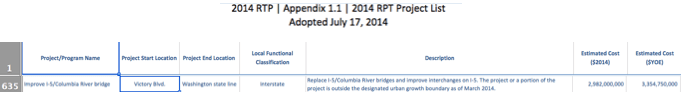
For the past month, we’ve been taking a hard look at plans to spend $500 million to widen I-5 at the Rose Quarter near downtown Portland.  Ostensibly, this project aims to reduce congestion and improve safety. We’re at the point the process where the public is being asked to review the project’s Environmental Assessment (EA), a document prepared to address the requirements of the National Environmental Policy Act (NEPA). The I-5 Rose Quarter Freeway Widening EA looks at just two alternatives: a “Build” alternative, consisting of a $500 million, mile-long freeway widening, and a “No-Build.”

But the state could achieve the same objective, faster, more effectively and far more cheaply by implementing congestion pricing.

Tragically, the project’s environmental assessment didn’t consider that as a possible alternative. But look high and low in the Environmental Assessment and its Traffic Technical Report and you’ll find not a single mention of pricing. In our view, that’s a plain violation of the National Environmental Policy Act, which requires a consideration of a full range of reasonable alternatives.

Congestion pricing is a better solution for traffic, according to Oregon DOT’s own studies

Now in some places, you might be able to argue that congestion pricing is far-fetched or politically infeasible.  In Oregon, as it turns out, its neither:  In fact, it’s already been adopted as law.  Two years ago, Oregon’s Legislature adopted HB 2017, which directed the state Department of Transportation to begin work to implement congestion pricing on Interstate 5 and Interstate 205 in the Portland metropolitan area.  In addition, in December 2017, Portland’s City Council voted unanimously to endorse congestion pricing as part of the city’s future transportation planning. Last year, the state transportation department published a preliminary analysis of several pricing alternatives.  Among the proposals is one, called “Concept 2” which would extend pricing to all lanes of these two major freeways.

The studies undertaken by the Oregon Department of Transportation conclude that congestion pricing could measurably reduce traffic congestion on I-5. The analysis concludes that the project would reduce congestion and improve travel time reliability on I-5.  It would save travel time for trucks and buses.  It enables higher speeds and greater throughput on the freeway–because it eliminates the hyper-congestion that occurs when roads are unpriced. Here’s an excerpt from page 17, of the report.  We highlighted in bold the most salient bits of the analysis:

Overall, Concept 2 – Priced Roadway, will reduce congestion for all travelers on the priced facility. This will produce overall improvement in travel time reliability and efficiency for all users of I-5 and I-205.  [Concept 2 is] Likely to provide the highest level of congestion relief of the initial pricing concepts examined. [It] Controls demand on all lanes and, therefore, allows the highest level of traffic management to maintain both relatively high speeds and relatively high throughput on both I-5 and I-205. Vehicles 10,000 pounds and more (such as many freight trucks and transit vehicles) would benefit from travel time improvements on the managed facilities.  Pricing recovers lost functional capacity due to hyper-congestion, providing greater carrying volume with pricing than without. This means that diversion impacts may be minimal, but still warrant consideration and study.

This concept is relatively inexpensive to implement, and significantly less expensive than concepts that include substantial physical improvements to the pavement and bridge infrastructure.

Oregon Department of Transportation,, (2018). Portland Metro Area Value Pricing Feasibility Analysis Final Round 1 Concept Evaluation and Recommendations Technical Memorandum #3, 2018.

Bottom line:  congestion pricing works better for freeway users, freight mobility, and transit riders; in keeps unpriced traffic from causing hyper-congestion and effectively and is vastly cheaper than building new lanes and bridges.  It is also likely to result in minimal, if any diversion to local streets.

Omitting pricing as an alternative in the Environmental Assessment violates the National Environmental Policy Act

This is clearly a viable alternative to widening the freeway at the Rose Quarter.  Viable is actually a significant understatement:  pricing isn’t simply a viable alternative, it’s arguably, on its face, a superior alternative).  But that’s beside the point.  From a legal standpoint, not seriously evaluating road pricing as an alternative to expensive, environmentally damaging road widening is violates NEPA’s requirement for a robust analysis of alternatives.

The substantive requirements for alternative analysis are spelled out in 40 CFR1502.  As explained by the Federal Highway Administration,

The Council on Environmental Quality (CEQ) refers to the alternatives analysis section as the “heart of the EIS,” and requires agencies to:

1. Rigorously explore and objectively evaluate all reasonable alternatives and for alternatives which were eliminated from detailed study, briefly discuss the reasons for their having been eliminated.

2. Devote substantial treatment to each alternative considered in detail including the proposed action so that reviewers may evaluate their comparative merits.

The FHWA guidance requires that the agency clearly state the rationale for not advancing reasonable alternatives:

Alternatives analysis should clearly indicate why and how the particular range of project alternatives was developed, including what kind of public and agency input was used. In addition, alternatives analysis should explain why and how alternatives were eliminated from consideration. It must be made clear what criteria were used to eliminate alternatives, at what point in the process the alternatives were removed, who was involved in establishing the criteria for assessing alternatives, and the measures for assessing the alternatives’ effectiveness.

Nothing in the EA describes the criteria used to select or eliminate alternatives, nor is any analysis offered for the the failure to advance pricing as an alternative in its own right.  It’s simply arbitrary and capricious of the Oregon Department of TRansportation and the Federal Highway Administration to produce an Environmental Assessment which takes no notice of efforts they are both currently undertaking to implement road pricing on this very roadway.

Moreover, while NEPA requires that congestion pricing be evaluated separately as an alternative, it is also the case that road pricing ought to be incorporated in the analysis as part of the No-Build alternative.  The implementation of road pricing in the next decade or so is, in NEPA terms, a reasonably foreseeable event.  Just as the Environmental Analysis has incorporated its expectations about the growing electrification and increased fuel efficiency of future vehicles in its forecasts of emissions (due to the future implementation of fuel economy regulations), it should likewise include the analysis of congestion pricing, which is also a reasonably foreseeable part of the regulatory environment in the next decade or so.

Pricing first, building (if at all) later is the smarter choice

It’s likely that implementing road pricing would obviate entirely the need for capital construction at the Rose Quarter.  But even if it didn’t, it is far more prudent from both a fiscal and environmental standpoint to implement congestion pricing first, to determine which, if any, “improvements” are needed at the Rose Quarter to reduce congestion and improve safety. The “build first-price later” strategy is a recipe for squandering scarce public resources on roads that people don’t value and won’t use.  As we chronicled at City Observatory, Louisville spent a billion dollars adding capacity to its I-65 bridge over the Ohio River, only to discover that traffic volumes fell by almost half when they started charging a modest toll to bridge users.  It’s financially, as well as ecologically prudent to toll first, and then invest in capacity, when, were and as needed, only later.

Major cities around the world have implemented various forms of congestion pricing, with strongly positive results.  The London Congestion charge is well-known.  Pricing systems are up and running in Stockholm, Singapore and Milan. Once established, the systems generate strong public support because they make urban traffic flow more smoothly.  Systems in Milan and Stockholm were both endorsed in city-wide public referenda after being established. New York seems finally, to be on the verge of approving congestion pricing for lower Manhattan.


For the record, we’ve included a screen-shot of page 17 of the ODOT value pricing report here:

Oregon Department of Transportation, (2018). Portland Metro Area Value Pricing Feasibility Analysis Final Round 1 Concept Evaluation and Recommendations Technical Memorandum #3, 2018

National transportation experts: Portland, you’re doing it wrong

Long regarded as a national leader in transportation policy, Portland is being called out by some of the best and brightest for a wrong-headed decision to spend half a billion dollars widening freeways. The damage done is not just to the city’s reputation.

Janette Sadik-Khan:  Once king of sustainable transpo, Portland could be come jester

Robin Chase: Portland’s planned investment in highway widening is pointless, counterproductive, and a misuse of funds

Jennifer Keesmaat: Cities that are widening highways, including, sadly, Portland, are on the wrong side of history

Jeff Speck: This is a clear case of State DOTs vs. cites, and humans. If Portland loses, can any of us have hope?

It’s remarkable.  In just the past couple of weeks, many of the nation’s most widely recognized and authoritative leaders on transportation policy have taken note of plans unfolding in Portland to spend $500 million to widen a mile-long stretch of the Interstate 5 freeway opposite downtown Portland.  From these leaders, there’s a sense of shocked disbelief and dismay, that in the face of an increasingly dire climate crisis, Portland is squandering money of freeway widening.

Here’s Janette Sadik-Khan–pioneering transportation director under New York Mayor Michael Bloomberg, and founder of the National Association of City Transportation Officials, and author of StreetFight–had a visceral reaction when she read about Portland’s Rose Quarter freeway widening project.

At the same time, Robin Chase a pioneer entrepreneur in innovative transportation and founder of ride-sharing firm ZipCar, wrote at CityLab about the critical role cities have to play in fighting climate change, in an article bluntly titled:  “To avoid climate disaster, urban transportation must change.”

She singled out the need to stop building additional road capacity:

How cities spend their money

Right now, too many transportation investments take us further away from a carbon neutral world, rather than closer. We need to stop investing in new automobile infrastructure and put that money into improving the quality and service of more efficient ways of travel, such as public transit and segregated bike lanes. Not only have these been typically underinvested in, the investments that have been made are not commensurate with the fraction of travel that should be made by these means.

Chase followed up with City Observatory by email to lend her thoughts on the Rose Quarter project.

Portland’s planned investment in highway widening is pointless, counterproductive, and a misuse of funds. We’ve learned and proven again and again that highway widening induces demand and is therefore provides just short-term relief. Just at the moment when we need to reduce carbon emissions and especially in the challenging transport sector, this investment would increase vehicle miles travelled and emissions. That said, the timing of this scale of investment in transport infrastructure could not be better if it were strategically invested in ways to reduce car dependency, reduce fuel use, and improve the quality and reach of more efficient modes.

Portland’s freeway fight has even drawn international attention.  Chase’s article drew a comment from Jennifer Keesmaat, former planning Director for Toronto (and a recent mayoral candidate there as well) who likewise expressed her disappointment at Portland’s lack of leadership:

Jeff Speck, the author of Walkable City and Walkable City Rules, wrote to us via email to say:

The data are clear: if Portland wants to worsen its air quality, crash mortality rate, traffic congestion, carbon footprint, and inner-city property values, it should plow right ahead with the I-5 expansion. Once again, this is a clear case of State DOTs vs. cites, and humans. If Portland loses, can any of us have hope?

This set of concerns also extends to the proposal that Portland’s regional government will likely designate half of the money raised from a likely regional bond measure to expanding roads.  Yonah Freemark, author of the blog Transport Politic, tweeted:

It’s really this simple: If you think climate change is a pressing concern, stop funding expanded roadways. The idea the Portland could designate half its future transport dollars to roads is scary and indicative of a lack of political leadership.

Here’s Vox’s David Roberts, responding to an Op-Ed authored by the Chair of the Oregon Transportation Commission:

Streetsblog USA, the nation’s leading transportation reform website lamented:

Brent Toderian, former planning director for Calgary and Vancouver, added his voice.


Although they didn’t mention Portland by name, Smart Growth America specifically warned cities about the danger of having their transportation and urban planning decisions made for them by state DOTs. In an article titled “How to build a better state DOTs,” Smart Growth America argued:

Big, over-engineered road projects waste precious funds, generate more driving and more pollution, and prioritize high-speed vehicle travel over the safety of every other road user.

Similarly, Lara Fishburne, Joseph Kane and Adie Tomer, transportation experts at the Brookings Institution, writing on March 20, 2019, argued that if we’re to make progress, city leaders have to overcome a fixation with traffic. Their article, “Stop trying to solve traffic and start building great places,” is directly applicable to Portland’s situation, where the Rose Quarter project is aimed at trying to improve the “level of service” (LOS) a letter grade measuring how fast cars move at the peak hour.  They explain that the obsession with chasing level of service has made urban transportation problems worse:

The irony of the LOS system is that it hasn’t solved congestion at all. In fact, it’s just the opposite: LOS keeps making traffic worse.

The fundamental reason is that state and local governments often only view new or wider roads as the right intervention to improve LOS. Major urban road mileage rose by 77 percent from 1980 to 2014 (a total of 169,153 lane miles), compared to 41 percent growth in U.S. population. As the number of lane miles grew, urban residents drove more, and vehicle miles traveled (VMT) on major urban roads grew by 146 percent over the same period. This phenomenon is best explained by the concept of “induced traffic,” which states that more roadways just means more miles traveled via car.

Not only does all that LOS-inspired construction fail to solve congestion, it actually helps create other sets of challenges. Urban highways cut through and separate communities, incentivize sprawling development, and over decades have contributed to the hollowing out of urban neighborhoods. Wide roads encourage high speeds, making corridors unsafe, and simply unpleasant, for pedestrians and bike riders while reducing overall quality of place. Finally, because only a few hours of peak use determine LOS, state and local governments build roads that are underutilized most hours of the day, and cost more to maintain in the long run.

A city’s soul, not just its reputation, is at stake

For decades, Portland has traded on its reputation as a leader in progressive transportation policies. In the 1970s, the city tore out a waterfront highway to build an urban park and cancelled another proposed freeway and used the money it saved to build the first leg of its light rail transit system. Killing the Mount Hood Freeway was the seminal event in the creation of the modern, progressive Portland.  As the city’s original alt-weekly, Willamette Week, chronicled:

The Portland City Council voted in July [1973]  to kill the freeway. The victory did more than stop one road from tearing up quiet residential streets. Light rail became the region’s primary answer for transportation. Neighborhood associations emerged as the power blocs of Portland politics. Most of all, the victory over the Mount Hood Freeway created the story of Portland exceptionalism, and the fight helped define us as an urban model for the nation. The heady days following the freeway’s death gave many at City Hall the conviction there was more that could be done, that a progressive movement was about to overtake a stodgy Portland. 

It’s been a leader in urbanism and bike transportation. But arguably, the city may be coasting, drawing on the fading glamor of past successes, and with little appetite or courage for aggressive leadership in what is decidedly a more serious situation.

As Brent Toderian has wisely observed,“The truth about a city’s aspirations isn’t found in its vision, it’s in its budget.“  The $500 million I-5 Rose Quarter Freeway widening project is the largest single transportation investment currently on offer for the Portland’s central city. Spending that much to make car movement easier makes a mockery of stated city and state goals to reduce carbon emissions–even as the state’s Global Warming Commission points out that the state is losing ground in its adopted goal to reduce carbon emissions to 20 percent of 1990 levels by 2040, solely due to the recent increase in driving.

Ultimately, this isn’t about losing credibility with transportation thought leaders and think tanks–though we should ponder their warnings carefully. It’s really about who we are as a city.  In the face of the most serious environmental crisis we’ve ever experienced, we can’t align our spending choices with our stated values, maybe we’re not the place we thought we were, or the place we say we want to be.

_____

Editors Note:  This commentary has been revised to include comments from Yonah Freemark, David Roberts and Jeff Speck.


Safety last: What we’ve learned from “improving” the I-5 freeway.

Expanding freeway capacity on I-5 hasn’t reduced crashes in Woodburn, but did triple in cost

Today, we’re pleased to offer a guest commentary from Naomi Fast. Naomi currently lives in Beaverton, Oregon. Previously, she lived in Portland, where she learned to ride a bicycle as transportation while earning graduate degrees at Portland State University. Her website is naomifast.com

In the next few weeks, metropolitan Portland will be taking a close look at an Oregon Department of Transportation (ODOT) proposal to spend half a billion dollars widening a mile-long stretch of I-5 near downtown Portland.  ODOT is marketing the project through the release of a multi-volume “Environmental Assessment,” which makes a number of claims about how the project will influence the environment, affect traffic, and–so we are told–reduce crashes.

But as the saying goes, this isn’t our first rodeo.  ODOT has been expanding capacity and widening chunks of I-5 for years. What has that experience taught us about how freeway widening affects safety, and what does it tell us about ODOT’s ability to bring projects in on time and under budget?

Previously, City Observatory has looked at a recent widening of I-5 just north of the Rose Quarter project area.  But just a few years ago, ODOT completed a capacity expansion project on I-5, about 30 miles to the south, at the Woodburn Interchange.  Just like the Rose Quarter, this project was pitched as a congestion-busting safety improvement. Did this project pan out as planned?

When I heard about two separate & serious multiple vehicle crashes this February at the Woodburn Interchange, each of which caused hours of delays on the I-5, I thought: Wait a minute—wasn’t that section widened recently?


As it turns out, it was. The expansion project at Milepost 271, completed in 2015, was in fact similar to in concept to the one being promoted now for the Rose Quarter.  While it didn’t add auxiliary lanes like those in the Rose Quarter, it did add huge new loop ramps with long exit and entrance lanes to increase capacity to move cars on and off I-5.  It had its own lengthy design process, with its own Environmental Assessment. It affected a little less than a mile of freeway, slightly smaller than the propose Rose Quarter widening, with a similar justification, and with an Environmental Assessment that compared just two options: Build & No Build.

Oregonians were told that congestion and crashes were going to be significantly reduced in that section, according to ODOT’s planning reports for the project.

  • ODOT’s 2005 EA said, “Travel speeds, traffic flow, and overall safety and function would be improved for all modes of travel using the reconstructed interchange.”
  • In the 2006 Revised EA report, ODOT said the widening would “provide a facility that would safely accommodate multimodal travel demands 20 years into the future.”
  • A 2011 project paper said, “The purpose of the Woodburn Interchange Project is to improve the traffic flow and safety conditions of the existing Woodburn/I-5 interchange.”
  • And at the 2015 ribbon cutting less than four years ago, even Governor Brown was optimistic, as seen in this video.

If improving safety is a key reason for widening freeways, then we should be looking for tangible real-world evidence that widened freeways, like the one at Woodburn, are getting safer.  That means the February crashes cast real doubt on the efficacy of freeway widening and flow improvements as a safety strategy. Along with the February 15th and 20th Woodburn Interchange crashes, there have been others; there was a fatal crash at the interchange just months after it opened.

ODOT’s own annual crash data aren’t conclusive.  In 2016, the first year after the project opened, and the latest year for which annual data are available, the project area experienced 14 crashes.  With so few crashes (less than one per month, on average) crash rates can vary a lot from year to year. The data so far suggest that the crash performance of this area is no better than it was before the project was built.  It remains to be seen how last month’s crashes will figure into the 2019 totals, but two in a little over two weeks is a lot.


There’s one other thing to consider:  While highway engineers almost always think its a good thing if traffic can move faster, safety analysts point to crash data that shows that speed is strongly associated with more crashes and more severe injuries.  The real world experience with widening Interstate 5, both here in Woodburn, and to the north of the project between Lombard and Victory in Portland, shows that contrary to the claims of engineers, there’s no reason to believe that wider freeways will have fewer, or less severe crashes.

How much will it cost?

There’s a postscript to the Woodburn Interchange story.  Not only does it not appear to have delivered improved safety, it’s also ended up costing vastly more than promised.  When initially proposed by the Oregon Department of Transportation in 2005, the project was supposed to cost $25 million (according to the project’s 2006 Environmental Assessment).  When finally completed in 2015, the project’s cost had nearly tripled to more than $70 million. In the case of the Rose Quarter–a much more complex project, in a dense urban setting–imagine if $500 million were to nearly triple.


The Lemming Model of Traffic

Highway planners use a deeply flawed “lemming” model of traffic that rationalizes highway widenings

The traffic projections made as part of the Environmental Assessment for the $500 million Rose Quarter I-5 widening project make an audacious claim that the project will reduce traffic congestion and greenhouse gases, and completely unlike any other freeway expansion project, won’t induce any additional demand.

How do they know that?  Because they have a model that says so.

But how realistic is that model?  As it turns out, not very.  As we detailed earlier, one  problem is that the model (without saying so) is based on the assumption that a 12-lane, 5 mile long freeway was built (reality check:  it wasn’t) between Portland and Vancouver in 2015, and is funnelling thousands and thousands more additional cars into the Rose Quarter than is actually the case.

But there’s a more fundamental problem. The traffic forecasting model used by ODOT is inherently structured to over-predict traffic congestion, and presents a distorted picture of what’s likely to happen with freeway widening.The model, a classic four-step traffic demand model (albeit with a few tacked on bells and whistles, like a microsimulation package) is decades old technique with a couple of critical and well documented weaknesses. The most important one is that it allows traffic to grow without limit in the “base” case.  It predicts that as population increases, more and more people will drive more and more miles, and that they will all be oblivious in their trip making behavior to any changes in congestion.  That is, they won’t be deterred by congestion from changing the timing, mode, destination, or whether they take a trip at all.  That’s because four-step models, like the one used to create the Rose Quarter I-5 estimates, uses something called static trip assignment, STA that takes almost no notice of the effects of congestion and delay.

In an important sense, static trip assignment is a kind of “lemming” model of travel behavior.  It assigns successively more and more trips to congested links even as they become more and more congested.  Implicitly, it assumes that traveler behavior doesn’t respond at all to experienced travel conditions, especially delay.  In fact, the model allows traffic to actually exceed the capacity of the roadway link–by definition of physical impossibility–and consequently over predicts traffic, and leads to forecasts of hours and hours of congestion, as more and more traffic piles obliviously onwards into the congested roadway–and does so every single day, with no learning or adaptation.  Like lemmings, you might say.

This is like the classic 1958 Walt Disney nature film, White Wilderness showing hundreds of lemmings running off the edge of a cliff.  The following lemmings leap to their death, even though they can see the lemmings in front of them falling.

In the film, the little rodents assemble for a mass migration, scamper across the tundra and ford a tiny stream as narrator Winston Hibbler explains that, “A kind of compulsion seizes each tiny rodent and, carried along by an unreasoning hysteria, each falls into step for a march that will take them to a strange destiny.”

That destiny is to jump into the ocean. As they approach the “sea,” (actually a river -more tight cropping) Hibbler continues, “They’ve become victims of an obsession — a one-track thought: Move on! Move on!”

The “pack of lemmings” reaches the final precipice. “This is the last chance to turn back,” Hibbler states. “Yet over they go, casting themselves out bodily into space.”

They don’t do this in real life:  They were pushed, just like drivers in ODOT’s traffic model Lemmings leaping to their doom (Walt Disney, 1958, via Youtube)

Lemmings are an apt analogy, because in real life (as opposed to 1950s nature films) lemmings don’t actually blindly leap to their death.  As the Alaska Department of Fish and Wildlife explains, the classic footage which appears in White Wilderness was actually staged by the producers, who from positions off camera, chased the terrified lemmings off the cliff.

In a sense, that’s what modelers are doing with Static Traffic Assignment–no matter how bad congestion gets in the STA models, the lemming motorists, just keep pouring into the congested roadway link.  But in the real world, as opposed to traffic models or 1950s Disney films, drivers (and lemmings) don’t just mindlessly drive into congestion day after day (or jump off cliffs along with hundreds of others).  Instead, in the face of congestion, they change their behavior, changing the time, mode or destination of their journey, or foregoing it altogether.

What the unrealistic static traffic assignment lemming scenario does is to create a fictitious baseline forecast of traffic that looks truly horrible.  And, in comparison, the “build” scenario, in this case, a road widening, looks less bad.  And it also doesn’t have any “induced” demand, because the projections dramatically over-estimated the amount of traffic that would occur in the base no-build scenario. (Induced demand is almost impossible in these models because traffic demand is derived from an earlier step in the process and there’s no feedback loop of less delay to encourage greater trip-making.)

For technicians in the field, the problems with static traffic assignment are well documented.  Norm Marshall writing in the peer-reviewed technical publication “Research in Transportation Business and Management, says:

STA has two fundamental problems that make it ill-suited at analyzing peak period congestion. First, most peak period congestion, especially on freeways, involves traffic queuing behind bottlenecks. Therefore, the roadway segments are not independent, as is assumed in STA. Second, these bottlenecks meter traffic flow to the capacity of the bottlenecks. In sharp contrast, STA allows modeled traffic volumes to exceed capacity. This misrepresents traffic not only on the over-capacity segment, but on downstream segments that the excess traffic could not really reach because it either would divert to other routes or be queued upstream.

Forecasting the impossible: The status quo of estimating traffic flows with static traffic assignment and the future of dynamic traffic assignment, published in Research in Transportation Business and Management, https://doi.org/10.1016/j.rtbm.2018.06.002

Static assignment models allow traffic forecast on specific segments of roadway to exceed the capacity of that segmenta –physical impossibility, and also inaccurately forecast actual speeds because of the non-linear relationship between capacity and speed.

There is a method to reduce this bias, called dynamic trip assignment, which adjusts travel volumes and routing based on modeled levels of congestion.  Portland Metro is developing some dynamic assignment techniques, but they weren’t used in preparing the forecasts for the Rose Quarter freeway widening project.

The lemming model is pernicious for two reasons.  First, it presents a distorted view of what will happen under the no-build alternative.  The EA claims that there will be environmental benefits because we’ll avoid all of the congestion and pollution caused by motorist/lemmings jamming themselves into the Rose Quarter day after day..  But this claim is a fiction: in reality, traffic will never grow to the levels forecast in the model, because the model predicts more vehicles than the road can physically accommodate.  By exaggerating the level of traffic in the no-build scenario, the EA has created a false baseline for estimating the environmental effects of the widened freeway, thus disguising the effect of induced demand.  Because under static trip assignment, capacity makes no difference to whether or when people travel, there can’t possibly be induced demand.  Induced demand is effectively assumed away.  

The tendency to overestimate future traffic levels in mature travel corridors is also an endemic problem with the current methodology used to predict future transportation demand. After a careful review of the literature, the Government Accountability Office found:

. . . current travel demand models tend to predict unreasonably bad conditions in the absence of a proposed highway or transit investment. Travel forecasting, as previously discussed, does not contend well with land-use changes or effects on nearby roads or other transportation alternatives that result from transportation improvements or growing congestion. Before conditions get as bad as they are forecasted, people make other changes, such as residence or employment changes to avoid the excessive travel costs.

The weakness of transportation models in accurately predicting future traffic levels is a continuing problem. So it is not merely the Rose Quarter traffic projection model that is problematic; rather the entire class of four-step (trip generation, assignment, mode, routing models) have proved inaccurate in practice. After an exhaustive review of the state of the art, the Transportation Research Board of the National Academies wrote:

“. . . as has been true for the past four decades, these models could not provide accurate information to inform decision making on many transportation and land use policies or traffic operation projects.”
(Committee for Determination of the State of the Practice in Metropolitan Area Travel Forecasting, 2007)

While technology has allowed for faster computation, and more detailed mapping, they conclude:

“The practice of metropolitan travel forecasting has been resistant to fundamental change. Every 10 years or so there begins a cycle of research, innovation, resolve to put innovation into practice, and eventual failure to affect any appreciable change in how travel forecasting is practiced.”

(Committee for Determination of the State of the Practice in Metropolitan Area Travel Forecasting, 2007) pages 123-124.

Why wouldn’t highway departments implement a better method?  Well, as it turns out, the static trip assignment/lemming model tells them exactly what they want to hear:  If you don’t give us money to widen the highway, we’ll have endless gridlock.  It also “proves” that the expansion won’t create any induced demand. From the standpoint of highway builders, this is a convenient property for a model to have.

A model, any model, is only as good as the assumptions that go into it.  The fundamental assumption of static traffic assignment, that motorists behave like (fictional) lemmings, filing irrationally over a cliff (or into a gridlocked roadway, day after day), and that they don’t change their behavior in response to congestion, is dramatically wrong. It produces a gross over-estimate of how much roadways are likely to be congested, and paints capacity improvements in an unrealistic, favorable light, while structurally excluding the well-documented effects of induced demand.

Distorted images: Freeway widening is bad for pedestrians

The proposed I-5 Rose Quarter freeway widening project creates a bike- and pedestrian-hostile environment

The Oregon Department of Transportation has crafted distorted images that exaggerate pedestrian use by a factor of 200

As part of its effort to sell its $500 million dollar project to widen Interstate 5 at the Rose Quarter, the Oregon Department of Transportation has prepared some computer generated renderings of what area streets will look like.  At first glance, they seem to buttress the notion that this will be a pedestrian and bike friendly environment, with lots of space devoted to non-car travel. Project staff are is fond of repeating the words “36-foot wide multi-use path.”

But if you take a close look a the computer rendering, what you’ll see is both some troubling design flaws that actually make this a bad place for people who aren’t in cars.  And if you turn a critical eye on the way the rendering is constructed, you’ll see that ODOT has intentionally distorted the perspective to make things seem rosier than they actually are.

Wrong Way Traffic

The first thing you should notice is the two-way street in the center of the diagram.  It’s got lanes of traffic on either side of a combined bike-pedestrian multi-use path.  But unlike every other road in the city of Portland or the state of Oregon, traffic is driving on the left-hand side of the road. It is a miniature diverging diamond. Diamonds are used by traffic engineers explicitly to facilitate the faster movement of cars. But they’re disorienting to pedestrians and cyclists, because instinctively, they tend to look in the wrong direction to detect traffic.  That’s why diverging diamond intersections regularly have “Look Left” and Look Right” stenciled on the pavement to warn pedestrians that traffic is coming from an unexpected direction.  There’s also a bus only lane that appears to run on the sidewalk.

Two freeway on-ramps

Again, because this is a still image rather than a moving one, it isn’t clear what the cars on the wrong way diverging diamond are doing.  Where they’re going, in both cases is directly onto freeway on-ramps.  In both cases, the traffic light at the end of the diverging diamond (the southbound one is over Williams Avenue, immediately in the foreground, another one, not shown is at the other end of the diverging diamond) is the last traffic signal before vehicles enter the I-5 freeway both north and south bound.  Vehicles on the diverging diamond will be accelerating to freeway speeds.  So not only will the cyclists and pedestrians in the center of diverging diamond be disoriented by heavy traffic going in the wrong direction, they’ll also be confronting drivers intent on accelerating to freeway speeds.  The arrows on the following chart show the movement of cars, both from the west and from the north which will be accelerating on to the Southbound I-5 freeway on-ramp.


High Speed Corners

Throughout Portland, as part of the city’s efforts to improve safety, the city is building curb-extensions, bumping the corner of intersections out further into the street, to shorten crossing distances, to make pedestrians more visible to drivers, and critically, to force drivers to slow down to make turns–because the curb extension sticks out further into the junction of two roads, it forces drivers to make a sharper, and therefore slower turn. These drawings are from Portland’s Pedestrian Design Guidelines, and the photo shows a curb extension in practice:

But look closely at the corners of this intersection–in every case they’ve been cut back and rounded off, moving the corner further away from the street–the exact opposite of curb extensions. The following illustration shows the portion of the corners of each of these intersections–the red triangles–that would be cut away to speed car turning movements.

By making these turns wider–in engineering parlance “increasing the radius of curvature”–this encourages cars to drive faster, increasing the hazard to pedestrians.  In addition, it makes pedestrians less visible, and increases crossing distances.  At each of these corners, pedestrians in crosswalks will be confronting fast moving cars.

Distorted Images

While a close look at these renderings reveals some of the flaws in the design of this intersection, it’s important to remember that the image itself was crafted by the Oregon Department of Transportation, which made a number of editorial decisions which are clearly designed to influence the viewer.  Consider first the perspective and vantage point chosen for this image.  The viewer is floating 20 or 30 feet in the air, looking down at the bike path and sidewalk.  This doesn’t represent how actual humans will encounter and perceive the project. The foreground (which due to the rendering is shown much larger) is filled with bikes, pedestrians and green-painted spaces.  Nearly all of the car lanes are shown in the background and thereby made to seem much smaller. In a sense, that’s how perspective works, but the decision to put bike/pedestrian infrastructure in the foreground, and cars in the background conveys the impression that one is big, and the other small. Imagine for example, the cars were in the foreground and the bikes in the background–one would have a much different sense of how much space was devoted to cars as opposed to bike-riders and pedestrians.

Invisible cars

Another distortion comes from what’s shown–and what isn’t shown–in the renderings.  This seems to be a very pedestrian-oriented space because ODOT has chosen to show only a handful of cars. The easiest way to detect bias in this image is simply to count things.  How many cyclists are there? How many pedestrians? How many cars?  We can do that.  Here are 25 pedestrians (and we didn’t count ones that weren’t shown on sidewalks.


In addition there are 8 cyclists.

But there are only 5 cars.

On one of the busiest intersections in Portland, at the convergence of two major north-south and east west arterials, as well as the I-5 freeway, there are almost no cars.  But there are huge numbers of bike riders and pedestrians.  Bikes and pedestrians outnumber cars 5 to 1 in this illustration. That’s a wild distortion of reality.  Consider the actual evidence of who uses this intersection.  The City of Portland’s traffic counts, last taken on a typical afternoon in June, showed that in the afternoon rush hour, cars outnumbered pedestrians by about 40 to 1.  Here’s the data:

The data show that between 4 and 6 pm, there were 4,228 cars and trucks that traveled through this intersection and just 96 pedestrians:  In round numbers there were about 40 times more cars than pedestrians used this intersection.  What that means is that ODOT’s rendering has distorted the actual use of this intersection by a factor of about 200.  The ODOT rendering shows five times as many pedestrians as cars.  Reality is that there are about 40 times as many cars as pedestrians.  This is distortion on an epic scale. If one were to take this image as a depiction of reality, you would have to wonder, why are we widening the freeway when there are virtually no cars in this neighborhood?

Imaginary buildings

Like so many freeway interchanges, this is a hardly a pleasant urban environment.  In addition to freeway on-ramps, desolate and unkempt patches of land next to the roads and abutments, the most prominent commercial uses are a gas station, a car dealership and a paint store.  But this image has improved the area by adding several imaginary wireframe buildings.  Of course, the project doesn’t actually involve building any buildings, and there are no plans to make the freeway covers strong enough to support buildings, but that hasn’t stopped ODOT from making its project look more urban and inviting by installing fictional buildings that simply aren’t there.

The renderings prepared by ODOT masquerade as objective information, but are deeply biased.  If you look closely, you can see the projects flaws–wrong way traffic, high speed corners, bus lanes running on the sidewalk, city streets functioning as acceleration lanes for freeway on-ramps. More tellingly, though, the renderings are drawn in a particular way to present a misleading view of the project and its impacts, the viewer is looking at the seen from a kind of video-game viewpoint floating in air, perspective is used to make people and bikes look large, and cars look small, non-existent buildings are conjured out of thin air, to make the area seem more urban and inviting, and the entire scene is populated with people and bikes, while almost no cars are shown.

The Rose Quarter: ODOT’s Phony safety claims

There’s no evidence that widening the I-5 freeway at the Rose Quarter will reduce crashes.

ODOT used a model that doesn’t work for freeways with ramp-meters

When ODOT widened I-5 lanes and shoulders near Victory Boulevard in 2010, crash rates did not decline

Research shows interstate freeway shoulder widths aren’t correlated with crash rates

The marketing campaign for spending $1.45 billion to widen the I-5 Rose Quarter freeway heavily emphasizes safety–falsely claiming that this is a particularly dangerous roadway

Reducing crashes is a linchpin of the project in two ways, both to support an argument about safety, and also because the project claims that with fewer crashes they’ll be less “non-recurring delay.”  City and state officials concede that due to induced demand the project won’t do anything about daily recurring delay–any improvements in the regular flow of traffic will simply prompt more people (who now avoid the roadway because of congestion) to try to use it, with the result that it will be just as slow in future as it is before spending a billion dollars or so).

ODOT incorrectly applied the ISATe model to I-5, ignoring the effect of ramp meters.

The project claims that widening the freeway will reduce crashes.  How they know?  Well according to the project’s “Transportation Safety Technical Report,” were generated by a tool called “ISATe”.  Despite the impressive moniker, ISATe is just an excel spreadsheet.

The AASHTO HSM (AASHTO 2010) predictive method for highways and interchanges using the software ISATe was applied to estimate the relative safety performance of the proposed Project. The method was applied without calibration factors, so the results are presented as relative differences rather than absolute predictions. The models are applied on a segment-by-segment basis, and segments are defined to have consistent geometric characteristics. The largest safety benefit results from upgrading shoulders to full standard on both sides of the highway.

(Emphasis added)

This statement reveals a number of important points.  First, they didn’t calibrate the ISATe mode to existing crash rates on the roadway.  ISATe is based on a rough approximation of factors for a wide range of roadways, and to produce relative, rather than absolute values.

The report specifically says that the the methodology doesn’t account for the effects of ramp metering.  Ramp meters have already been installed on this portion of freeway,

And if you read the ISATe technical manual, there’s a section that explains the limitations of the model, helpfully labeled “Limitations of the Predictive Methods.” The manual says that the ISATe spreadsheet doesn’t estimate crashes for freeways that have ramp meters.

Bonneson, J., Pratt, M., and Geedipally, S., (et al), Enhanced Interchange Safety Analysis Tool: User Manual, National Cooperative Highway Research Program, Project 17-45, Enhanced Safety Prediction Methodology and Analysis Tool for Freeways and Interchanges, May 2012.

This is important because a key reason for ramp meters is to smooth the flow of traffic, and reduce merge conflicts that would otherwise result in an increase in crashes. What ODOT has done is use a tool that assumes that there are no ramp meters to estimate the number of crashes on a road that has long had — and will continue to have ramp meters.

Consequently, by inappropriately applying the ISATe spreadsheet to a roadway that’s already had ramp metering installed, ODOT has overstated the base level of crashes on the road, and overstated the likely reduction in crashes from wider shoulders.  According to the US Department of Transportation, ramp metering on Portland freeways has already produced a 43 percent decline in crashes.

Because the ISATe model doesn’t take account of the actual presence of ramp meters, it over-estimates the reduction in crashes that might be attributable to adding lanes and shoulders to this stretch of I-5.  In essence, the installation of ramp meters here has already accomplished some, if not most of the supposed crash reduction benefit that would be achieved by widening the freeway.

ODOT’s own experience on I-5 shows wider shoulders didn’t decrease crash rates

So rather than looking at a spreadsheet based model that, according to its own user manual, isn’t capable of accurately estimating crash rates on this kind of freeway, it makes more sense to look at the actual experience with freeway widenings on Interstate 5.  As we’ve pointed out at City Observatory, ODOT has already helpfully run this experiment. It widened a mile-long stretch of I-5 just north of the Rose Quarter in 2010, between Lombard Street and Victory Boulevard, adding lanes and widening shoulders.  That stretch of road is used by essentially the same drivers to travel through the Rose Quarter. It is, in a sense, a perfect natural experiment on the efficacy of wider freeways reducing crashes.

And what ODOT’s own data show is that after widening I-5 crash rates were higher than before the freeway widening. The data is shown below.  Crashes spiked during the construction period (2010; gray bar), which is a common occurrence.  But after project construction was completed, from 2011 onward, crashes were consistently about 10 percent higher than they had been prior to construction.  Far from reducing crashes, freeway widening actually increased them.

Research shows wider shoulders aren’t statistically associated with fewer crashes on Interstate Freeways

There’s actually no valid statistical evidence that shoulders wider than 6 feet on divided roads produce any additional safety benefit.

The same could be observed for shoulder width, where the crash rate decreases up to 6 ft and then varies as the shoulder becomes wider. These trends are simple observations, and statistical tests were not conducted to determine their statistical significance. (page 21)

Stamatiadis, N., Pigman, J., Sacksteder, J., Ruff, W., & Lord, D. (2009). NCHRP Report 633: Impact of shoulder width and median width on safety. Transportation Research Board of the National Academies, Washington, DC.

Other research has concluded that there is no statistically significant relationship between outside shoulder width and crash frequency on Interstate highways.

Highway geometric factors are found to have variable impacts on highway safety (across accident severity level and road class). For example, it is found that widening outside shoulder by 1% will have no impact on Interstate highways  . . .

Chen, S., Saeed, T. U., Alinizzi, M., Lavrenz, S., & Labi, S. (2019). Safety sensitivity to roadway characteristics: A comparison across highway classes. Accident Analysis & Prevention123, 39-50.

In short, there’s no evidence that the Rose Quarter freeway widening will improve safety:

  • ODOT used a model (ISATe) that doesn’t apply to this freeway, which has ramp meters.
  • ODOT’s own experience with widening the I-5 freeway and shoulders resulted in an increase in crash rates, not a decline
  • The scientific literature concludes that lane and shoulder width is a statistically insignificant factor in determining crash rates.


The Hidden Rose Quarter MegaFreeway

ODOT is really building an 8-lane mega-freeway at the Rose Quarter

You can tell from the tortured rhetoric about “auxiliary” lanes that the Oregon Department of Transportation is falling all over itself to make the freeway widening project it has proposed for the I-5 Rose Quarter area seem absolutely as small as possible.  They maintain that they’re not actually widening the roadway at all, just adding “ramp to ramp connections.”  In reality, however, ODOT is engineering a right-of-way that can easily hold an 8 lane freeway–effectively doubling the size of the current Interstate 5.

How big is it?

The public descriptions of the Rose Quarter freeway project go to great lengths to minimize the size of the project.  As we’ve noted the project’s Environmental Assessment insists that the lanes its adding to the I-5 freeway aren’t actual freeway lanes, but are an entirely different and environmentally benign creature called an auxiliary lane.

But for a moment, set-aside all this talk about counting lanes or what they’re called.  How big a footprint will the widened I-5 freeway have?  That fact is carefully concealed from view in the main Environmental Assessment Report, but if you did dig through the appendices, you’ll find one diagram in the project’s Right-of-Way analysis that hints at the freeway’s actual footprint.

This chart shows a representative cross section of the I-5 freeway at the Rose Quarter, as currently built (top) and as proposed to be widened by ODOT (bottom).  The fine print in the bottom of each schematic shows the number of feet of width of each lane and of the shoulders.  In the proposed widening, the total width is about 126 feet.  There are six 12-foot traffic lanes (three in each direction, two labeled “thru” lanes one labeled “auxiliary”), plus 12 foot shoulders on the left and right side of the traffic lanes.  We assume the median is five feet wide.  That works out to about 126 feet ((6 *12)+(4*12)+5=126).

If you look at that diagram, it looks like there’s a lot of space in that 126 feet relative to the size of the illustrated cars and trucks:  48 feet is dedicated to shoulders, which is a lot for a busy urban highway built on extremely expensive land.  (The Right of Way Report notes that land near the freeway is worth as much as  $150 to $200 per square foot, and land acquisition for the project will require a total budget of $55 million).

How many lanes can you fit in a 126-foot right of way?

So instead of arguing about what we call lanes, let’s ask a basic question:  How many freeway lanes can you fit in an urban, 126-foot right-of-way?  Well the answer can easily be found by simply looking at the way the ODOT stripes freeway lanes and shoulders in Portland.  According to ODOT’s lane report data, this section of the Interstate 84 freeway, just east of 12th Avenue has 3-foot left shoulders, and 7-foot right shoulders.  (Highway 2/Columbia River Highway is ODOT’s designation for Interstate 84.  LN1 through LN3 correspond to travel lanes, LS and RS are left shoulder width and right shoulder width, with all data presented in feet.  Data are show for I-84 from NE 12th Avenue to NE 21st Avenue (which corresponds approximately to the area illustrated in the photograph below).

If ODOT were to simply re-stripe its widened 126-foot Rose Quarter right of way in exactly the same fashion it has striped Interstate 84, less than a mile away, it could easily fit eight full-sized travel lanes in the space it is planning to build.  Four 12-foot travel lanes (48 feet), plus a 3-foot right shoulder and a 7-foot left shoulder (10 feet total shoulders), are equal to 58 total feet of width.  Allowing for a 5 foot median, this means an eight lane freeway would use 121 feet ((58*2)+5=121).  As noted above the Environmental Assessment schematic shows 126 feet of total right of way.

Despite the protestations that 12 foot left and right shoulders are “standard,” ODOT’s own practice–in this exact area–makes it clear that isn’t true. ODOT not only builds and operates urban freeways with narrower shoulders (and consequently more lanes), the US Department of Transportation holds out these design standards as a best practice for other cities and states to follow in providing more freeway capacity.

Portland’s I-84, is actually touted by the US Department of Transportation’s as poster child for narrower shoulders.  Here is a page of the USDOT report, “USE OF NARROW LANES AND NARROW SHOULDERS ON FREEWAYS: A Primer on Experiences, Current Practice, and Implementation Considerations.” FHWA HOP-16-060.  The narrow shoulders on I-84 are also featured on the cover of the document.


Build now, paint later

It’s pretty easy to see what’s likely to happen here, if this project is allowed to go ahead.  ODOT will widen the right of way and, on opening day, stripe it for six lanes (it will probably stop calling them auxiliary lanes just as soon as it breaks ground).  It will let a decent interval (six months or a year) pass, and in all likelihood, traffic will be just as bad, if not worse than it is today.  Then Oregon DOT–which will be operating under a new director–will note that the previous administration underestimated the challenge at the Rose Quarter, and will “discover” that there’s actually room to fit in a couple more travel lanes.  And ODOT will fire up the paint truck.

All that stands between the proposed Rose Quarter freeway widening project that’s depicted in computer renderings of the Environmental Assessment and an 8-lane freeway is a few hundred gallons of Federal Spec TTP-1952b traffic marking paint.  A few hours with a lane-marking machine would essentially double the capacity of the current I-5 freeway.  And nothing in the Environmental Assessment examines what the effects of such a widening would be, in terms of added car traffic from induced demand, air pollution and carbon emissions. Which brings us to the National Environmental Policy Act (NEPA).  NEPA requires that ODOT disclose the cumulative and reasonable foreseeable future consequences of its actions. This provision is designed to prevent agencies from breaking down otherwise environmentally significant actions into smaller, less impactful pieces that can individually escape review, but which cumulatively would affect the environment.

If striped like I-84, a widened Rose Quarter I-5 could accomodate four travel lanes in each direction.

In NEPA terms, the possibility that the Oregon Department of Transportation could come back, a few months or a few years after it’s spent $500 million on the concrete and structures for its 126 foot right-of-way, and simply restripe the freeway to add capacity, is “reasonably foreseeable.”  That means that rather than just looking at the project with stripes as proposed, the Environmental Assessment should present the likely consequences of building a road that could easily accomodate one more full travel lane than it has considered.  Alternatively, the Environmental Assessment ought to look at the alternative of building a narrower physical right-of-way.  The freeway right of way could be at least 20 feet narrower–and all of the physical impacts of widening on the community, including land takings (especially onto the site of Tubman Middle School), could be reduced, while achieving the same traffic flow that ODOT has claimed is needed.  Considering just this kind of alternative is exactly what the NEPA process is designed to do.  By treating 12 foot inside and outside shoulders as an unquestioned and unquestionable assumption, ODOT has both built in the room to easily widen the freeway, and concealed the likely long-term environmental effects of this decision and sidestepped its responsibility under NEPA to consider alternatives that would reasonably have smaller environmental impacts.

We’ve been down this road before

But would a state Department of Transportation so brazenly and cynically manipulate its environmental disclosures to hide its true intent?  Surely, if it really wanted to widen I-5 to 8 lanes through the Rose Quarter ODOT it would level with the public, wouldn’t it?

In fact, the Oregon Department of Transportation has a demonstrated track record of concealing the actual number of lanes it plans to build when it widens freeways, and specifically, the Interstate 5 freeway in Portland. In the Final Environmental Impact Statement of the Columbia River Crossing, issued in 2011, ODOT was always careful to refer to the new bridge and widened freeway it was proposing as having 10 lanes, 5 lanes in each direction.

On paper, this was a reduction from the 12-lane bridge and freeway put forward in the project’s Draft Environmental Impact Statement (DEIS), issued in 2008.  After the issuance of the DEIS, the City of Portland and other regional leaders sought to reduce the project’s environmental impact by reducing the number of proposed automobile lanes.  In 2010, at Mayor Sam Adams request, the Project Sponsors Council for the CRC directed ODOT to reduce the number of lanes on the CRC from 12 lanes to 10.  Let’s turn the microphone over Oregon Public Broadcasting‘s Kristian Foden-Vencil:

Leaders of cities, ports and transportation districts around Portland, agreed Monday on key aspects of a new I-5 bridge over the Columbia River. They agreed the new Columbia River Crossing ought to be 10 lanes wide — not 12. . . .  Portland Mayor Sam Adams, called the vote a significant step forward.
“Portland-Area Leaders Agree On Aspects Of New I-5 Bridge” OPB News, August 9, 2010

ODOT dutifully complied with this direction. When the project’s final environmental impact statement (FEIS) was released, all the references were to 5 lanes.  But the document and all its appendices had been carefully purged of any references to the actual physical width of the structure they were going to build.  Here’s the illustration of the freeway bridge’s cross-section from the project FEIS.  The CRC was to consist of two parallel, double-decker bridges, with the freeway carried on the top deck. The FEIS shows five travel lanes on each structure–for a total of ten.  Three lanes in each direction are labeled “through” lanes, and two lanes labeled “add-drop” lanes–an earlier version of ODOT’s Orwellian naming conventions).  Notice that this diagram lacks any dimensions, and carries the cryptic disclaimer “Not to scale.”
Columbia River Crossing, Final Environmental Impact Statement, page S-19.
Not to scale, indeed. It took a Freedom of Information Act request to get the Oregon Department of Transportation to disgorge the cross-sectional schematics showing  the bridge profile with actual dimensions.  They showed the bridge was going to be built to exactly the same physical width as originally proposed.  This diagram shows a close up view of a cross-section of one of the two spans; the deck is angled slightly due to the horizontal curvature of the bridge as it crosses the river.  The deck of each of these two bridges is 90 feet edge-to-edge, 180 feet wide in all–enough room for six 12 foot travel lanes and 18 feet of highway shoulders–exactly what ODOT included in the DEIS.  So while it played up the proposal’s five-lane paint scheme, ODOT charged ahead with concealed plans to build exactly the same physical structure as before.
CRC Bridge Cross Section Schematic, (Public Record Request #D00482).
Then, just as now, ODOT will conspicuously tell the public and the leaders what they want to hear about the number of lanes, as a way of assuaging environmental concerns, but will then quietly–even secretly–go ahead with plans to engineer a structure and right of way that provides space for the number of lanes it wants.

The black box: Hiding the facts about freeway widening

`State DOT officials have crafted an Environmental Assessment that conceals more than it reveals

In theory, the National Environmental Policy Act is all about disclosing facts. But in practice, that isn’t always how it works out. The structure and content of the environmental review is in the hands of the agency proposing the project, in this case the proposed $500 million widening of the I-5 Rose Quarter freeway in Portland. The Oregon Department of Transportation and the Federal Highway Administration have already decided what they want to do: Now they’re writing a set of environmental documents that are designed to put it in the best possible light. And in doing so, they’re keeping the public in the dark about the most basic facts about the project.  In the case of the I-5 project, they haven’t told us how many vehicles are going to use the new wider freeway they’re going to build.

A traffic report without ADT is like a financial report without $

To take just one prominent example, the Project’s “Traffic Technical Report” which purports to discuss how the traffic will affect the flow of vehicles on the freeway–which after all, is the project’s purpose–conspicuously omits the most common and widely used metric of traffic volume:  average daily traffic or ADT.

How common is ADT?  It’s basically the standard yardstick of describing traffic. ODOT uses it to decide how wide roads should be.  It’s the denominator in calculating road safety. Average daily traffic is also, not incidentally, the single most important variable in calculating how much carbon and other air pollutants cars will emit when they drive on this section of road. ODOT maintains a complicated system of recording stations and estimation, tracking traffic for thousands of road segments on highways. ODOT’s annual report,  Traffic Volume Trends details average daily traffic for about 3,800 road segments statewide.  It also turns out that predicted future ADT is an essential input into the crash modeling software that ODOT used to predict crash rates on the freeway (“ADT” appears 141 times in the model’s user manual). ODOT uses ADT numbers throughout the agency: Google reports that the Oregon DOT website has about 1,300 documents with the term “ADT” and nearly 1,000 with the term “average daily traffic.” Chapter 5 of ODOT’s Analysis Procedure Manual, last updated in July 2018, contains 124 references to the term “ADT” in just 55 pages. “Average daily traffic” as fundamental to describing traffic as degrees fahrenheit is to a weather report.

But there’s one place you’ll find absolutely no references to ADT:  The Rose Quarter I-5 Traffic Analysis Technical Report.  We searched the PDF file of the report for the term “ADT”–here’s the result:

Search through the appendices to the Environmental Assessment, and you might stumble on a reference to ADT that escaped the censors.  You’ll actually find four references to ADT in the Safety Technical report (page 31), but these are only for surface streets, not for the freeway.

ADT is just the very prominent tip of much larger a missing data iceberg.  There’s much, much more that’s baked in to the assumptions and models used to create the estimates in the report that simply isn’t visible or documented anywhere in the Environmental Assessment or its cryptic and incomplete appendices.  The advocacy group No More Freeways have identified a series of documents and data series that are missing from the report and its appendices, and has filed a formal request to obtain this data. To date, no further data has been provided by the state or federal transportation departments.

This is important because the Environmental Assessment makes the provocative claim that this project–completely unlike any other urban freeway widening project in US history–will reduce both traffic and reduce carbon emissions. The academic literature on both questions is firmly settled, and has come to the opposite conclusion. The regularity with which induced demand swamps new urban road capacity and leads to even more travel and pollution is so well documented that it is now called “The Fundamental Law of Road Congestion.” The claims that freeway widening projects can offset carbon emissions by reduced idling have also been disproven:  Portland State researchers Alex Bigazzi and Manuel Figliozzi have published one of a series of papers indicating that the reverse is true:  wider roads lead to more driving and more carbon pollution, not less.  And in addition to not providing data, there’s nothing in the report to indicate that the authors have produced any independent, peer-reviewed literature to support their claims about freeway widening. The agencies simply point at the black box.

If the Oregon Department of Transportation and its consultants have discovered a remarkable new scientific finding by which this project–unlike any other, anywhere–can reduce carbon emissions, then they owe it to not just the citizens of Portland, but to the entire world to explain how this remarkable process operates.

In this context, it’s worth pointing out that the Oregon Department of Transportation has previously presented flawed  estimates of carbon emissions from transportation projects.  During the 2015 Oregon Legislature, the department produced estimates saying that a variety of “operational improvements” to state highways would result in big reductions in carbon.  As with the Rose Quarter freeway widening, the putative gains were assumed to come from less stop and go traffic. Under questioning from environmental groups and legislators, the department admitted that its estimates of savings were overstated by a factor of at least three. ODOT’s mis-representations so poisoned the debate that it killed legislative action on a pending transportation package. What this case demonstrates is that the Oregon Department of Transportation is an agency that allows its desire to get funds to build projects to bias its estimates. That demonstrated track record should give everyone pause before accepting the results of an Environmental Assessment that conceals key facts.

Not presenting this data as part of the Environmental Assessment prevents the public from knowing, questioning and challenging the validity of the Oregon Department of Transportation’s estimates. In effect, we’re being told to blindly accept the results generated from a black box, when we don’t know what data was put in the box, or how the box generates its computations.

This plainly violates the spirit of NEPA, and likely violates the letter of the law as well.  Consider a recent court case challenging the environmental impact statement for a highway widening project in Wisconsin. In that case, a group of land use and environmental advocates sued the US Department of Transportation, alleging that the traffic projections (denominated, as you might have guessed, in ADT) were unsubstantiated.  The US DOT and its partner the Wisconsin Department of Transportation (WisDOT) had simply provided the final outputs of its model in the environmental report–but had concealed much of the critical input data and assumptions. A federal judge ruled that the failure to disclose this information violated NEPA:

In the present case, the defendants [the state and federal transportation departments] have not explained how they applied their methodology to Highway 23 in a way that is sufficient for either the court or the plaintiff to understand how they arrived at their specific projections of traffic volumes through the year 2035. They do not identify the independent projections that resulted from either the TAFIS regression or the TDM model and do not identify whether they made any adjustments to those projections in an effort to reconcile them or to comply with other directives, such as the directive that projected growth generally cannot be less than 0.5% or the directive to ensure that all projections make sense intuitively. For this reason, the defendants have failed to comply with NEPA. This failure is not harmless. Rather, it has prevented the plaintiffs from being able to understand how the defendants arrived at traffic projections that seem at odds with current trends. Perhaps the defendants’ projections are accurate, but unless members of the public are able to understand how the projections were produced, such that they can either accept the projections or intelligently challenge them, NEPA cannot achieve its goals of informed decision making and informed public participation.

1000 Friends of Wisconsin v. U.S. DOTCase No. 11-C-054, Decision & Order, May 22, 2015

Statistical errors are common and can easily lead to wrong conclusions

Maybe, just maybe, the Oregon Department of Transportation has a valid and accurate set of data and models. But absent disclosure, there’s no way for any third party to know whether they’ve made errors or not.  And, even transportation experts, working with transportation data, can make consequential mistakes. Consider the recent report of the National Highway Traffic Safety Administration (another arm of the US Department of Transportation) which computed the crash rate for Tesla’s cars on autopilot.  In a report released January 2017, NHTSA claimed that Tesla’s autopilot feature reduced crashes 40 percent.

That didn’t sound right to a lot of transportation safety experts, including a firm called Quality Control Systems. They asked NHTSA for the data, but were unable to get it, until the agency finally complied with a Freedom of Information Act (FOIA) request two years later.  The result:  NHTSA had made a fundamental math error in computing the number of vehicle miles traveled (which is actually an analog of Average Daily Traffic).  Rather than being relatively safe, the corrected calculation showed that the auto-pilot feature is significantly more dangerous that the average of all human drivers.

What QCS found upon investigation, however, was a set of errors so egregious, they wrecked any predictive capability that could be drawn from the data set at all. In fact, the most narrow read of the most accurate data set would suggest that enabling Autosteer actually increased the rate of Tesla accidents by 59 percent.

A government agency hiding key data is putting the public behind the 8-ball

Without the opportunity to look at the data, there’s no way for anyone to check to see if ODOT has made a mistake in its calculations. A black box is no way to inform the public about a half billion dollar investment; you might say, it put us behind the 8-ball. It makes you wonder:  What are they hiding?


Why do poor school kids have to clean up rich commuter’s pollution?

The fundamental injustice of pollution from urban freeways

Item:  In the past two years, Portland Public Schools has spent nearly $12.5 million of its scarce funds to clean up the air at Harriet Tubman Middle School.  This money will buy an expensive state-of-the-art air filtration system that will make the air inside the school safe for students to breathe.  Scientists from Portland State University, who conducted an air quality assessment of the site–at a cost of an additional half million dollars–have warned the students against exercising outside because of poor air quality.

And make no mistake, pollution from cars is a threat not just to the health of students, but to their ability to learn as well. A recent study shows that pollution from cars and trucks lowers student performance in schools near highways.  Students attending schools located near and downwind from busy highways had lower rates of academic performance, higher absenteeism and higher rates of disciplinary problems than those attending less polluted schools. The more traffic on nearby roads, the larger the decline in scores on state standardized tests.

Tubman School faces a further increase in air pollution from the proposal of the Oregon Department of Transportation to spend a half billion dollars to widen the portion of Interstate 5 that runs right by the school.  The freeway-widening project will cut away a portion of the hillside that now separates the freeway from the school, moving the cars and trucks still closer to the building, and also increasing their volume—and the volume of pollution they emit.

This video shows how the freeway would be moved closer to Tubman Middle School.

So, here’s a question:  Why is the school district paying for the pollution controls?  Why aren’t the 120,000 vehicles that drive past the school every day paying for it?  They’re the ones creating the pollution and benefitting from the freeway.

As we pointed out earlier at City Observatory, the gravity of this question is underscored by the huge disparity in the demographics of those who use the freeway, especially at peak hours, and those who attend Tubman Middle School.  Peak hour, drive-alone commuters from Clark County, Washington have average household incomes of $82,500; and 75 percent of them are white, non-Hispanic.  More than two-thirds of Tubman students are people of color; and half the student body is poor enough to qualify for free or reduced price meals.

In a very real sense, what this does is make students pay for the costs of pollution.  The millions and millions of dollars being used to pay to install and operate air filters is money that isn’t available to pay for books and teachers. Meanwhile, freeway users get a free ride. This is plainly unfair.

Who was here first?

So why did Portland Public Schools build a school next to a freeway in the first place?  If they did so, then clearly, they must bear a big part of the blame for the fact that kids have to breathe here.  What makes this whole situation even more unfair is that, actually, the school was here first.  Lest there be any doubt, take a look at this aerial photo showing the construction of Interstate 5 in 1962.  (The Tubman School is outlined in red).

Source: City of Portland Archives, 1962.

When it was built, Tubman School stood on a bluff, overlooking the city of Portland.  The Oregon State Highway Department, following the advice of Robert Moses, cut away the hillside and dropped the freeway right next to the school.  So if the school was there first, why isn’t ODOT paying to clean up the air its students have to breathe?

Well, back in the 1960s, highway departments, Oregon’s included, seldom paid for any of the damage they did to cities.  As we’ve noted, the Oregon Department of Transportation obliterated hundreds of homes in this neighborhood and did nothing to replace the lost housing. Back then, air pollution was a greatly under-appreciated problem. Years after I-5 was built, ODOT did install some concrete walls to attenuate freeway noise in North Portland, but as to air pollution, nothing.

The Coase Theorem

Here’s where things get a bit wonky, at least for economists. There’s a famous conjecture in economics called the Coase Theorem which at its root is based on a story very much akin to that of the the freeway and the school.  Coase’s story is about a farmer and a railroad, in this case, an old fashioned steam-powered railroad, with smoke-and-spark belching engines. Sparks from the steam engines would fly into the farmer’s field, burning her crops. Coase mulled over the economics of who should pay whom for the damages, and what would be an efficient and fair outcome. He concluded, that it didn’t actually matter, as long as either one party or the other had clear property rights. Let’s turn the microphone over to University of California economist Brad DeLong, who picks up the story, first summarizing Coase’s argument, then pointing up a huge flaw.

The brilliant Ronald Coase . . .  was interpreted to have argued that pretty much any arrangement of property rights will do about as well as any other and the government should simply step back.The canonical case adduced was the locomotive that occasionally throws off sparks that burn the nearby farmer’s crops. If the railroad has a duty of care not to burn the crops, Coase said, the railroad will attach spark-catchers if it is cheap and makes sense to do so – and the railroad will pay damages and settle in order to avoid being hauled into court on a tort claim if it is expensive and doesn’t make sense to do so. If the railroad has no duty of care, Coase said, then the farmer will offer to pay the railroad to install spark-catchers – and spark-catchers will be installed if the potential damage to the crops is greater than the cost of the spark-catcher and it makes sense to do so, and spark-catchers will not be installed if the damage to the crops is less than the cost.

Thus the same decisions will be made whatever the property rights – as long as there are settled property rights. If there are not settled property rights, then the crops burn and lawyers grow fat. But as long as there are property rights, the market will work fine. Maybe the widows and orphans who own railroad shares will be wealthier under one setup and maybe the farmers will be wealthier under the other, but that is rarely a matter of great public concern.

Now this argument has always seemed to me to be wrong. If there is no duty of care on the part of the railroad, it has an incentive not just to threaten not to install a spark-catcher, but to design and build the most spark-throwing engine imaginable – to make sure that the firebox is also a veritable flamethrower – and then to demand that the farmer bribe it not to set the fields on fire. What economists call “externalities” are rife, and call for the government to levy taxes and pay bounties over wide shares of the economy in order to make the incentives offered by the tax-and-bounty-augmented market the incentives that it is good for society that decision-making individuals have. Cutting property rights “at the joints” to reduce externalities is important. But it will never be efficient: what economists call Pigovian taxes and bounties make up a major and essential part of the business of government.

And in fact, while DeLong’s point about “a veritable flamethrower”  seems like hyperbole, that’s pretty much exactly what the Oregon Department of Transportation is doing here:  Having already polluted the air near Tubman, it is doubling down on its earlier transgression—in part because of the moral hazard:  coping with the pollution isn’t it’s problem—it’s neatly shifted all of the costs of pollution to others–in this case the students and Portland Public Schools.

As a matter of both justice and efficiency, the Oregon Department of Transportation–and through them, the users of Interstate 5—ought to be required to pay for cleaning the air at Tubman.  Failing to impose these costs on ODOT leads it to falsely and unfairly under-value the lungs of these students, and to make a further investment that will make this problem worse.  If ODOT had to bear these costs, it would likely look at the freeway widening project very differently, and instead, consider alternatives that produce smaller amounts of emissions (and might even consider ways to reduce traffic, rather than increasing it).

Making kids pay for freeway pollution—and in fact, pay twice, first by breathing polluted air, and then second, by having to pay for the cost of cleaning it–is both wrong and inefficient.  And like Coase’s example of the farmer and the locomotive, there’s actually a bigger issue here:  More generally, we should be insisting that car users pay the costs that they impose on others. The reason why pollution, sprawl and even traffic congestion are so bad is because we’ve radically under-priced car travel, in essence subsidizing people to do things that degrade our cities and communities. Assigning the responsibility correctly, and getting the prices right can improve fairness, and make our cities better places to live.

Editor’s note:  Commenters are puzzled that they can find no record of Harriet Tubman school prior to the 1980s.  The building now named Harriet Tubman was originally built as Eliot Elementary School in 1952.  Eliot Elementary was subsequently merged with Boise Elementary—due to declining population in the neighborhood, caused in major part by the construction of the freeway. The Eliot/Tubman building has been owned continuously by Portland Public Schools. (This note added on March 8, 2019).

Wider freeways don’t reduce congestion

Portland’s $500 million Rose Quarter Freeway Widening Project is being sold as a way to reduce congestion:  But it won’t work

In three recent commentaries at City Observatory, we’ve explored whether a wider freeway at Portland’s Rose Quarter would have any meaningful impact on daily traffic congestion.  All of the available evidence says that even spending $500 million won’t make things noticeably better.

Widening the freeway won’t solve daily traffic congestion. More highway capacity generates more traffic–the phenomenon of induced demand is so well documented that it’s now called “The fundamental law of traffic congestion.”  Added capacity encourages more people to drive, and in dense urban environments, there’s plenty of “latent demand” that almost immediately fills added lanes as soon as they’re built. Houston widened its Katy Freeway to 23 lanes, and it’s now even more congested and slower moving than before. Even PBOT and ODOT officials acknowledge that widening I-5 won’t reduce daily traffic congestion.


A wider freeway won’t reduce crashes that produce “non-recurring” congestion. Because they know they can’t reduce daily congestion, city and state engineers instead make a different claim:  that more lanes and wider shoulders will reduce occasional congestion from crashes.  But they don’t actually have evidence for that; instead the claim is just based on engineering “rules of thumb.” And our actual experience on this freeway, with the same drivers, has been just the opposite:  After ODOT widened I-5 between Lombard and Victory Blvd. in 2010, crashes went up, not down.  It’s not surprising: Metro’s State of Safety report shows that wider roads tend to have higher crash rates. If crashes don’t decline, ODOT can’t claim to reduce traffic congestion.


Wider roads will likely make congestion worse.  There’s good evidence that funnelling more traffic onto the region’s roads will actually cause congestion to get worse. After ODOT widened I-5 north of Lombard, and expanded ramps onto the freeway, traffic congestion became worse, as more cars were funnelled even more rapidly into bottlenecks, causing the freeway to lose capacity.  Consequently, the Interstate 5 bridge now carries about 10 percent fewer cars in the afternoon peak hour than it did ten years ago. 

Orwellian freeway-widening

What pretends to be an environmental assessment is actually a thinly-veiled marketing brochure

In theory, an environmental impact statement is supposed to be a disclosure document. The idea behind the National Environmental Policy Act was to force thoughtful consideration of potentially environmentally harmful projects and policies, and by providing the public and decision-makers with clear information, enable better choices.

In practice, the environmental review process has simply become a way to manipulate opinion and manufacture consent, or more accurately, the simulacrum of consent.  The preparation of environmental impact statements is left to the agencies that are sponsoring projects, and who have a vested interest in a particular outcome.

When it comes to the proposed half billion dollar I-5 Rose Quarter Freeway widening project, the Environmental Assessment is less of a honest and objective disclosure, and much more a carefully edited and thinly veiled sales brochure.  The hucksterism starts with the name of the project, proceeds through its “communication plan,” and is executed in technical documents that have been carefully edited to remove the most salient information.

It’s not a freeway widening, it’s an “improvement” project.

Let’s start with what it’s called. The project’s carefully chosen moniker is the “Rose Quarter Improvement Project”– nothing about freeways, or pollution or widening.  Just “improvement.” Who can be against that? The trouble of course, is that the word improvement, in this context is argumentative, to the point of being Orwellian.

The trouble is, that’s exactly the slanted tactic that is regularly used to sell road widening projects, without accurately explaining their nature, purpose and effects.  It’s so well understood that even Washington State’s Department of Transportation is specifically educating its staff not to use this deceptive approach.  WashDOT’s Barb Chamberlain gave a presentation, “Words Matter:  Recognizing and address modal assumptions to shift transportation culture”  at Portland State University’s Transportation Research and Education Center on February 22, 2019.  She specifically spoke out against unqualified claims that a project “improves” a neighborhood.

“Improvement” is loaded. “Improvement” says its qualitatively better, but then you have to ask “for whom?” Some of the measures might be better for some, and worse for some, and you may need to be able to measure that, and you just need to say that so people understands what’s happening. . . .  “What do you mean improved?” Explain to this woman what you are doing to her street, don’t just tell her you’re improving it.

Chamberlain’s advice is clear and unambiguous:  Don’t just say improvement.  Improvement is a loaded word.  The Oregon Department of Transportation knows that.  It’s undoubtedly exactly why they’ve chosen the name “Rose Quarter Improvement Project” for their $500 million freeway-widening effort.  If they only could have, we’re pretty sure that they would have called it the “Rose Quarter Double-Plus Good Project.”

Improvement for whom?

The problem, of course, is that the word improvement not only conceals what will happen, but it begs the question of who the improvement is for.  In order to really understand whether a wider highway constitutes an improvement, we have to know both what will happen and who will win and who will lose.  When that question is asked and answered honestly, the public can make a reasoned decision as to whether a project makes sense.  That’s exactly what happen in Portland in the 1970s.

Famously, when he rallied public opinion against the Mt. Hood Freeway in the early 1970s, Mayor Neil Goldschmidt famously challenged the fairness of wrecking the city to benefit suburban commuters.  Willamette Week, in a retrospective “Highway to Hell,” published in 2005, wrote:

Buoyed by a cadre of campaigners, a new coalition on the City Council, a fresh urban-planning ethic and a positive solution, Goldschmidt hammered away at the central question: Who pays and who benefits? The answer was clear. City residents would pay, sacrificing their neighborhoods, schools and tax base. Suburban commuters would reap the benefits with a slightly shorter commute. What an injustice, argued the evangelical Goldschmidt. His reasoning even appealed to conservatives. 

As we’ve shown before at City Observatory, there are stark differences in the income, race and ethnicity between those who will benefit from the project–chiefly higher income, drive-alone peak hour commuters, many from suburban Clark County–and those who will bear its costs, such as coping with additional traffic and pollution–who tend to have lower incomes, and are much more likely to be people of color.

Wholly Moses

There’s actually an even long history here.  Branding big transportation projects as “improvements” actually stretches back seven decades in Portland, and touches the most famous freeway builder of all:  Robert Moses.  During World War II, Portland’s town father’s commissioned the power broker and a select team of his “Moses Men,” to come to Portland, to write a plan for the city’s future.  Moses sketched out a grid of freeways that ultimately led to the construction of Interstate 5 through the Rose Quarter.  This was the same Moses who his biographer Robert Caro related felt that in planning in a big city, you “you have to hack your way with a meat ax.” (Quoted in Robert Caro, The Power Broker: Robert Moses and Fall of New York, (1974), p. 849)  Which is exactly what he proposed in New York and Portland.

But even the great builder was a little sensitive to what you called his projects.  In Portland, he devoted two paragraphs to rebranding his highway-oriented development scheme for the city. He worried that “public works” wasn’t a sufficiently promotional moniker for the program he proposed, and instead specifically insisted it be called “Portland Improvement”

Magritte the highway engineer

One of the most famous image of early 20th Century is Rene Magritte’s Ceci n’est pas une pipe (This is not a pipe).  Magritte’s point, of course, is that his painting is not actually a pipe itself, but is an image of a pipe, which makes the caption seem like an ironic and incorrect statement.

This is not a pipe                                            This is not a wider freeway

Who would have thought that highway engineers had so much in common with surrealist painters? Talk to anyone associated with the “improvement project,” and they’ll go to great pains to tell you they’re not adding any lanes to the freeway.  Well, at least not “real” freeway lanes.  Instead, what’s being added are “auxiliary” lanes. ODOT even has a video extolling the virtues of the special “auxiliary” lanes. Calling them “auxiliary” lanes means, somehow, that they don’t actually count.  We’re told that an auxiliary lane carries traffic between intersections, facilitating merging and exiting, and isn’t carrying “through” traffic, and so we should disregard it. But, as we’ve pointed out before at City Observatory, if that’s true, then the current freeway consists of just one through lane and one auxiliary lane in each direction, because one of the current lanes functions effectively as an auxiliary lane.  In this case, going from one auxiliary lane and one through lane to one auxiliary lane and two through lanes, still represents and increase of one through lane.

Washington Department of Transportation’s Barb Chamberlain is right:  Words matter.  Whether this, or any other project is an “improvement” should be a a subject of inquiry and analysis, not a pre-determined outcome.  In this case, it’s questionable whether and for whom this is an “improvement.” Attaching the adjective “auxiliary” to the added freeway lanes you build doesn’t mean that the freeway isn’t wider and doesn’t generate more traffic, pollution, and ultimately congestion. ODOT owes the citizens of the state a clear and honest explanation of what it’s up to:  What we have so far is fraught with deception. It’s tragic that a process that was legislated to provide information and inform discussion has instead been twisted to promote a single, predetermined outcome.


How a freeway destroyed a neighborhood, and may again

Portland’s Albina neighborhood was devastated by the I-5 freeway; Widening it repeats that mistake

Freeways and the traffic they generate are toxic to vibrant urban spaces. The great lesson of the urban freeway building boom of the 1960s was that it served chiefly to destroy, devalue and depopulate city neighborhoods throughout the nation.  Freeways accomplished that in a variety of ways, first by demolishing homes and businesses for their right of way, then by flooding neighborhoods with traffic, and then further by facilitating flight to the suburbs. In essence, freeways re-prioritized urban spaces, not for the people who lived in them, but for the people who were traveling through them in automobiles.  We now understand that facilitating car traffic degrades the urban environment, with predictable consequences for the health of city neighborhoods.

Nowhere was that process more apparent in Portland than in the Lower Albina neighborhood, which at the time was, thanks to racial segregation, the most significant concentration of African Americans in the state.  In 1960, the Lower Albina neighborhood had a population of about 3,000 persons, about two-thirds of whom were black.  In 1962, the Oregon State Highway Department carved Interstate 5 through the heart of this neighborhood and through North Portland, and directly demolished more than 300 homes, which it did not replace. But the indirect effects of the freeway, and its attendant traffic were equally, if not more devastating. By injecting a flood of cars into the area, the freeway led to the collapse of the local neighborhood.

Just as elsewhere, freeway expansion and increased car traffic killed neighborhoods and crippled cities. In the aftermath of freeway construction, I-5 turned the Albina neighborhood from houses and shops to a collection of car dealers, gas stations and parking lots.  Humans were replaced as the dominant life form by metal boxes. This was obvious even at the time, as James Marston Fitch wrote in The New York Times in 1960:

The automobile has not merely taken over the street, it has dissolved the living tissue of the city.  Its appetite for space is absolutely insatiable; moving and parked, it devours urban land, leaving buildings as mere islands of habitable space in a sea of dangerous and ugly traffic.

The impact of freeway construction here is similar to what has been found across the United States:  freeway construction kills urban neighborhoods.  In a detailed study of the effect of freeway construction on city population, Professor Nathan Baum-Snow found that each additional radial freeway constructed through a city reduced the city’s population by 18 percent. As Jeff Speck put it in a recent speech in Houston, “Highway investment is the quickest path to devaluing the inner city.”

Wholly Moses:  Taking a Meat Axe to the City

This, as the saying goes, was no accident.  The original route of the Interstate 5, which at the time was called the “Eastbank Freeway” was recommended by none other than Robert Moses, who came to Portland in 1943 with a group of his “Moses Men,” to recommend a public works program for the region, which consisted at its core, of recommendations that the city be carved up by a series of freeways, beginning with one on the east bank of the Willamette River. Freeways, Moses said “. . . must go right through cities, and not around them, . . . When you’re operating in an overbuilt metropolis you have to hack your way with a meat axe.” (Moses, 1954, quoted in Mohl, 2002).

ODOT’s Moses Meat-Ax Falls on Albina, 1962

Building the freeway clearly privileged the interests of those driving through the area, especially suburban commuters, over the people who actually lived here. The onslaught of demolitions led to a decline in business, a loss of the community’s economic and social critical mass, and triggered a long period of decline in Lower Albina. That’s clear when we look at what happened to the Albina neighborhood in the years after the freeway was completed.  Here we focus on Census Tract 23.03, an area that closely corresponds to the project impact area of the proposed Rose Quarter Freeway widening project.  Tract 23.03 runs from the southernmost ramps of Interstate 5 as it connects to the Fremont Bridge on the North to Interstate 84 on the South, and includes the area lying between the Willamette River and Williams Avenue.

Census Tract 23.03, Portland.

In the 1960s and earlier, this area was classified by the Census Bureau as two different Census Tracts, 22.02 and 23.02.  Tellingly, the two tracts were subsequently consolidated due to sustained population losses.  We’ve created a harmonized set of population estimates for the period 1960 to 2015 by linking these two different definitions.  Notice that the Census Bureau’s map still refers to I-5 in this area as the “Eastbank Freeway”–an anachronistic appellation that dates back to Moses’ 1940s freeway plan for Portland.

In 1960, which was actually after the completion of the Memorial Coliseum, this area still had a population of almost 3,000.  By 1970, just eight years after freeway construction, population declined by a third.  Over the next decade, population declined even further, and by 1980 population had declined by another third.  In the two decades following construction of the I-5 freeway through lower Albina, more than 1,700 persons were displaced from this neighborhood.

Neighborhood decline continued through 1990, when population in tract 23.03 bottomed out at 1,100 persons–barely one-third of its 1960 level.  Since then, population has begun to rebound, and has grown.

What’s remarkable about the growth of the neighborhood is that it has attracted people who have chosen to live in a much more sustainable fashion than the average Portland resident. Census Tract 23.03 is one of handful of neighborhoods in the Portland metropolitan area in which a majority of residents commute to their jobs by transit, walking and cycling.  Only about a third of residents drive alone to work. Just as was the case with the initial construction of Interstate 5, the freeway widening project again privileges the interests of those passing through the neighborhood (providing more travel lanes and rearranging local streets to more quickly move cars on and off the freeway), over the interests of local residents.

Source: Census Bureau, American Community Survey, via CensusReporter

It has taken four decades to begin to reverse the decline, and now ODOT is planning to delivery a fresh dose of cars.  Public relations messaging to the contrary notwithstanding, the Rose Quarter “Improvement” Plan, plainly prioritizes cars and disadvantages people walking, biking, taking transit, or just hanging out on the streets of this neighborhood.

Take just one detail–the radius of curvature at major intersections.  All over the city, were spending public dollars to “bump out” the corners of intersections, to shorten crossing distances for people on foot, and to slow turning cars, and make pedestrians more visible. Here, we’re doing just the opposite, carving away walking space to create shorter, faster turns for those in automobiles.  That decision speaks volumes about the true priorities this project has.  Car movement trumps people.  We’re building an environment that privileges the vehicles of those moving through it over the people who are choosing to be in it.

People and investors are hardly blind to the pecking order in these places.  A streetscape dominated by lots of fast moving cars is not one where people will linger, or the kinds of businesses–like restaurants, cafes and interesting shops–will set up shop.

Just as this neighborhood is getting back on its feet, ODOT is once again proposing a massive freeway project that will remake the neighborhood, chiefly to the benefit of car travelers.  The freeway will be physically widened, it is virtually certain to induce more traffic.  In addition, as we’ve pointed out at City Observatory, the footprint of the project allows ODOT to have eight full-sized travel lanes on the freeway, just by striping it to the same standards it already uses in urban interstate freeways in Portland.  That, combined with pedestrian-hostile high speed corners and a miniature diverging-diamond interchange–which puts fast moving car traffic on the wrong (left) side of two way streets, it’s just a kind of passive-aggressive 21st century way to mold urban space in a way that prioritizes cars over people. This effort may have slicker PR, but the message is the same:  this place is for cars. History has taught us what that kind of priority means for city neighobrhoods.


There’s a $3 billion bridge hidden in the Rose Quarter Project EA

ODOT hid its plans to build a $3 billion Columbia River Crossing in the Rose Quarter Freeway Widening Environmental Assessment

The carefully crafted marketing campaign for the I-5 Rose Quarter Freeway widening project is adamant that you don’t call it an expansion.  It’s an “improvement project” they say.  We’re not widening the freeway, we’re just building auxiliary lanes.  But that rationale evaporates when you understand that the traffic projections that justify the project (and allegedly minimize its environmental effects) appear to be  based on the assumption that the region spends $3 billion (and likely a good deal more) to build a 12-lane Columbia River Crossing project.

The modeling for the Rose Quarter Freeway expansion has hidden its assumption that the CRC gets built–and produces a flood of traffic into the Rose Quarter.  Search the project’s Environmental Assessment (EA) and its traffic technical report, and you’ll find no mention of the Columbia River Crossing or the CRC.  But there are a couple of very obscure passages in the Traffic Technical Report that deserve close scrutiny.

Start with this  seemingly innocuous statement buried 38 pages into the Traffic Technical Report .

So, what exactly are “”planned future I-5 projects?”

Well you have to turn back to a reference buried on a footnote on page 7 of the Traffic Technical Report  to learn that:

Notice, that there’s a lot of misdirection here:  the EA draws our attention to the local street network and bike lanes.  But local streets are just “one of the actions.” That naturally begs the question:  What are the other actions? The EA doesn’t say.  To find out, you have to follow the link buried in the footnote.  If you click on the link in that footnote, you’re taken to an Excel spreadsheet hosted at the Metro website (it’s laid out in 8-point type, and the zoom is set by default to 50%), so you’ll want to enlarge it considerably to read what’s there.  If you scroll through six hundred rows of the spreadsheet, on row 635, you’ll find this reference.

That’s small and hard to read, so let’s zoom in a bit:

That’s right:  The environmental analysis for the Rose Quarter Freeway widening says, in the most indirect and obscure way imaginable, it is based on the assumption the region spends $3 billion on building the Columbia River Crossing (a 5-mile long, 12-lane wide freeway project between Portland and Vancouver).  And critically, they’ve assumed that the CRC is part of the “No-Build” scenario for the Rose Quarter.

ODOT’s “No-Build” Scenario includes a 12-lane freeway and bridge on I-5 at the Columbia, at a cost of $3 billion (or much more)

Assume a Twelve Lane Firehose Pointed at the Rose Quarter

There’s also quantitative evidence that ODOT built the CRC into its traffic forecasts for the Rose Quarter freeway widening project.  This too was carefully concealed from public disclosure. As we noted, the Traffic Technical Report contains no references to Average Daily Traffic levels (the most basic measure of traffic volumes).  After repeated requests to ODOT, on March 13, 2019, the agency released PDF images of several tables showing hourly traffic volumes on I-5.  (Releasing them with just 18 days left in a 45-day comment period, of course, minimized public opportunity to evaluate ODOT’s data and claims).

These data tables show peak hour traffic volumes at various locations on Interstate 5, and include data for existing (2016) levels of traffic and modeled 2015 and 2045 levels of traffic.  Here is one of those tables, summarizing traffic in the morning (8AM to 9AM) and evening (5PM to 6PM) peak hours in both directions on I-5 at Going Avenue (the portion of the I-5 freeway at the northern end of the Rose Quarter Freeway widening project).  We’ve shown two estimates:  the modeled 2015 level of traffic in the No-Build (the top panel labeled “RQ VISUM Model 2015 No Build” and the reported existing levels of traffic (the bottom panel labeled “RQ Existing Conditions 2016”).

I-5 North Volumes Modeled v. Existing
Northbound Southbound Total Difference
Time Period RQ VISUM Model (2015)
AM Peak 8AM-9AM 3,945 6,204 10,149 39%
PM Peak 5PM-6PM 5,052 5,175 10,227 46%
RQ Existing Conditions (2016)
AM Peak 8AM-9AM 2,146 5,133 7,279
PM Peak 5PM-6PM 3,360 3,639 6,999
RQ VISUM Model, “Mainline North of Going, 2015 No Build”
RQ Existing, “2016 Existing Conditions” “Mainline North of Going”

Source: ODOT March 13, 2019 Delayed Disclosure, “Model Volumes.pdf”

The discrepancy to pay attention to here is the difference between 2016 existing traffic levels and modeled 2015 traffic levels. In theory, you might think that the numbers should be the same, or almost the same, and that, if anything, the 2016 numbers should be higher than the 2015 numbers, due to economic and population growth. But in fact, the modeled 2015 traffic volumes are uniformly higher–much higher–than the actual measured 2016 traffic volumes.  What this means is that ODOT built a model of 2015 that assumes this area gets more traffic than it got in reality.  There is no explanation in the EA, in the Traffic Technical Report, or in the materials submitted by ODOT on March 13 that explain this discrepancy. But what it represents is the effects of building a traffic model that assumes–quite counterfactually–that the CRC was built and operational in 2015, and funnelling roughly 3,000 more vehicles per hour in the peak hour into the Rose Quarter.

The following chart summarizes differences between the actual level of traffic in 2016 (blue) and the estimates contained in ODOT’s model of 2015 conditions (red).  ODOT’s model exaggerates the current level of traffic on I-5 by 39 percent in the morning peak hour and by 46 percent in the evening peak hour.  While the Environmental Assessment and accompanying documents offer no explanation for this discrepancy, the only  plausible explanation is that ODOT has assumed a massive increase in capacity and traffic on I-5 north of the project impact area–the 12-lane Columbia River Crossing. (Not only that, but they’ve apparently created a kind of alternative reality in which the CRC existed in 2015).

There’s a very real unanswered question of how many vehicles per day ODOT assumed would be coming across the Columbia River in 2045.  There are very different answers to that question depending on whether one believes ODOT’s own Final Environmental Impact Statement for the Columbia River Crossing or whether one believes ODOT’s subsequent Investment Grade Analysis–a traffic report done by independent experts to assess the impact of tolling on traffic.  In the case of the FEIS, ODOT predicted that 180,000 vehicles per day would use I-5 in 2030 (the terminal year of its traffic forecast).  The Investment Grade Analysis, conducted for ODOT by CDM Smith concluded that even in it “high” scenario, tolls would dramatically reduce bridge traffic and that fewer than 100,000 vehicles would use in 2035–a number 20,000 to 30,000 lower than current traffic levels.

Because the EA makes no direct mention of the CRC, and suppresses all data about average daily traffic, it’s impossible for the public to know which of these very disparate estimates (the FEIS estimate or the CDM Smith investment grade analysis estimate) or some other estimate was used to generate the modeled estimates of traffic flows into the Rose Quarter.

Five big problems with hiding the CRC

Obscuring its assumption that the CRC will be built, and generate traffic flows into the Rose Quarter delegitimizes ODOT’s planning process, in five ways:

  1.  It’s dishonest and a violation of NEPA to hide such a fundamental assumption
  2.  The EA fails to present a true “No-Build Scenario” against which the project’s effects can be judged
  3.  The inflated traffic levels in the No-Build make the project look better than it really is in environmental terms
  4.  The modeling shows that the Rose Quarter project is needed to solve a problem that the CRC creates
  5.  Hiding the CRC in the No-Build violates the requirements that the EA address cumulative impacts

Hiding fundamental facts and assumptions violates NEPA

The purpose of an Environmental Assessment or Environmental Impact Statement is to fully and fairly disclose the impacts a project will have on the environment. It’s important to remember that the National Environmental Policy Act is just a procedural law:  it doesn’t prohibit you from doing things that change, or even hurt the environment. What it does do is insist that you honestly and accurately tell the public what those impacts are likely to be, and to give due consideration to reasonable alternatives that would likely have fewer impacts. The Rose Quarter Environmental Assessment does not meet that standard:  it’s a biased and self-serving marketing document that conceals important facts from the public, constructs a phony No-Build scenario to put its impacts in a better light, and hides the most basic data about the projects traffic and environmental impacts.

The “No-Build” scenario isn’t accurate

A fundamental premise of NEPA is that the agency consider a “No-Build” option:  What will the environmental effects be if the agency doesn’t move forward with the project.  It’s apparent that ODOT didn’t analyze a true “No-Build” scenario.  It’s assumed that the Columbia River Crossing is built.  The trouble is that project is, if not dead, certainly in limbo.  Oregon and Washington spectacularly failed to agree on the project and funding more than five years ago. The project itself is still the subject of ongoing litigation (which like the project itself, is in limbo). The finances of the project were never fully worked out, and in the meantime, the expected sources of federal funding have essentially evaporated.  Putting an imaginary $3 billion bridge, and its attendant traffic, in the “No-Build” scenario distorts the environmental assessment beyond reason. ODOT could remedy this by undertaking a new analysis that forecast traffic levels based on the actual no-build situation:  a world in which the existing I-5 bridges provide six lanes of traffic across the Columbia River.

Inflated “No-Build” traffic levels bias the environmental assessment.

Assuming that there’s a 12-lane I-5 bridge of the Columbia River or otherwise inflating the assumed traffic level on I-5 north of the project area above the current level of traffic fictitiously creates a “No-Build” world of congestion and pollution levels that don’t, and can’t exist, and therefore casts the project in an artificially favorable light by comparison.  A realistic No-Build, one which reflected actual traffic levels, and which left out the surge of traffic created by the modeler’s assumption that the CRC is built, would have much lower levels of congestion and pollution.  In addition, as we’ve shown, the added capacity at the Rose Quarter would induce millions of miles of addtional vehicle travel that wouldn’t occur in the absence of the project, and which would increase pollution, congestion and carbon emissions.

Traffic problems at the Rose Quarter are created by the Columbia River Crossing

What ODOT has done is assume that we spend $3 billion to create a flood of traffic across a 12-lane Columbia River Crossing, and that this problem that is created is then “solved” by widening the freeway at the Rose Quarter.  The rationale presented for the I-5 Rose Quarter widening project is the engineering equivalent of iatrogenic disease.  (Iatrogenic is “doctor-caused” for example, when an otherwise healthy person undergoing surgery in a hospital acquires an antibiotic resistant infection).  In this case, the quantitative justification for the Rose Quarter Freeway widening is to cope with the flood of induced traffic created by the construction of the Columbia River Crossing.  This kind of modeling leads traffic engineers to a never ending game of whack-a-mole with traffic bottlenecks:  you expand capacity in one location, that feeds more traffic into the bottleneck in the next location, and provides justification for expanding capacity at that location.

The EA conceals the cumulative impacts of the Rose Quarter project

The purpose of NEPA is to get decision makers to pause and reflect, and not allow a steady stream of seemingly minor and incremental decisions to systematically foreclose other, more environmentally sensitive options. Failing to break out the connected decisions to widen I-5 at the Rose Quarter and build the Columbia River Crossing, and to consider a the environmental effects of a world in which the region choose to do neither of these things, means that the EA fails to meet the NEPA requirement that it fairly consider the cumulative impacts of this investment decision. An honest cumulative impacts analysis would compare a world in which we built neither the Columbia River Crossing, nor widened the I-5 freeway at the Rose Quarter.You can’t judge the cumulative impacts of this decision, because ODOT hasn’t separated out a world in which just the Rose Quarter project is built.

The CRC and the Rose Quarter have always been closely intertwined, although ODOT officials have tried to obscure that fact.  The Independent Review Panel for the Columbia River Crossing–appointed jointly by the Governor’s of Oregon and Washington, flagged this issue in their critique of the CRC in 2010.  They wrote:

“Questions about the reasonableness of investment in the CRC bridge because unresolved issues remain to the south threaten the viability of the project.” (Independent Review Panel Report, 2010, page 112).

The panel recommended further  traffic studies to test whether the CRC will simply shift the bottleneck south, and called for ODOT and the City of Portland to “fully develop a solution for I-5 from I-405 to I-84” and to program that solution in conjunction with the phasing of the construction of the CRC (page 113).

While its pitched as some kind of stand alone, safety related project affecting just a small area, the Rose Quarter freeway is really an integral part of a much larger, and entirely freeway-centric vision of transportation in the Portland area. It traffic projections are founded directly on the assumption that the region spends at least $3 billion, and likely a great deal more, to widen I-5 across the Columbia to 12 lanes.  The project itself engineers a right-of-way through the Rose Quarter than can easily accomodate an eight-lane freeway. Yet these basic facts are purposefully concealed, and not revealed in the EIS.  Nor does the EIS do its job of disclosing the likely cumulative impacts of these steps.

Editor’s Note:  This post was updated on March 27.


Why Portland shouldn’t be widening freeways

Why Portland’s freeway fight is so important to the future of cities everywhere

The plan to widen the I-5 Rose Quarter Freeway in Portland, at a cost of $500 million, is a tragic error for one city, and an object lesson to others.  A wider freeway will induce more traffic and pollution (and ironically, worsen traffic congestion), runs directly counter to the city and state’s goals of reducing greenhouse gas emissions, does nothing to improve safety, especially for those walking or biking, and disproportionately benefits higher income commuters from outside the city, while imposing social and environmental costs primarily on lower income households and people of color.

There’s a lot we have to do to meet the growing demand for urban living. The first rule, as in medicine, is to do no harm.  In Portland, and in cities around the nation, building freeways has been consistently shown to devastate urban neighborhoods, and only exacerbate traffic congestion and car dependence. This is a signal issue, around which much of of possibility of crafting better, more sustainable and more inclusive cities revolves. That’s why we’re spending time exploring this issue in detail here.  The battle over this freeway widening project is increasingly drawing national attention, and the leading experts are warning Portland its in danger of making a terrible mistake.

This is City Observatory’s  guide to the public policy case against the proposed I-5 Rose Quarter Freeway Widening Project

Traffic congestion will worsen, thanks to induced demand

Widening the freeway won’t solve traffic congestion. More highway capacity generates more traffic–the phenomenon of induced demand is so well documented that it’s now called “The fundamental law of traffic congestion.”  Added capacity encourages more people to drive, and in dense urban environments, there’s plenty of “latent demand” that almost immediately fills added lanes as soon as they’re built. Houston widened its Katy Freeway to 23 lanes, and it’s now even more congested and slower moving than before. Even PBOT and ODOT officials acknowledge that widening I-5 won’t reduce daily traffic congestion.

A wider freeway won’t reduce crashes that produce “non-recurring” congestion. Because they know they can’t reduce daily congestion, city and state engineers instead make a different claim:  that more lanes and wider shoulders will reduce occasional congestion from crashes.  But they don’t actually have evidence for that; instead the claim is just based on engineering “rules of thumb.” And our actual experience on this freeway, with the same drivers, has been just the opposite:  After ODOT widened I-5 between Lombard and Victory Blvd. in 2010, crashes went up, not down.  It’s not surprising: Metro’s State of Safety report shows that wider roads tend to have higher crash rates. If crashes don’t decline, ODOT can’t claim to reduce traffic congestion.


Wider roads will likely make congestion worse.  There’s good evidence that funnelling more traffic onto the region’s roads will actually cause congestion to get worse. After ODOT widened I-5 north of Lombard, and expanded ramps onto the freeway, traffic congestion became worse, as more cars were funnelled even more rapidly into bottlenecks, causing the freeway to lose capacity.  Consequently, the Interstate 5 bridge now carries about 10 percent fewer cars in the afternoon peak hour than it did ten years ago. 

Climate change: greenhouse gas emissions will increase

The threat of climate change is real and serious, and Oregon is failing in its legally adopted goal of reducing greenhouse gas emissions to 20 percent of 1990 levels by 2040, almost entirely due to an increase in driving in the past few years, according to the latest report of the Oregon Global Warming Commission.

The University of California, Davis’s induced travel calculator suggests that widening the I-5 freeway at the Rose Quarter will generate an additional 10 to 17 million miles of vehicle travel per year, adding to hundreds of tons per year to Portland area greenhouse gas emissions.

Widening freeways runs directly counter to the need to take decisive action to deal with climate change. The evidence from last summer’s smokey skies to the latest dire report from the International Panel on Climate Change show we’ve put off action too long. And in Oregon, the latest state report tells us we’re losing ground in our stated objective to reduce greenhouse gas emissions, almost entirely because we’re driving more.  More freeway capacity will produce more driving. ODOT is claiming that somehow by reducing congestion (which they won’t do anyhow), that they’ll reduce pollution and greenhouse gases associated with idling.  That folk myth has been thoroughly debunked by the transportation experts at Portland State: emissions from added car travel more than offset lower pollution for idling.   

ODOT has previously lied about the the carbon emissions of its activities to promote its objectives. In 2015, the Director of ODOT admitted to the Oregon Legislature that his agency had grossly overstated the carbon emission reductions that could be expected from so-called “operational improvements” to state freeways.  This led to the collapse of transportation legislation, which was predicated on carbon reductions.

There is no evidence that operational improvements, like variable speed signs, which are the centerpiece of ODOT’s climate strategy, have any meaningful effect on carbon emissions. Independent studies showed that implementation of variable speed signs on Highway 217 were accompanied by an increase in crashes, and not a reduction; there’s no evidence they improved congestion.

Congestion pricing would solve Rose Quarter congestion more quickly and cheaply

The only effective means of reducing traffic congestion is road pricing. Two years ago, the Oregon Legislature enacted HB 2017, directing ODOT to pursue congestion pricing on I-5 and I-205. ODOT’s own studies show that congestion pricing would dramatically reduce congestion in the Rose Quarter area, and improve transit operations and freight mobility, while increasing freeway throughput. ODOT has completely omitted any mention of congestion pricing in the Environmental Assessment. Leaving out this demonstrably superior alternative is a violation of the National Environmental Policy Act.

Widening the freeway won’t improve safety

The Oregon Department of Transportation falsely claims that the Rose Quarter is the highest crash location in the state.  In fact, many other ODOT operated roadways in the Portland area have far higher crash rates than the Rose Quarter.

Freeways are among the safest roads in the Portland metropolitan area; the typical multi-lane urban arterial street in Portland has a crash rate five times higher than urban freeways.  Virtually none of the crashes on I-5 at the Rose Quarter involve serious injuries or fatalities.  Willamette Week debunked ODOT’s safety claims:.

There’s is no evidence that widening I-5 at the Rose Quarter would reduce crashes.  When ODOT widened Interstate 5 just north of the project area (a roadway that carries the same vehicles that travel through the Rose Quarter) crash rates did not decline, in fact they increased. Similarly, when ODOT increased capacity at the Woodburn intersection on I-5, crash rates also did not decline; that intersection had two serious crashes in the space of ten days in February 2019.

Freeway widening will worsen pollution

Increased traffic and air pollution will most severely affect students at Tubman middle school–the project would widen the freeway onto land now occupied by the school. Construction of the freeway will require excavating land at the school site and bring the freeway within feet of the school building.

Scientists at Portland State University who studied air quality at the Tubman site recommended that students not engage in outdoor activities to avoid exposure to air pollution from the freeway.  The school district spent $12 million on on environmental protection for Tubman, mostly for special air filtration equipment to make air inside classrooms safe for students to breathe. It’s monumentally unfair that students should bear the dual costs of breathing polluted air, and have their scarce educational dollars used to pay for air filters, while roads are used by high income commuters, who pay nothing towards these costs.

Freeway widening is inequitable

Widening freeways generally privileges higher income people, while doing nothing, or actually worsening travel and the environment for lower income people.  There are huge disparities in the income, race and ethnicity of the project’s primary beneficiaries (peak hour, solo car commuters) and local area residents, including those who walk, bike and take transit, and households who don’t own cars.

  • Peak hour, drive-alone commuters from Clark County to Oregon have a median household income of $82,500, 50 percent greater than the transit, bike and walk commuters living in North and Northeast Portland ($53,900), and more than three times greater than carless households in North and Northeast Portland (23,500).
  • Two in five (40 percent) of peak hour drive alone commuters from Clark County to Oregon have a median household income of more than $100,000.
  • Three-quarters of peak hour, drive-alone commuters from Clark County to Oregon are white, Non-Hispanic.  Two-thirds of Tubman Middle School Students are persons of color (including multi-racial).
  • Nearly half of all Tubman Middle School Students qualify for free and reduced price meals.
  • A majority of those who live in the project area (Census Tract 23.03), commute to work by transit, bike or walking.

Freeway widening doesn’t repair the Albina Neighborhood

Widening the freeway does nothing to fix the decades long scar ODOT inflicted on the neighborhood in the 1960s. ODOT demolished and never replaced over 300 homes in the Interstate 5 freeway right of way. Truly mitigating that damage would require providing $140 million to build new housing to replace that lost–not making the freeway even wider.

The freeway widening–coupled with other urban renewal projects–triggered neighborhood decline that  led to the displacement of 60 percent of the neighborhood’s population (more than 1,700 persons). The neighborhood’s black population declined. Freeways and the traffic they generate are intrinsically inimical to healthy urban spaces.

The covers proposed for the freeway are needed just to facilitate construction  (allowing traffic to be re-routed when existing overpasses are demolished). Surrounded by high volume, fast moving auto-dominated arterials, they’re genuinely un-pleasant spaces for humans. They’re badly fragmented and poorly located to provide meaningful public space.  ODOT has no plans or budget to build them strong enough to support buildings (which would likely be cost-prohibitive while spanning a widened active freeway right-of-way).

Bicycle and Pedestrian access is impaired by freeway widening

The Rose Quarter Freeway widening project would demolish the current Flint Avenue Crossing over Interstate 5.  Flint Avenue is a low-speed, low volume neighborhood street that provides a safe, limited grade route between Northeast Portland and the Rose Quarter and Broadway Bridge.

The freeway widening project would replace the current Flint Avenue crossing with steep and indirect bike-pedestrian bridges on Hancock and Clackamas Streets. It is not clear from existing designs that the grade of these two structures would be compliant with the Americans with Disabilities Act. The City’s own Pedestrian Advisory Committee has prepared a devastating critique of the project’s impacts on neighborhood walkability.

The project would build a diverging diamond interchange along Williams Avenue, in which car traffic would be placed on a two-way street with cars running in the left lanes–the opposite of every other street in the city. This would create a hostile environment for bicyclists and pedestrians. In addition, at the intersections of Broadway, Weidler, Vancouver and Williams, ODOT would increase the radius of curvature, accelerating car traffic across crosswalks in this area. The project’s renderings paint a highly distorted picture of the project, showing five times as many pedestrians and forty time fewer cars than actually use city streets.

Cost overruns

ODOT has routinely experienced cost overruns of 200% or more on its major projects.  It’s largest highway project, a five-mile widening of US 20 between Newport and Corvallis wen more than 300% over budget, rising from $110 million to more than $360 million. It’s Grand Avenue Viaduct project in Portland went 300% over budget, costing $98 million rather than $31 million.  The Woodburn Interchange on I-5 ballooned from $25 million to $70 million.

Editors Note:  The commentary was updated on March 26th to reflect additional information published on City Observatory.


Widening the I-5 Freeway will add millions of miles of vehicle travel

We can calculate how much added freeway lanes will induce additional car travel

The takeaway:  the I-5 freeway widening project in Portland lead to 10 to 17 million more miles of vehicle travel annually, which will in turn produce thousands of tons of additional greenhouse gas emissions.

A key part of the selling point for the proposed $500 million Rose Quarter Freeway widening project is the improbable claim that widening the freeway will reduce traffic congestion and not stimulate additional vehicle travel. That claim flies in the face of decades of experience and widely published research showing that, with great predictability, more freeway capacity generates proportionately more traffic, traffic congestion and pollution. The phenomenon is now so well established in the literature that it is called the “Fundamental Law of Road Congestion.”

It’s also so well-established that researchers at the University of California Davis have built an on-line calculator that allows you to compute how many more vehicle miles of travel a wider freeway will produce.  Their calculator is based on a careful review of the research on induced demand, and generates an estimate of the number of additional vehicle miles of travel that will be produced by each additional lane-mile of freeway in a city. Here’s the calculator showing how much adding 1.6 lane miles of freeway would increase travel in the San Diego metropolitan area (about 11 million miles per year).


Because it’s based in California, the model is calibrated for California metro areas and not Portland. To get a rough idea of what kind of impact we might expect from a freeway widening project in Portland based on this model, we looked at the model’s computations of the impact of freeway widening projects in the three California metropolitan areas most similar in population size to Portland–Sacramento, San Diego and San Jose).  For each city, we used the calculator to generate estimates of the additional vehicle miles of travel associated with adding 1.6 lane miles of interstate freeway.  Here are the results:  in these California cities, adding 1.6 lane miles of freeway would be expected to generate between 8 million and 12 million additional miles of vehicle travel.

Of course, Portland isn’t exactly like any of these three cities.  So using the data from the model, we developed our own estimate of the likely effects of induced demand from freeway expansion in Portland.  The section of I-5 that would be widened as part of this project carries about 120,000 vehicles per day, and has four lanes in each direction.  According to the Environmental Assessment Traffic Technical Report, page 9), the segment to be widened is about 4,300 or 0.8 miles long; adding two lanes therefore adds about 1.6 lane miles of freeway. The Induced Travel Calculator shows that there is a unit-elasticity of vehicle miles traveled to added capacity:  Therefore a 1 percent increase in lane-miles generates a 1 percent increase in freeway travel.

We applied this unit elasticity factor to the expansion of the freeway in the Rose Quarter area.  This .8 mile stretch of freeway currently has about 96,000  vehicle miles of travel daily ((120,000 *0.8), or about 35 million vehicle miles of travel per year.  This project increases the number of lane miles of freeway by 50 percent, from 3.2 lane miles (4 * 0.8) to 4.8 lane miles (6 * 0.8).  The unit elasticity of lane miles to vehicle miles traveled means that a 50 percent increase in lane-miles should produce a 50 percent increase in vehicle miles traveled or about 17.5 million additional vehicle miles of travel.

This estimate is higher than the estimate for the three California cities presented above.  It’s important to keep in mind that the results from the calculator are based on the average traffic volume on all freeways in a metro area; because this area is much more central and more heavily used, it has a higher base of traffic than the typical freeway in a metro area.  Taken together, the evidence from the UC Davis calculator and our application of its methods to the Rose Quarter project, we estimate that widening the I-5 freeway by adding one lane for about 0.8 of a mile would be expected to add between 10 million and 17 million additional vehicle miles of travel in the Portland metro area.

We can go one step further, and estimate approximately how much additional greenhouse gas emissions will results from this added driving. Transportation planning firm Fehr and Peers has yet another calculator for converting additional vehicle miles of travel into greenhouse gas emissions, with estimates calibrated to Western US metropolitan areas. Their calculator suggests that each additional thousand miles of driving is associated with about .466 tons of greenhouse gases; that means the Rose Quarter freeway widening project will produce between 4.7 and 7.9 thousand tons of additional greenhouse gas emissions per year.

It doesn’t matter what you call the added lanes

And we don’t buy for a minute that it matters in any way that ODOT wants to call the additional lanes its building “auxiliary lanes”.  If the point is that the right hand lane on I-5 at the Rose Quarter is handling merging traffic, that is true whether the facility is 2 lanes in each direction or three.  If we apply ODOT’s logic and nomenclature to the current setup, the freeway now consists of one through lane and one auxiliary lane–and the proposed project would increase that to two through-lanes and one auxiliary lane. Using sophistry and shifting definitions doesn’t change the fact that this project adds lane miles of freeway. And more lane miles of freeway, as these calculators show, produces millions more miles of driving and thousands of tons more greenhouse gas emissions every year.

Freeway widening for whomst?

There’s a huge demographic divide between those who use freeways and neighbors who bear their costs

When it comes time to evaluate the equity of freeway widening investments, it’s important to understand that there are big differences between those who travel on freeways and those who bear the social and  costs in the neighborhoods the freeways traverse. Our equity analysis of the proposed half-billion dollar I-5 Rose Quarter freeway widening project shows:

  • Peak hour, drive-alone commuters from Clark County to Oregon have a median household income of $82,500, 50 percent greater than the transit, bike and walk commuters living in North and Northeast Portland ($53,900), and more than three times greater than carless households in North and Northeast Portland (23,500).
  • Two in five (40 percent) of peak hour drive alone commuters from Clark County to Oregon have a median household income of more than $100,000.
  • Three-quarters of peak hour, drive-alone commuters from Clark County to Oregon are white, Non-Hispanic.  Two-thirds of Tubman Middle School Students are persons of color (including multi-racial).
  • Nearly half of all Tubman Middle School Students qualify for free and reduced price meals.
  • A majority of those who live in the project area (Census Tract 23.03), commute to work by transit, bike or walking.

How should we judge the equity or fairness of our transportation system, and of proposed investments?  One way is to look at the demographic characteristics of those who receive the benefits and who bear the costs of these investments. Today, we take a close look at the allocation of the costs and benefits of the proposed $500 million Rose Quarter Freeway widening project in Portland.  The project would widen the freeway from four lanes to six, and rebuild associated interchanges to create straighter, faster routes for vehicles entering and leaving the freeway.  The project also claims benefits for bikes and pedestrians, but that’s actually very questionable, as the project eliminates entirely one low-speed, pedestrian and bike friendly street that crosses the freeway (Flint Avenue), and creates a pedestrian and bike hostile miniature diverging diamond interchange (where multiple lanes of traffic will be traveling on the wrong (left) side of the road, to speed cars on and off the freeway). The wider freeway will add more traffic and more emissions to the neighborhood.

For this analysis we compare and contrast the demographics of two different groups:  peak hour freeway users and neighborhood residents.  Peak hour freeway users will be the primary beneficiaries of the Rose Quarter Freeway widening project.  On a regular basis, this portion of Interstate 5 is congested in a very particular pattern:  daily flows of commuters from Washington state (southbound in the morning, and northbound in the afternoon) are primarily responsible for congestion in this area.  The impacts of this project, in terms of local traffic and air pollution, are primarily felt by those who live, work and go to school in the project area.  Our analysis looks in more detail at two groups:  drive-alone peak hour car commuters from Clark County Washington who work in Oregon, and persons who live or attend school in the project area. We look at three different sub-groups of persons living in the project area:  residents of the Census Tract in which the project is located (Census Tract 23.03), persons living in North and Northeast Portland, and students attending the Tubman Middle School (which is located immediately adjacent to the Interstate 5 freeway).  We look at two principal socioeconomic dimensions of these groups:  household income and race/ethnicity.

Household Income

There’s a huge income disparity between those who commute by car on freeways from Washington to jobs in Oregon, and those live in the project neighborhood who walk, bike and take transit to their jobs.  Peak-hour solo car commuters from Clark County Washington have incomes more than 50 percent higher than those who live in the neighborhood affected by the freeway widening who take walk, ride bikes or take buses to their jobs.

How do the incomes of those who will benefit from the freeway widening project (peak hour drive alone commuters, many from Washington State) compare to the incomes of those who will be affected locally by the increased traffic and emissions?  There will undoubtedly be winners and losers from the Rose Quarter freeway widening project. While the project allegedly saves travel time for those who commute on the freeway, there are few if any benefits for those who ride transit, bike or walk in the project area. By many standards, the Rose Quarter project will make things worse.  Bike riders will face more circuitous and steeper routes.  Pedestrians will have to deal with “wrong-way” traffic on the project’s miniature diverging diamond interchange, and also cope with wider turn radius intersections–and faster moving cars–at the project’s “improved” freeway on-ramps.

We used Census data to look at the average household income of persons commuting during peak hours by themselves by automobile from homes in Clark County Washington to jobs in Oregon.  Using data from the American Community Survey’s Public Use Microsample, we looked for solo car commuters who left their homes in Clark County between 6:30am and 8:30 am on a typical day. On average, the median peak hour solo car commuter had a household income of $82,500.

For contrast, we computed the average incomes of persons who live in North and Northeast Portland, and who commute to work by walking, riding bicycles or by transit (including bus, streetcar and light rail).  The median walk/bike/transit commuter living in these neighborhoods had an average household income of just $52,900.  We can also look at the average income of non-car-owning households in North and Northeast Portland. By definition, these households are largely dependent on transit, walking and cycling to meet their travel needs.  The average income of non-car-owning households in this area is $23,000

Race and Ethnicity

There are profound differences in the race and ethnicity of those who will be the primary beneficiaries of this project (peak hour, drive alone commuters, chiefly from Washington State), and those who will bear the environmental consequences of the project (exemplified by Tubman Middle School students) who will breathe the emissions and cope with the increased car traffic associated with the project.  This is apparent when we examine the racial and ethnic composition of these two groups.  Peak-hour drive alone commuters from Washington State to jobs in Oregon are overwhelmingly White and non-hispanic; students at Tubman are overwhelmingly persons of color.

A majority of students attending Harriet Tubman Middle School are students of color according to demographic data collected by Portland Public Schools.  About two-fifths of students are African American, about one-in-seven are Latino, and just one in three are white, non=Hispanic.

Clark County auto commuters to Oregon are overwhelming white, non-Hispanic.  The American Community Survey provided data on the race and ethnicity of peak-hour drive alone commuters who travel from Clark County to jobs in Oregon.  Three quarters of all drive-alone peak hour car commuters from Vancouver are white, non-hispanic.

In addition to being primarily persons of color, students at Tubman come from households with high levels of economic distress. Roughly half of all students (48.9 percent) attending Harriet Tubman Middle School qualify for free- or reduced-price meals, and indicator of low socio-economic status, according to data compiled by Portland Public Schools.

Widening a freeway through a neighborhood that doesn’t drive

In addition, data from the Census allows us to look in more detail at the usual mode of transport to work by persons living in the immediate vicinity of the project.  This area is Census tract 23.03, and area that almost completely includes the entire portion of the freeway to be widened, as well as housing and commercial areas on either side of the freeway. According to the latest Census data, a majority of the persons living in this area commuted by transit, biking or walking.  Only a third of local residents commuted alone by automobile.  This makes this neighborhood one of the most car-free in the city.  Census tract 23.03 has the highest proportion of bike, walk and transit commuters of any neighborhood outside downtown Portland.  Fully 97 percent of Multnomah County residents live in neighborhoods that have lower levels of transit use, cycling and walking than this Census tract.

Journey to work by mode, Census Bureau, American Community Survey, Census Tract 23.03.

One of the so-called rationales for the freeway project is to somehow repair the damage to the neighborhood caused by construction of the freeway in the early 1960s.  It’s difficult to understand how widening the damaging freeway redresses these damages. As we’ve documented at City Observatory, the construction of the freeway led to the Oregon Department of Transportation to demolish of more than 300 homes, which it never replaced.  What the freeway expansion clearly does, however, is repeat the historical injustice done by freeway construction in the first place:  subsidizing travel for higher income persons who live outside the neighborhood, while doing essentially nothing to better meet the needs of lower income persons who live in and neary the project’s location.

Technical notes:  For North and Northeast Portland, we used data from Public Use Microsample Areas (PUMAs) 01301 and 01305, which include all of North Portland, most of Northeast Portland, and some portions of Southeast Portland. PUMAs are the smallest geography for which income by mode data are available for Portland. Data are for the 2017 ACS one-year sample. These data are from Ruggles, et al.

Steven Ruggles, Sarah Flood, Ronald Goeken, Josiah Grover, Erin Meyer, Jose Pacas, and Matthew Sobek. IPUMS USA: Version 8.0 [dataset]. Minneapolis, MN: IPUMS, 2018. https://doi.org/10.18128/D010.V8.0

How tax evasion fuels traffic congestion in Portland

Tax free shopping in Oregon saves the typical Southwest Washington household $1,000 per year

Cross border shopping accounts for 10-20 percent of all trips across the I-5 and I-205 bridges

Tax avoidance means we’re  essentially paying people to drive and create traffic congestion

Those who live in “the ‘Couv”–Vancouver, Washington–often like to poke at their larger neighbor on the South side of the Columbia River; in the heyday of “Portlandia” for example, Vancouver wags produced their own “The dream of the suburbs is alive in Vancouver,” video in reply.  A favorite political slur is to describe someone in favor of light rail or higher density as supporting Portland creep. But much as they complain, Vancouverites actually really, really like their neighbor to the South, because it facilitates what must be the city’s favorite sport: tax evasion, specifically sales tax evasion.

Washington has a sales tax, Oregon doesn’t.  In fact, no two adjacent states have more starkly different tax systems that Oregon and Washington.  Washington is just one of seven states with no personal income tax, and consequently has a very high state sales tax rate (over 8 percent in most places). Conversely, Oregon is just one of five states with no general retail sales tax, and has one of the nation’s highest personal income tax rates.  (Business taxes are also different: Washington taxes gross business receipts; Oregon taxes net business income).

A bit of geography:  Clark County Washington sits just across the Columbia River from Portland, Oregon.  The county is effectively a suburb of Portland, and has a population of about 475,000. Two Interstate freeways connect Portland to Vancouver.

Several of the region’s major shopping centers are located within a mile of the state border.  To the west, along Interstate 5, are the Jantzen Beach and Hayden Island centers; to the east, near I-205 are Cascade Station and a series of big boxes along Airport Way.  You’ll find in these areas, for example, a Lowes, two Home Depots, two Targets, two Staples, a Dick’s Sporting Goods, two Best Buys, a Walmart, a Costco, the region’s only Ikea, as well as a host of others: Petco, TJ Maxx, Ross Dress for Less, Pier One Imports.  Most of the merchandise in these stores would be taxable to Washington buyers, if they purchased it in Washington.

Estimating Clark County sales tax evasion

How much money does all this cross-border shopping saving Clark County residents?  Our estimate is about $120 million annually. We used data from the Washington Department of Revenue and from the U.S. Bureau of Economic Analysis to develop this estimate.

The key to our analysis is looking at the relationship between total personal income (the income of all the households living in an area) and retail sales tax receipts (the amount of taxes from spending on taxable retail sales. Washington State reports retail sales tax collections by county and for the state as a whole, while the U.S. Department of Commerce’s Bureau of Economic Analysis has comprehensive and comparable estimates of personal income earned by households in every county.

For Washington State as a whole, in 2017, taxable retail sales were 155.6 billion and total personal income was about 428.8 billion, meaning taxable sales were about 36.3  percent of personal income.  But in Clark County, retail sales tax revenues were just 30.3 percent of personal income–or about one-sixth lower per dollar of personal income than the statewide average. Clark County’s taxable retail sales were $7.2 billion and personal income was 23.8 billion.

The difference is a good estimate of how much sales tax Washington residents avoid on an annual basis. The shortfall in taxable sales in Clark County, compared to the rest of the state is equal to a little more than six percent of personal income, or about $1.5 billion annually.  At a tax rate of 8 percent, that works out to tax avoidance in the amount of about $125 million annually.  Clark County’s population is about 475,000, which means per capita tax avoidance is roughly $260 per person per year.  A Clark County family of four on average saves roughly $1,000 per year in Washington sales taxes by shopping in Oregon.

So while they main complain about Portland, they’re certainly well-compensated for the psychic strain that comes from living next to a city that they apparently don’t seem to like very well.

Technically, like most state’s Washington’s retail  levy is a “sales and use tax,” meaning that residents are liable to pay the tax on goods regardless of where they are purchased. But as a practical matter, for most consumer goods, the law isn’t enforced. The state even seems to have some trouble getting Washington residents to pay sales tax on automobiles:  the Washington State Patrol has a special unit that surveils local areas to see if automobiles with Oregon license plates are frequently seen.

To be fair, the border isn’t all gravy for Washingtonians.  For those who live in Clark County but commute to jobs in Oregon, they–like Oregonians–have to pay income taxes on the income they earn in the state.  In 2016, Clark County residents earned about $3.3 billion in taxable income in Oregon and  paid a total of about $200 million in Oregon income taxes.  About one-third of all Clark County households pay some Oregon income tax, which means that being on the border is an unalloyed good for about two-thirds of all Southwest Washington households.

How tax arbitrage creates traffic congestion

Yesterday, we told the story of how residents of Vancouver Washington save $120 million annually, about 1,000 per household, by shopping in Oregon (which has no sales tax).  This loss is a drain on the State of Washington’s public finances, to be sure, but it also has another, little noticed impact:  it’s a major contributor to traffic congestion in the Portland metropolitan area.

Nearly all of those shopping trips to avoid sales taxes, we can be sure, are made by private automobile.  And all the traffic across the state border (the Columbia River) are on two Interstate highway bridges (I-5 and I-205).

Most of our discussions of transportation focus, appropriately on commuting trips, the weekday travel from home to work and back. Commuting is the single largest category of travel, and the biggest contributor to peak hour travel (with most work trips occurring in the early morning and late afternoon, giving rise to the double-humped nature of traffic congestion.

But the according to the National Household Travel Survey conducted by the US Department of Transportation, shopping trips and related errands are actually the most numerous kind of automobile trips. In 2017, they estimate that the average American household took 580 shopping trips per year , compared to 546 work commute trips per year (Table 5c).  The survey also notes that shopping and errand vehicle trips are as numerous at the afternoon peak (5pm) as are work trips (Figure 15).

What this means is that a significant fraction of the travel on our roadways at the peak hour are not the kind of inflexible work trips, but are instead shopping trips–the kind that can more easily be re-scheduled (your boss insists that you be at work at certain hours; stores are open at a wide range of hours for customer convenience).

Sales tax avoidance is a major motive for Washington households to shop in Oregon.  In general, they can only do so by driving, and by driving on the two Interstate bridges across the Columbia River.  That means that a not insignificant portion of the automobile traffic across the river, including at the peak hour, is fueled by tax avoidance.

Earlier, we estimated that Clark County residents save about $120 million per year in sales taxes by shopping in Oregon.  At the roughly 8.4 percent sales tax rate levied in Clark County, that works out to total retail sales of about $1.5 billion per year.  It’s hard to know exactly how much households spend on each shopping trip.  It’s likely that tax avoidance trips are for larger ticket items (clothes, appliances, electronics) where the sales tax savings would offset the aded time and expense of driving to Oregon, compared to shopping in Washington. (Most groceries are exempt from Washington sales tax, so it’s unlikely that routine food shopping trips would cross the river).

How many shopping trips to Oregon would be required to spend $1.5 billion on items that would be subject to retail sales tax in Washington.

As a rough basis for estimate, we’ll assume that the average shopping trip in Oregon results in spending somewhere between $125 and $250 per trip. (saving the Washington shopper between $10 and $20 per trip).  At this rate, the $1.5 billion in spending, that would work between 6 and 12 million shopping trips per year.  To put that figure in context, there are about 160,000 households in Clark County, which works out to between 38 and 76 shopping trips per household per year, or about 3 to 6 Oregon shopping trips per month.

All those shopping trips make a significant contribution to automobile traffic across the two Columbia River interstate bridges.  On a daily basis, our 6 to 12 million shopping trips works out to between 16,600 and 33.200 trips per day. Each trip represents two crossings of the Columbia River (one going South from Washington to Oregon, and a second crossing returning to Washington). This suggests that sales tax avoidance generates between 33,000 and 66,000 trips across the two Columbia River bridges. The two bridges average about 300,000 trips per day (about 135,000 on the I-5 bridges; and 165,000) on the I-205 bridges, which means that tax avoidance shopping accounts for roughly 10 to 20 percent of the total trips across the Columbia River.

A survey of parking lots in North and Northeast Portland

In December, 2018, on a weekday afternoon, we did a windshield survey of parking lots in major retail shopping centers in north and northeast Portland, just south of the Columbia River.  We looked at parking lots in Hayden Meadows and Jantzen Beach (adjacent to I-5), and at Cascade Station and Airport Way, adjacent to I-5  We counted the number of cars in parking lots at major stores and noted what fraction of the vehicles had Washington license plates. Here’s a summary of what we found. The share of Washington vehicles in these parking lots ranged from about 20 percent to 70 percent, and varied according to the type of store. Best Buy–which specializes in televisions, computers, and electronics, was almost 70 percent Washington customers.  Michael’s, a hobby and craft store had just 20 percent Washington customers.

Home Depot, Jantzen Beach Shopping Center, Oregon

Four of the five cars shown here have Washington tags

Target, Cascade Station, Oregon

Four of the five cars shown here have Washington tags.

Best Buy, Jantzen Beach Center, Oregon

All seven of the vehicles shown here have Washington tags.

These calculations suggest that traffic congestion between Portland and Vancouver is materially affected by tax avoidance. Short of changing one or both of the two state’s tax structures it may be difficult to remove this incentive. But there is another way. Congestion pricing, particularly variable peak hour tolls, could prompt sales tax conscious shoppers to make their Oregon trips at off-peak times. Off-peak shoppers could continue to get their Oregon tax break and also avoid paying a high toll for peak hour travel. The result would be better traffic flow during peak hours for those who had less flexibility in arranging their travel schedules. It’s also worth remembering that it doesn’t take a huge reduction in traffic volumes, particularly at the peak hour, to get traffic to move much more smoothly. Getting shoppers to re-arrange their trips would make a material difference to travel times between the two states.

There’s a coda to our earlier story about the video parody of Portlandia that caricatures Vancouver (“The Dream of Suburbia is alive in Vancouver). At the end of the video, Melanie (the stand-in for Carrie Brownstein) has made it to the mall parking lot in Vancouver where the rest of the cast is singing. Asked what took her so long she says:  “I got stuck  on the I-5 bridge.” Her ersatz Fred Armisten responds: “Yeah, they need to replace that thing with a bigger bridge–and make Portland pay for it.”

The dream of the suburbs is alive in Vancouver (Youtube)


Safety: Using the big lie to sell wider freeways

Oregon’s Department of Transportation is  lying about safety to sell a half billion dollar freeway project

Fear-mongering is the one of the lowest, if unfortunately most effective, means of selling anything. Threaten anyone with a danger to their health and safety, and they’ll acquiesce to a sales pitch.

Oregon’s Department of Transportation is using an utterly phony set of safety claims to try and convince the public that an ineffective freeway widening project is somehow important to improving the safety of the region’s transportation system.

Safety is a shop-worn talking point for highway advocates: We need to spend more money on roads, don’t you understand, in order to make them safer. For example, we reviewed an Oregon Department of Transportation report that used the word “crash” nearly 200 times in describing the performance of Portland area freeways.

In this era of “Vision Zero” and with roadway fatalities increasing sharply, it makes sense that we all ought to be focused on making our transportation system safer.  While there are many valid and well-meaning efforts under way, at least one agency is trying, cynically, to sell a freeway widening project as a safety improvement. And they’re not averse to blatantly lying to do so.

The project in question is a proposed $500 million widening of Interstate 5 in Portland, Oregon.  The project would widen a mile-long stretch of freeway opposite downtown Portland from four lanes to six. To hear the Oregon Department of Transportation tell it, this project is all about safety. According to their marketing materials, this is THE #1 CRASH LOCATION IN THE STATE OF OREGON.  As the project’s website shows, they’re featuring this claim:

Sounds pretty scary, doesn’t it? There’s one problem.  It’s utterly false.

ODOT’s own data show it is lying about the safety of the Rose Quarter

The Oregon Department of Transportation’s own data make it clear that the “#1 crash site” claim is factually wrong.  The data produced by ODOT’s own Traffic Safety Section, which anyone can view on-line here, shows that other ODOT highways in Portland have higher crash rates. Powell Boulevard and 82nd Avenue–both places people have died in the past year, have crash rates that are two and three times higher than I-5 at the Rose Quarter.

And critically, these crash statistics make no mention of the severity of crashes.  Crashes at the Rose Quarter are overwhelmingly minor, non-injury fender-benders. Crashes on these other ODOT facilities kill and maim Oregonians on a regular basis. Willamette Week reporter Rachel Monahan comprehensively de-bunked ODOTs claims about serious injuries on the roadway in her article “State Officials Say I-5 in the Rose Quarter Poses a Deadly Danger. Police Reports Undercut that Claim.”  True, two pedestrians have died on I-5, both either mentally ill or intoxicated while attempting to walk across the freeway–something this project would do nothing to address. “The primary purpose of this project is to address a critical safety need,” told Willamette Week ODOT spokesman Don Hamilton.

It’s dishonest and irresponsible for anyone, especially a public agency, to make such claims.

It makes a mockery of the state’s real and growing problem of traffic injuries and fatalities. Fatal and debilitating crashes are happening with increasing frequency on the Portland-area roadways the ODOT manages–but it is turning its back on improving them, and instead is poised to waste half a billion dollars on a widening a roadway segment with few serious injuries and almost no fatalities.

Widening the freeway won’t make it safer, it may even increase serious crashes

What’s worse is that ODOT has no scientific evidence that the freeway-widening will reduce crashes.  As we reported earlier, an earlier $70 million mile-long highway widening project on the same freeway, just a few miles away, actually produced an increase in the crash rate.

Moreover, data from Metro’s State of Safety report shows that higher speeds, less congestion, and more lanes on freeways are all correlated with higher rates of serious crashes–the kind that injure and kill.    For example, severely congested freeways have a serious crash rate that is 40 percent lower than roads with moderate congestion.  This data suggest that reducing congestion and increasing speeds on Portland area freeways would lead to more, not fewer serious crashes.

By purposefully ignoring the difference between rush hour fender benders and the kinds of crashes that kill and maim, OODT is engaging in a kind of fraud.  A private company making this claim to sell its products might be subject to legal liability for making such a demonstrably false claim. A public agency ought to hold itself to a higher standard.

It’s official:  “Minor and non-injury crashes”

Want confirmation of just how phony this claim is? Thumb through the 2040 Metro Regional Transportation Plan, which is essentially a wish-list of the region’s transportation projects, with short descriptions of their primary purpose. Look at the way the Rose Quarter project is described as: “Primary purpose: reduce minor or non-injury crashes.”

What makes this even worse is the Oregon Department of Transportation’s truly awful record when it comes to safety.  Between 2013 and 2016, , traffic deaths in Oregon grew 58 percent, four times more than in the nation as a whole.

Manufacturing consent

This big lie isn’t inadvertent-it’s intentional. And it isn’t dictated by actual analysis–it’s part of a calculated strategy to “sell” the freeway, regardless of its merits, and in spite of the fact that this is demonstrably not about safety.  As we’ve pointed out, interstate freeways are generally the safest part of the region’s road system.  Multi-lane arterial streets have crash rates that are 5 times higher than freeways.  The Oregon Department of Transportation maintains many roads with crash rates–and serious fatalities and injuries–that are far higher than the Rose Quarter freeway, including 82nd Avenue, Powell Boulevard and Barbur Boulevard.

Safety is just a cynical talking point. That’s evident when you read ODOT’s so-called public involvement plan.  In theory, it’s designed to solicit the opinions of those in the area. In reality, it’s a thinly veiled marketing campaign, replete with all the trappings of slick salesmanship aimed at generating pre-selected outcome.  And its apparent from even a casual reading of the plan that ODOT has decided that safety is a selling point.

The project’s public involvement plan, has a section entitled “Key Messages/Talking Points” that spells out exactly the way they plan to sell the project to the public.

3.1.2 Key Messages

Key messages that should be communicated throughout the project include:

  • With high traffic volumes, closely spaced interchanges, and no shoulders, I-5 at the Rose Quarter has the highest crash rate in the state of Oregon.

For ODOT, crying “safety” is just a cynical talking point–again

ODOT has a long history of making demonstrably phony claims about safety to justify its expensive highway widening projects.  Back in 2011, when it was pushing the $3.5 billion 12-lane Columbia River Crossing, ODOT Director Matt Garrett testified to the Oregon Legislature that that the I-5 bridges were the worst crash location in the state.  That was false then, just as claims about the Rose Quarter crash rates are false now. Here’s Willamette Week’s Nigel Jacquiss in his article, “A Bridge Too False” (which won prestigious Bruce Baer Award for investigative journalism):

Another claim CRC backers like to make is the number of crashes on either side of the Interstate Bridge. They often exaggerate here as well. 

“Currently, the I-5 Columbia River bridges have the highest incidence of crashes of any highway segment in Oregon,” Portland Business Alliance lobbyist Bernie Bottomly told lawmakers in written testimony on March 28. ODOT’s Garrett supported that claim with a PowerPoint presentation that included slides claiming that the Interstate Bridge had the “highest crash locations on I-5 in Oregon.”

Again, false. ODOT’s own stats show that both the Marquam and Fremont bridges have higher crash rates than the Interstate Bridge, and other stretches of Oregon highways see far more crashes per mile traveled.

The Oregon Department of Transportation routinely exaggerates safety issues to sell its megaprojects, while consistently turning a blind eye to the portions of its own highway system that are far and away the most lethal for road users–and then pleads poverty when asked why it doesn’t fix the roadways it operates that kill people.

It’s time to be shrill

People are dying.  They are dying on ODOT roadways.  They are dying in increasing numbers.  And yet ODOT is shamelessly trying to use safety as an excuse for squandering half a billion dollars on a freeway widening project where there is little if any threat to human life or well being.  It’s simply wrong and unjustifiable.  As Paul Krugman remarked in another context, using such language may make one sound shrill. But there’s a time to stand up and say that a public agency, one that is funded by taxpayers, and is expected to work in the general interest, has an obligation to tell the truth, and not routinely engage in deceptive, misleading and dishonest attempts to characterize its pet highway project as a safety priority, while studiously ignoring those parts of the roadway system it manages which kill and maim Oregonians in growing numbers. It’s dishonest and shameful. To say so may sound shrill, but that’s the characterization that this behavior merits.


The Week Observed, March 29, 2019

What City Observatory did this week

A note to City Observatory readers:  Bear with us, folks:  We’re in the last week of our month-long deep dive into  Portland’s debate about whether to spend a half billion dollars to widen a mile-long stretch of freeway near the city’s downtown. Based on all we’ve learned in our research at City Observatory, and our analysis of the project, we think its a signal example of the application of failed highway engineering practices that are likely to seriously damage a rebounding neighborhood in a thriving city.  We think there are broad lessons for cities around the country, and so this week and next, we’ll be devoting most of our coverage to an in-depth examination of the project and its implications.  Our regularly scheduled Week Observed features, “Must Read” and “New Knowledge” will return next week.

1. National Experts weigh in on Portland’s freeway-widening folly. The battle over whether Portland will squander half a billion dollars widening a mile-long stretch of Interstate 5 near the Rose Quarter has captured national attention. And the verdict of an impressive string of national experts is a mixture of shock and dismay: Janette Sadik-Khan says the project would turn the city from a progressive transportation king, to a jester. Robin Chase, founder of ZipCar added Portland’s planned investment in highway widening is pointless, counterproductive, and a misuse of funds. It’s a sign that Portland leader’s ought to pause and reflect on the direction this decision will take the city. There’s more a stake that just the Rose City’s progressive transportation reputation: this is really a battle to define the city’s values.

2. Congestion Pricing could solve Portland’s traffic problems faster, cheaper and better than freeway-widening. Oregon is on the path to deploy congestion pricing on its major north-south freeways I-5 and I-205. The Legislature directed implementation of pricing in a law passed in 2017; and the Oregon Department of Transportation has been studying it. But there’s one place you won’t find pricing: in the I-5 Rose Quarter’s Environmental Assessment. That’s tragic, because ODOT’s own studies show pricing would be unusually effective in reducing traffic congestion—and speeding transit and freight, and reducing emissions—and would do so at a cost far lower than expensive construction. The failure to advance pricing as an alternative in the EA is a blatant violation of NEPA’s requirement that the agency fully consider reasonable alternatives, and not discard alternatives without a careful and clearly identified reason.

3. Hiding a $3 billion freeway project. The marketing plan for the Rose Quarter Freeway widening project has been clear: paint it as a small scale, safety project. But dig deeper, and you’ll find there’s a $3 billion, 12-lane freeway project inextricably tied to the Rose Quarter: the Columbia River Crossing. Documents uncovered in response to a public records request show that the Oregon Department of Transportation assumed construction of the massive bridge in its “No-Build” traffic forecasting scenario: essentially funneling a firehose of imaginary traffic into the Rose Quarter project area, and creating a fictitious and exaggerated baseline level of traffic and congestion against which to measure its build alternative.  Hiding these numbers, and concealing its assumption that the Columbia River Crossing was built (and in service in 2015), is a massive act of bad faith by the Department of Transportation, violating the spirit, and likely the letter of the National Environmental Policy Act. It also means that the estimates provided in the project’s EA present a contrived and biased picture of the project’s likely effects, rather than a fair and honest one. It’s no basis for reasoned public discussion and a prudent decision.

4. Lemming Models of Transportation. The heart of the case for the I-5 Rose Quarter Freeway widening project is based on traffic projections that purport to show that a wider freeway will have less congestion, less pollution and fewer carbon emissions than a no-build alternative. But it you look deep into the underlying assumptions of the models used to estimate future traffic levels, you’ll see that they make fundamentally unrealistic assumptions about travel behavior. In particular, the “static traffic assignment” used in four-step models allows forecasted traffic to exceed the actual capacity of roadways and intersections, and produces wild over-estimates of future traffic levels and congestion.  In essence, the models treat traveler behavior like proverbial lemmings:  drivers continue to pile into congested roadways, day after day and never change their behavior in the face of congestion.  For the record, in real life not even lemmings do this; the myth of lemmings running over a cliff comes from a staged 1958 movie in which terrified lemmings were chased over the cliff. The errors in these models have long been understood by experts, but since the models neatly fit the biases of highway-building agencies, almost nothing has been done to fix them. In the case of the Rose Quarter project, the Oregon Department of Transportation’s lemming model overpredicts traffic in the base case, and therefore makes the $500 million widening look more effective than it would be in reality. It’s a flawed model that shouldn’t guide such an important decision.


In the News

1. Oregon Public Broadcasting‘s Jeff Mapes reported on our analysis that “ODOT used long dead I-5 bridge replacement to plan Rose Quarter.”

2. The Portland Business Journal (gated) published Joe Cortright’s Op-Ed estimating the extent of sales tax evasion in Vancouver Washington, and its impacts on traffic congestion in the Portland metropolitan area.


The Week Observed, March 22, 2019

What City Observatory did this week

A note to City Observatory readers:  We’re deep in the thick of Portland’s debate about whether to spend a half billion dollars to widen a mile-long stretch of freeway near the city’s downtown. Based on all we’ve learned in our research at City Observatory, and our analysis of the project, we think its a signal example of the application of failed highway engineering practices that are likely to seriously damage a rebounding neighborhood in a thriving city.  We think there are broad lessons for cities around the country, and so this week and next, we’ll be devoting most of our coverage to an in-depth examination of the project and its implications.  Our regularly scheduled Week Observed features, “Must Read” and “New Knowledge” will return next week.

1. How sales tax avoidance creates traffic congestion in Portland.  No two states have more different tax systems than Oregon and Washington State. Washington has one of the nation’s highest sales tax rates, over 8 percent, while Oregon has no general sales tax. In the Portland metropolitan area, the only thing that separates residents of Vancouver Washington from tax free shopping is the Columbia River, which is spanned by just two bridges, carrying Interstates 5 and 205. We estimate that residents of the Vancouver area spend about $1.5 billion a year on goods and services purchased in Oregon that would otherwise be taxable in Washington State, saving them a total of about $120 million a year in state and local sales taxes. But the steady flow of Washington shoppers to Oregon stores imposes its own toll on the region’s freeway system.  We estimate that 10 to 20 percent of the traffic on the two bridges across the Columbia River consistents of tax avoiding Washington shoppers–that’s enough to be a measurable contributor to the region’s traffic congestion problems. Time-varying congestion pricing of I-5 and I-205–which has been approved by the Oregon Legislature–would likely prompt large numbers of these shoppers to change the timing of their shopping trips to avoid peak hours, with beneficial effects on traffic congestion.

2. Using the Big Lie to sell freeway widening. Fear-mongering is a time tested sales tactic, and it’s very much in play in the efforts of the Oregon Department of Transportation’s efforts to sell a half-billion dollar widening of Interstate 5 near Portland’s Rose Quarter.  ODOT’s staff and consultants have a frequently repeated talking point that this stretch of freeway is the “#1 crash location” in Oregon. It’s a scary, but utterly false claim. The agency’s own safety data show crashes on other ODOT managed highways in Portland are two to five times higher. More important, the freeway crashes are overwhelmingly non-injury fender-benders; in contrast the crashes on state-run arterials like 82nd Avenue, Barbur Boulevard and Powell Boulevard regularly kill Portlanders. And make no mistake, Oregon has a serious and growing road safety problem: traffic deaths in Oregon increased 58 percent from 2013 to 2016–four times faster than nationally. The decision to plow $500 million into a project whose official purpose is described as “reducing minor and non-injury crashes” shows that when it comes to allocating resources, ODOT puts no weight on achieving vision zero.  Instead, ODOT’s internal Public Involvement Plan shows just how cynically it has chosen to make “#1 crash location” a “key message” as part of thinly veiled marketing campaign.

3. How freeway expansion destroyed a neighborhood–and may again. In the 1950s and 1960s, the initial construction of the Interstate Highway System slashed through city neighborhoods around the nation. In Portland, Interstate 5 was routed through North and Northeast Portland, location of the city’s African-American neighborhoods. Freeway construction directly destroyed hundreds of homes, but more importantly destabilized neighborhoods that then experienced successive decades of economic and population decline. That was true in Portland’s Albina neighborhood, where population fell almost two-thirds in the decades after the freeway was completed. Nationally, economic studies suggest each additional radial freeway constructed through a city reduced its population 18 percent. In recent years, the Albina neighborhood has begun to recover; and just as it has, the Oregon Department of Transportation is proposing a freeway widening project that will bring more and faster traffic to city streets–something that’s especially ironic because a majority of neighborhood residents travel to work by walking, transit or by bike. The lesson of the twentieth century is that freeways and freeway generated traffic are inimical to healthy urban neighborhoods. Will we have to learn that lesson, again, the hard way, in the twenty-first?

4. Safety last: What we’ve learned from previous freeway “improvement” projects. We have a guest post from Naomi Fast, critically examining whether freeway capacity expansions actually do anything to improve safety. The proposed Rose Quarter freeway widening isn’t the first time that the Oregon Department of Transportation has invested in capacity improvements with the ostensible purpose of improving safety.  A few years ago, it spent more than $70 million on capacity expansion at the I-5 Woodburn interchange, south of Portland. They pitched the project as a promoting safety by moving cars more efficiently on and off the freeway. There doesn’t seem to be any evidence that the project has worked:  there were two serious injury accidents at the interchange in February, and ODOT’s own crash data show that the crash rate in this section of the freeway is, if anything, higher than before the project was undertaken.


In the News

1. The Portland Tribune published Joe Cortright’s commentary on the traffic effects of the Rose Quarter freeway: as has been demonstrated time and again, widening urban freeways only generates more driving, congestion and air pollution.

2. The Portland Business Journal (gated) published Joe Cortright’s Op-Ed estimating the extent of sales tax evasion in Vancouver Washington, and its impacts on traffic congestion in the Portland metropolitan area.


The Week Observed, March 15, 2019

What City Observatory did this week

A note to City Observatory readers:  We’re deep in the thick of Portland’s debate about whether to spend a half billion dollars to widen a mile-long stretch of freeway near the city’s downtown. Based on all we’ve learned in our research at City Observatory, and our analysis of the project, we think its a signal example of the application of failed highway engineering practices that are likely to seriously damage a rebounding neighborhood in a thriving city.  We think there are broad lessons for cities around the country, and so this week and next, we’ll be devoting most of our coverage to an in-depth examination of the project and its implications.  Our regularly scheduled Week Observed features, “Must Read” and “New Knowledge” will return in two weeks.

1. The case against freeway widening. We and others have written extensively about the effects of freeways on cities, and on this project in particular. We’ve boiled that down to a single guide-posted commentary that outlines each of the distinct arguments against freeways, ranging from induced demand, to safety, to climate concerns, to neighborhood impacts, to the project’s financial consequences. We’ll be updating this one-stop guide to the freeway fight in the coming weeks.

Wholly Moses! Portland’s destructive I-5 Eastbank Freeway was originally sold in 1943 as an “improvement” by the Power Broker himself. Is Portland smarter now?

2. Hidden in a black box. The Oregon Department of Transportation makes a remarkable claim for its freeway widening project:  that unlike virtually every freeway widening in a major city anywhere, it will speed traffic but not create induced demand. In addition, they argue that somehow it will result in lower carbon emissions. Both those claims fly in the face of a consistent and well-understood literature about induced demand, one that is so-well established that its now referred to as “the fundamental law of road congestion.” What’s missing from this transportation miracle, though, is any actual documentation as to how traffic and emission models were constructed to generate these results. What assumptions were made? It’s almost impossible to know. Take one example:  the project’s “Traffic Technical Report” contains absolutely no references to the average daily traffic levels (ADT), which are the single most common yardstick for measuring traffic (and calculating congestion and emissions). A traffic report without ADT is as useless as a financial report with no dollar amounts. This willful hiding of the facts in the face of some outlandish claims about project results puts the public and decision-makers behind the eight-ball.

3. Using Orwellian double-speak to sell freeways.  To hear the Oregon Department of Transportation tell it, they’re half-billion dollar project doesn’t actually widen the I-5 freeway at all. That’s because they’re not adding “freeway lanes” but are instead adding “auxiliary lanes.” No matter what you call them, this stretch of freeway is going to get more lanes, and it’s the expanded capacity and freer movement that will induce additional traffic, not what the agency decides to call them. It borders on the surreal: Just as Magritte told us that it wasn’t a pipe, so to does ODOT tells us that theirs are not freeway lanes. ODOT also insists on calling it an “Improvement” project, a tactic that staff of the neighboring Washington Department of Transportation has specifically branded as deceptive and misleading. It turns out that this particular rhetorical device has a long history in Portland, Robert Moses (yes, that Robert Moses) came to Portland in 1943, sketched out a freeway grid for the city (thankfully, mostly not built, save for this stretch) and insisted that his plan be called “Portland Improvement.”

4. Engineering an eight-lane freeway.  As noted above, there’s a huge amount of public relations spin being devoted to denying that this project has anything to do with a wider freeway. But rather than debate how we count lanes, or what we call them, it’s much more illuminating to look at the road space and structures ODOT is proposing to build. It’s hidden away in an appendix of the Environmental Assessment, in the fine print in a single figure, but the agency is planning to build a right-of-way that is 126-feet wide. With standard 12-foot lanes, and the kind of shoulders widths ODOT regularly uses in Portland-area Interstate freeways (including I-84, just a few hundred meters from this project), that 126-foot right of way will hold a full eight-lane freeway, with four foot-inside shoulders, and seven foot outside shoulders. Once the project is built, it would take a few hours work with a paint truck to turn this into an eight-lane freeway. ODOT has been intentionally deceptive about the number of lanes it engineers before; in 2010, despite direction to reduce the proposed Columbia River Crossing from 12 lanes to 10, the agency simply edited all its project documents to say “ten lanes,” and also disappeared all  published references to the physical width of the bridge it would build–and carried on to build the same twin 90-foot wide bridges it engineered to carry 12 lanes in the first place.

Portland’s I-84: USDOT’s official poster child for freeways with narrow shoulders in urban settings.

5. Distorted images: What highway department renderings reveal and conceal about impacts on bikes and pedestrians. A major selling point of the “improvement” project is a claim that it will make things better for those who walk and bike in the area. The project’s got a series of carefully-crafted computer-generated renderings that attempt to highlight these features. But if you look closely, you’ll see that there are a range of bike- and pedestrian-hostile aspects: a central feature of the project is miniature diverging diamond interchange, in which car traffic runs on the left side of the roadway. In addition, while Portland, like many cities has been installing curb extensions, to shorten pedestrian crossing distances and slow car traffic, this project actually cuts away the corners of blocks, to create higher speed turning lanes–exactly the feature that endangers pedestrians. In addition, the renderings are constructed to put bikes and pedestrians in the foreground (making them appear larger and more prominent) while putting cars in the background (making them seem small and insignificant).  And speaking of cars, in this crowded intersection, ODOT shows only 5 automobiles, in contrast to 25 pedestrians.  That turns out to be a 200-fold visual lie:  city traffic counts show cars actually outnumber pedestrians here more than 40 to one. The renderings also insert wireframes of non-existent buildings to make the site seem more interesting and urban.

In the News

1. Oregon Public Broadcasting summarized the outpouring of community opposition to the freeway widening project at this week’s public hearing in Jeff Mapes’ story, “Opponents Dominate Hearing On Portland Rose Quarter I-5 Expansion Project.

2. The Oregonian’s Andrew Theen summarized City Observatory’s examination of the freeway widening project in a story entitled “Portland economist calls Rose Quarter Freeway project ‘tragic error.’

3. StrongTowns published our analysis of the deceptive and at times surreal rhetorical devices that Oregon’s Department of Transportation is using to sell it’s proposed freeway widening project.

The Week Observed, March 1, 2019

What City Observatory did this week

1. The high price of cheap gas. The most fundamental point in economics is that people respond to incentives. Make something cheaper to buy, and people will buy more of it. Make something more expensive, and they’ll buy less. That’s plainly the case when it comes to driving, and one of the biggest and most visible costs of driving is the price of a gallon of gas. When global oil prices collapsed in 2014, gas prices nose-dived as well.  The predictable result: driving increased sharply. But in the past year, as gas prices have edged steadily upward, the number of miles the average American drives each day has started declining again.  The key takeaways for policy are two-fold: First, short term fluctuations in gas prices aren’t very important (even though some studies over-analyze these micro-trends. Second, larger, long term shifts in gas prices trigger changes in behavior.  Our challenge is to figure out how to get the prices right in the long-run.

2. Backfire: How widening a freeway made traffic worse. It seems like it should be so simple.  If there’s a lot of traffic and congestion on a freeway, just adding lanes should make it better, right? Well it’s not so simple:  more lanes allow more traffic onto the freeway at one point, but that may simply lead to bigger jam ups just downstream.  That appears to be exactly what’s happened on a stretch of Interstate 5 through Portland, where the Oregon Department of Transportation addressed one bottleneck with additional lanes and widers shoulders, and expanded ramp capacity. The effect was to funnel more cars into the next bottleneck, at the Interstate 5 Columbia River Bridge.  As a result of their “improvements” traffic jams there are worse today, and the bridge now carries about 10 percent fewer vehicles in the afternoon peak hour than it did before the improvement project. Keep in mind that the patron saint of traffic engineers is Sisyphus: pushing the rock up hill, only to have it come sliding down again.

Must read

1. Your risk of crime has more to do with who you are than were you are. Thanks to the proliferation of geographic information systems and open crime databases, we’ve seen a proliferation of maps that compute the incidence of crime across different neighborhoods.  These maps invariably convey the impression that some places are vastly more dangerous than others. But careful studies of crime statistics show that location is a secondary, and often incidental factor:  your likelihood of being a victim of crime, especially violent crime, has much more to do with who you are than where you are.  Violent crimes are perpetrated by, and directly affect only a tiny, and non-random selection of the population. Stephen Lurie has a terrific essay at CityLab exploring this misunderstood phenomenon. Briefly:

While violence is concentrated in very particular places, it’s not the places themselves that are committing homicides. . . . In our forthcoming study of serious violence in over 20 cities, we found that less than 1 percent of a city’s population—the share involved in what we call “street groups” (gangs, sets, and crews)—is generally connected to over 50 percent of the city’s shootings and homicides.

2. Our roads are killing more pedestrians, again. A new report from the Governors Highway Safety Association chalks up the gruesome toll that cars have taken on the nation’s pedestrian in the past year.  Pedestrian deaths in 2018 were 6,227, the highest number since 1990.  Despite the advent of “Vision Zero” pedestrian fatalities are rising steadily. The report calls the increase dire:

 In recent years, pedestrian fatalities in the U.S. have risen at an alarming and unprecedented rate: During the 10-year period 2008-2017 the number of pedestrian fatalities increased by 35 percent, while the number of all other traffic deaths combined decreased by six percent.

What’s behind the increase? There are many contributing factors. More driving is one. And the number of pedestrian deaths attributable to Sport Utility Vehicles is increasing faster than for passenger vehicles. Consistent with other safety reports, like Dangerous by Design, this report shows the highest rate of pedestrian fatalities in sprawling Sunbelt states.  More driving, by more dangerous vehicles, in more dangerous places is the likely culprit.

3. Black population growth is increasingly suburban.  CityLab takes a close look at some data from a recent Brookings report on majority black cities. They zoom in on one factor: the city/suburban growth rates of black population in different cities. The following chart assembled by CityLab’s David Montgomery shows black population change minus white population change for the cities and suburbs in two dozen large metro areas. In all but three, black population is growing noticeably faster in the suburbs than white population, while white population is growing faster than black population in the cities. (The three exceptions are Charlotte, Jacksonville and Virginia Beach). This suggests a significant reversal of the historic “suburban white flight” narrative: black populations growing faster in suburbs; white populations growing faster in cities. Might this lead to greater integration?

In the News

In its article, “Portland Oregon says a new highway expansion will be better for the environment,” Slate quoted City Observatory’s Joe Cortright and questioned claims that Portland’s proposed $500 million freeway widening project will somehow actually reduce carbon emissions–something no freeway widening ever has done.

Strongtown’s re-published City Observatory’s commentaries on the faulty analysis underlying the proposed Rose Quarter freeway widening project, in a feature they entitled “A novel–but still wrong–argument for widening a freeway.

The Week Observed, March 8, 2019

What City Observatory did this week

1. Widening freeways increases car travel and carbon emissions. Induced demand from additional freeway capacity is now so well proven that it’s referred to “The Fundamental Law of Road Congestion.” Based on the scientific literature showing how more road capacity produces more driving, the University of California Davis has built an on-line calculator to show how much more driving one can expect from any additional capacity.  We use this calculator to develop estimates of how much more driving Portland can expect if it widens Interstate 5 at the Rose Quarter.  The calculator’s answer: a wider freeway would generate 10 to 17 million more miles of vehicle travel each year, which would produce hundreds of thousands tons of additional carbon emissions.

2. Deep demographic disparities between those who drive on freeways and those who live near them. Widening freeways systematically privileges higher income people. The median income of peak hour drive alone commuters from Washington state to jobs in Oregon is more than $82,000 per year, about 50 percent more than area residents who walk, take transit, or bike to work, and more than three times higher than the average household that doesn’t own a car. Similarly, while three-fourths of the peak-hour, drive alone commuters from Washington are white, non-Hispanic, more than two-thirds of the students attending the public school next to the freeway they’re driving on are persons of color, and half the students qualify for free and reduced price meals. Is there any transportation investment that’s more skewed against low income households and persons of color than widening inner-city freeways?

3. Why do poor school children have to pay to clean the air polluted by rich commuters? Portland Public Schools just spent over $12 million to install special state-of-the-art air filters at Tubman School, to clean up the air pollution from cars traveling on the stretch of I-5 that runs right by the school. It’s exactly the place that the Oregon Department of Transportation plans to widen the freeway, moving it even closer to the school. There’s a basic law and economics question here:  Why does the school district have to pay for these filters–out of money that could otherwise be used for these kids education–rather than the Oregon DOT, and through them, the driver’s benefitting from the freeway.  It’s not fair, and it’s also not efficient.

Must read

1. Looks like there’s a deal for congestion pricing in New York. After long expressing doubts about congestion pricing, New York Mayor Bill de Blasio has apparently agreed to support congestion pricing for New York City. The continuing financial crunch for the city’s transit system probably has a lot to do with his conversion.  It’s estimated that congestion pricing could generate billions for transit construction and operations.  But, the real payback, as Charles Komanoff has demonstrated, is that congestion pricing will likely dramatically reduce congestion on city streets, and improve the flow of traffic, especially transit buses, improving their service and cost efficiency, and likely taking pressure off the city’s overtaxed subway system. So, Bill:  Come for the revenue, stay for the improved traffic flow.  A successful roll out of pricing in Manhattan could be just the demonstration US cities need to apply this proven approach to urban congestion around the country.

2. LA and Portland push forward with congestion pricing studies.  It looks like 2019 will be the year that congestion pricing gets traction in other cities as well. In Los Angeles, Metro has initiated a multi-year study. LA Councilman Paul Krekorian has a very succinct summary of the case for pricing in the Long Beach Post

A hugely disproportionate number of the people who use our system are transit-dependent, and they are disproportionately impacted by congestion slowing down buses,. We build really expensive streets that people use for free, and that is nothing but a subsidy to the automobile industry and people who use cars.

Meanwhile in Portland, where the state Legislature has already directed the Oregon Department of Transportation to pursue pricing on Interstate freeways, and where the Portland City Council has endorsed pricing as a transportation policy, Metro, the elected regional government is also pushing forward.  Newly elected Metro President Lynn Peterson says she supports the state’s plans to toll I-5 and I-84, and wants to go further to explore how congestion pricing could alleviate congestion, and help the region meet other goals, like greenhouse gas reduction.

3. Jennie Schuetz on Oregon’s rent cap law.  There were congratulations all around last week as the Oregon Legislature passed, and Governor Kate Brown signed a law capping annual rent increases for most Oregon tenants at inflation plus 7 percent. Much of the press coverage has a surprising degree of triumphalism, “a first in the nation statewide rent control program,” but for the most part the limits it imposes are pretty modest. In reality, it’s an “anti-rent-gouging” law, rather than rent control. Even so, Brookings Economist Jenny Schuetz has a few words of caution for the celebrants. Any form of rent control is likely to prompt some land owners to consider condominium conversion. In addition some aspects of the law incentivize perverse behavior: As written the law doesn’t cap rents on apartments newer than 15 years old; the presence of the cap may prompt landlords of units reaching that age to boost rents preemptively before the law applies to them. In addition, as Schuetz points out, the real trick in holding down rents is encouraging more supply. Other bills now pending in the Oregon Legislature to allow three- and four-plex homes in many single family zones, and to generally allow apartments in transit served locations in large cities, could really help address affordability in a more durable and effective fashion.

New Knowledge

Does broadband Internet corrode social capital? If we’re spending more time on Facebook, do we spend less time face-to-face?  A new study from the UK looks at variations in broadband availability and detailed measures of social interaction. The research exploits a key bit of random variation in the initial deployment of broadband Internet.  With DSL technology, the speed and availability of broadband were determined by proximity to a local switch, with more distant homes having much slower service. The authors of this study looked at measures of social capital, including personal interactions and civic engagement, and found that places with higher broadband speeds had lower rates of interaction and engagement. The findings are complicated:  while people don’t seem to reduce their social interactions with friends, other activities do suffer:  fast Internet crowded out forms of cultural consumption such as watching movies  and attending concerts and theatre shows. In addition, broadband penetration significantly displaced civic engagement and political participation. The data also show that broadband adoption, and the amount of time spent on-line was positively associated with Internet speeds.

Geraci, A., Nardotto, M., Reggiani, T.,Sabatini, F. 2018. Broadband Internet and Social Capital. MUNI ECON Working Paper n. 2018-01. Brno: Masaryk University.

In the News

The Portland Mercury quoted our analysis of the likely increase in greenhouse gas emissions as a result of freeway widening in a story entitled, “I-5 Rose Quarter Expansion Could Increase Greenhouse Gas Emissions, Researchers Find”

Willamette Week summarized our analysis of the wide income disparities between the persons who will benefit from the Rose Quarter freeway widening project and those who will bear the impacts of the project’s increased traffic and pollution.