A proposed freeway widening project will tear out one of Portland’s most used bike routes
At City Observatory, were putting a local Portland-area proposed freeway widening project under a microscope, in part because we think it reveals some deep-seated biases in the way transportation planning takes place, not just in Portland, but in many cities. Today we turn our attention to plans to tear out a key local street which serves as a major bikeway in North Portland as part of the Interstate 5 Rose Quarter Freeway widening project.
A quick refresher: I-5 is the main North-South route through Portland, and the Oregon Department of Transportation is proposing spending at least $450 million to widen the roadway from 4 lanes to 6 in a one-mile stretch in North Portland, opposite downtown. A growing coalition of community groups has organized to fight the project as wasteful, ineffective and at odds with the region’s climate change and Vision Zero goals.
One of the supposed rationales for the project is that it will “knit together” the fabric of community that was rent asunder by the original construction of the Interstate 5 freeway in the 1960s. (The freeway runs adjacent to areas that then had the largest concentration of African Americans in Portland). The freeway includes several over-sized multi-street overpasses that the project grandly describes as “covers” over the freeway.
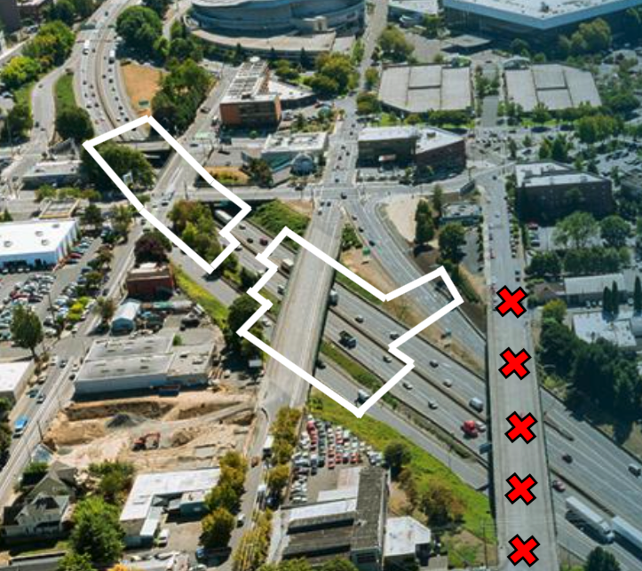
While the project touts the so-called covers, it downplays the fact that one element of the project is eliminating the current over-crossing that carries N. Flint Street over I-5. Flint street is a two-lane, two-way neighborhood street that runs parallel to the busier N. Williams/N. Vancouver couplet that funnels traffic on and off I-5. The plan for widening the freeway calls for tearing down the Flint street overpass–and not replacing it.
Disconnecting the street grid
City officials have repeatedly claimed that a key purpose of the project is to knit together a community split apart by freeway construction, in part by improving bike and pedestrian links. Portland Bureau of Transportation Manager Art Pearce told the Oregonian:
“We see the Rose Quarter project as really reconnecting the central city,” said Art Pearce, the Transportation Bureau’s manager for projects and planning. “It has the potential to reconnect the area, make it more of a destination … and having more of the bike and pedestrian streets people have come to expect in other parts of Portland.”
But this project does nothing of the kind, and if anything, severs an important local street. This point was made strongly by long-time local transportation advocate Jim Howell of AORTA (the Association of Oregon Rail and Transit Advocates), in his testimony to the City Council on November 30, 2017. Howell noted that “Flint Street is not going to be replaced, it will be lost to the neighborhood. This is one of the major North-South routes through the neighborhood, it’s been there since it was platted as the City of Albina.” (Howell’s illustration, produced below, shows the overpasses to be replaced by covers or lids (white rectangles) and on the right, the current Flint Street overpass (marked with red x’s) which will be eliminated.

And this corridor is one of Portland’s busiest, and fastest growing bike routes. In total, about 10,000 bikes per day travel north and south through this project area–a five-fold increase from 2001 levels, according to city bike counts. North Flint street, with its two-way traffic, lower volumes and slower speeds, is an attractive route for many of these cyclists. While the city doesn’t have street level counts, it appears that a majority of South bound cyclists use N. Flint Street to cross the freeway and reach the Broadway Bridge across the Willamette River: City of Portland bike counts show that 56 percent of south-bound morning peak hour trips on N. Williams Avenue turn on N. Russell (a takes them to N. Flint Street). In addition, N. Flint Street is home to the Harriet Tubman middle school, which though currently vacant, is scheduled to be re-opened to serve students from North and Northeast Portland. The project is proposing a steeply graded new extension of N. Hancock Street that would run East to West as a partial substitute for Flint Street.
If this project goes forward, Flint Street will dead-end at the new, wider freeway. Rather that “connecting” the community better, the project actually disconnects it. It’s coming to be recognized that a grid of local streets better manages traffic flow and enables pedestrian safety. And this project is a step backwards, concentrating more vehicle movements as well as more bicycles on main arterial streets, and eliminating a slower-speed, local serving street.
Why amputate Flint Street?
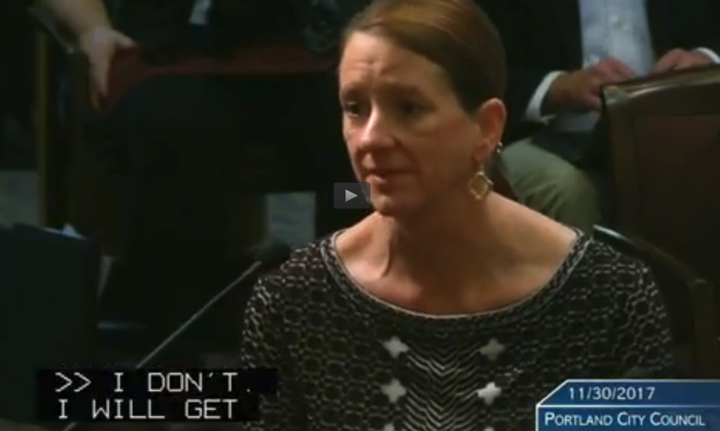
Given Portland’s reputation (mostly well-deserved) for progressive policy on transportation, you might think that the city would have a clear rationale for killing Flint Street. But according to the discussion at last week’s Portland City Council meeting, the Director of the city’s transportation bureau didn’t know what it was. After Howell and other presenters questioned the claim that the project would “re-connect the neighborhood,” City Commissioner Amanda Fritz asked Portland Bureau of Transportation Director Leah Treat why the city had eliminated Flint Street. Treat didn’t know. Here’s their colloquy, (which was repeated for the record due to a glitch in the city’s closed caption hearing system–we report both versions here):
November 30 Meeting at 1:44:11
Commissioner Amanda Fritz “I was wondering about the taking out the Flint; What’s the rationale was behind that?”
Portland Bureau of Transportation Director Leah Treat: “I can’t answer that; I’ll have to get back to you on that.”
November 30 Meeting at 1:45:25
Fritz: “My question was, do you know what the rationale was for taking out Flint?”
Treat: “I don’t; I’ll will get back to you and follow up on that.”

To put this in context: the Rose Quarter freeway widening project is the largest transportation investment in the central city contemplated in the City’s current land use plan. It’s being sold as somehow reconnecting the community and benefiting cyclists and pedestrians. And yet, when asked the simple question as to why a city street is being removed and displacing a major bike thoroughfare, the city’s Director of transportation has no idea of what the rationale for this step is.
This is a bureau that regularly agonizes over the loss of a handful of parking spaces and which has detailed and copious justifications for road diets when they are implemented. But in the case of a $450 million freeway widening project, they don’t immediately know, when asked, why their amputating a key local street as part of an initiative which is supposedly all about re-connecting the neighborhood. Given the objective and the stakes, Portlander’s deserve a clear and compelling answer to that question.
