What City Observatory did this week
A Bridge too low. The Oregon DOT is fundamentally misrepresenting the process and legal standards for setting the height of a proposed new multi-billion dollar I-5 bridge across the Columbia River between Portland and Vancouver. Ignoring the Coast Guard’s determination that a new bridge must provide 178 feet of navigation clearance likely dooms the I-5 Bridge Project to yet another failure.
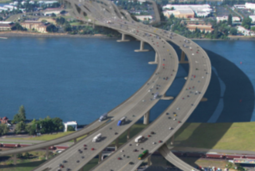
The Oregon and Washington DOTs have again designed a I-5 bridge that’s too low for navigation. In their rush to recycle the failed plans for the Columbia River Crossing, the two state transportation departments have failed to address Coast Guard navigation concerns. State DOT PR efforts are mis-representing the approval process: The Coast Guard alone, decides on the allowable height for bridges, and only considers the needs of navigation.
Those who refuse to learn from the past are condemned to repeat its mistakes. That is certainly the case for Portland’s Metro Council which voted on July 14 to wave on the Oregon and Washington highway department plans for a multi-billion dollar freeway widening project packaged as a “bridge replacement.” Then-Metro Council President David Bragdon weighs in with a warning for the Council, arguing that they have been systematically lied to by highway advocates, and that they will rue their decision.
Must read
Are state highway forecasters committing scientific fraud? The statistical foundation of every highway expansion project in the country is a forecast of future traffic. Planners build models incorporating demographic, economic and spatial data and attempt to predict how roads will perform, and what pollution will result if projects are (or aren’t built). Typically, models are built by and for state highway departments, and are a key part of their efforts to justify and sell bigger roadways. And unsurprisingly, these DOT models routinely produce just the results their sponsors want: not widening a road will lead to cataclysmic gridlock; widening as planned will lower traffic congestion and speed travel times. Its well known that these models have serious structural limitations and flaws–chief among them the inability to model induced demand, and the models themselves are impenetrable black boxes that are almost never available for external scrutiny and verification. Ben Ross of Maryland alleges that dodgy models and opaque processes have produced scientific fraud in Maryland. He and colleagues point to inexplicable anomalies in model results, which as usual, reach just the conclusion the state DOT wants. They’re asking the Federal Highway Administration to independently verfify the modeling.
Dangerous by design, 2022. Driving may be down, but the number of pedestrians killed on America’s streets and roads is going up. That’s no accident, according to the latest version of Smart Growth America’s report DAngerous by Design. The nation’s road systems are built in a way that encourages speeding and other risky driving behaviors that put vulnerable road users at greater risk. As roads became less crowded in the during the pandemic, drivers drove faster and more recklessly, with predictable results. The report’s data show that crash rates and fatalities are systematically higher in a series of Sunbelt metros with hevaily auto dominated road systems.
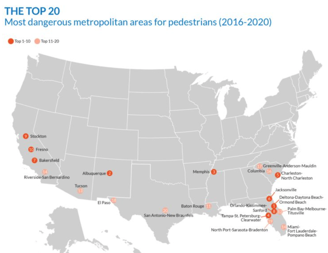
Tragically, this problem is getting worse. Even though SGA’s reports have shown this geographic pattern for years, the traffic fatality rate has continued to increase in every one of the top 20 metros shown on the map above. Once again, the report signals that traffic safety can’t be achieved by largely symbolic “Vision Zero” pledges or vapid public relations campaigns. We have to change the way our streets and roads are built and used. Until then, we can expect more of the same.
New Knowledge
The importance of two way streets. One of the key adaptations of the urban road system to automobiles has been the creation of one-way streets. Prior to the automobile, pedestrians, vehicles and horses all mixed and traveled in both directions and all streets were “two-way.” But to facilitate faster car travel, engineers created one-way streets. One-way streets may be faster, but they come at a cost to the urban fabric. For example the “back sides” of one way streets (corners facing away from the direction of vehicle traffic) essentially disappear from view and lose value
A new paper from Geoff Boeing and William Riggs points out another cost to one-way street systems: Longer trips. By definition, one way streets require at least some out of direction travel to go between most pairs of destinations. Boeing and Riggs have applied some big data to this question, and they estimate that in the typical city, a system of one way streets results in 1.7 percent percent more vehicle miles of travel due to more circuitous routes.
Applied to San Francisco, their estimates show that converting one-way streets to two-way operation would likely reduce vehicle miles traveled and associated pollution:
If San Francisco converted its one-way streets to two-ways, the new network efficiencies could improve travel distance minimization by 1.7%. This allows us to sketch out a simple back-of-the-envelope ceteris paribus estimate of surplus fuel consumption and greenhouse gas emissions, assuming an average US fuel economy of 10.5 kilometers per liter and 2.4 kilograms of CO2 released per liter of gasoline combusted. All else equal, a citywide two-way conversion policy in San Francisco could reduce annual VKT by 27 million kilometers, fuel consumption by 2.6 million liters, and carbon dioxide emissions by 6,200 metric tonnes (6.2 million kilograms)—just for intra-city trips that begin and end within San Francisco proper.
