I-5 wasn’t the first highway that carved up Portland’s historically black Albina Neighborhood.
Seventy years ago, ODOT spent the equivalent of more than $80 million in today’s dollars to cut the Albina neighborhood off from the Willamette River.
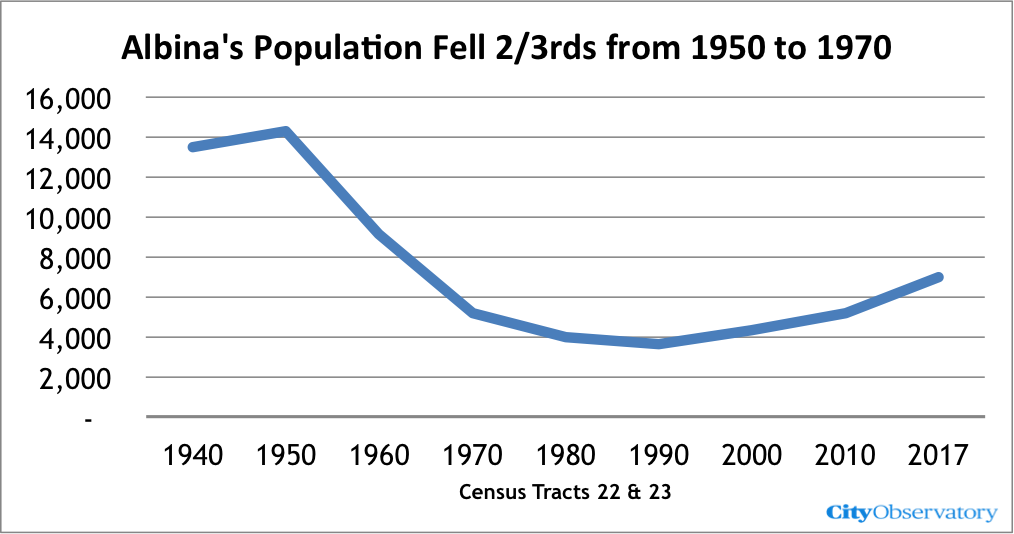
ODOT’s highways destroyed housing and isolated Albina, lead to a two-thirds reduction in population between 1950 and 1970.
Demolishing neighborhoods for state highways is ODOT’s raison d’etre.
As part of its efforts to sell a $800 million I-5 freeway widening project in Portland, ODOT, the Oregon Department of Transportation, has made quite a show of acknowledging its complicity in destroying the Albina neighborhood, which six decades ago, was the segregated home of a plurality of the city’s Black residents. But its role didn’t start with the construction of I-5 in the early sixties, nor did it end then. ODOT has made repeatedly hemmed in and destroyed Albina, starting more than seventy years ago.
In 1950, the Oregon State Highway Department built a mile-long extension of Highway 99W that cut Albina off from the Willamette River, and began the process of destroying the housing and businesses that made up the neighborhood.
It’s lost to the living memory of all but a handful of Oregonians, but before 1950, there was no “North Interstate Avenue” between the Steel Bridge and North Tillamook Street (several blocks North of the Broadway Bridge. In 1950, the Oregon State Highway Department leveled dozens of houses, and removed city streets. Here’s a grainy contemporaneous news photo from the Oregonian showing the nearly completed Interstate Avenue highway.
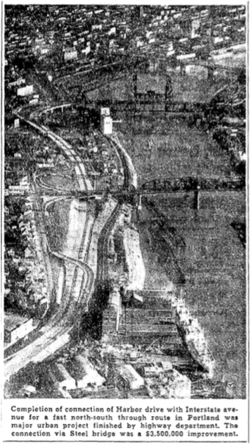
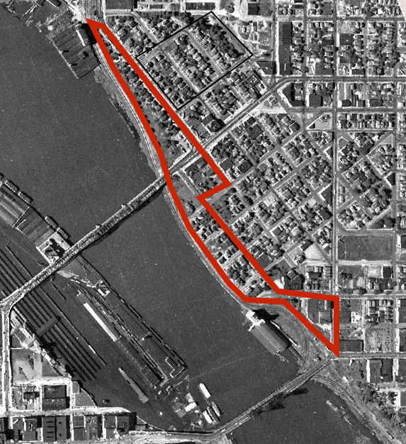
Before the highway was built, this whole area was mostly housing. In 1950, the Oregon State Highway Department spent the equivalent of $80 million in today’s money to demolish the portion of the Albina neighborhood along the Willamette River to construct a new limited access highway. The following map shows, bordered in red, the housing that ODOT demolished for Interstate Avenue. This destruction has been acknowledged only in passing by ODOT in its Rose Quarter freeway widening work.*
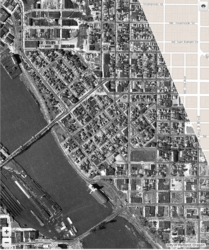
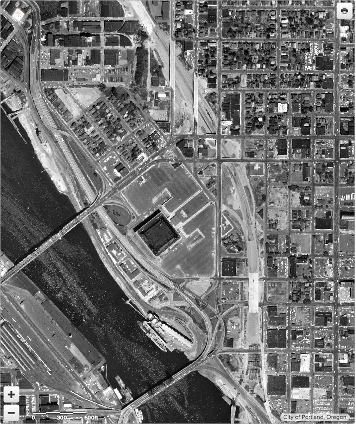
Albina in 1948 and 1962
To get a sense of how the neighborhood changed, we’ve overlaid the 1948 image of the neighborhood with its 1962 appearance. The entire area between the Memorial Coliseum and the River was cleared by ODOT for Interstate Avenue. Albina was now cut off from the river by a state highway.
[compare]
[/compare]
What ODOT hasn’t acknowledged as part of the Rose Quarter discussion is how its demolition of the neighborhood actually began even earlier, in 1950, when the department built a highway extension from the Steel Bridge to Interstate Avenue. Ironically, this highway (US 99W), was an extension of the westside Harbor Drive, which opened in 1943 and famously removed in 1974, and transformed into Portland’s Tom McCall Waterfront Park, replete with verdant lawns and cherry trees. The city’s tonier west-side had its riverbank 99W highway turned into a park; the predominantly Black Albina neighborhood’s segment of the 99W highway remains an auto-dominated arterial to this day.
Conspicuously, the ODOT narratives about its culpability for the destruction of Albina are generally confined to looking just at current right of way of the I-5 freeway. But in fact, its role in demolishing the Albina neighborhood began more than a decade earlier, with the construction of the Highway 99W/Interstate Avenue extension, and continued for more than a decade later—with the construction of the Fremont Bridge and ramps, which further devastated the Albina community (and which is conveniently left out of ODOT project maps—more about that in an upcoming City Observatory commentary).
But in 1950, to speed the flow of traffic in and through Portland, the State Highway Department (the more accurately named predecessor of today’s ODOT), condemned and demolished a strip of houses along the Willamette River for an mile-long highway project.
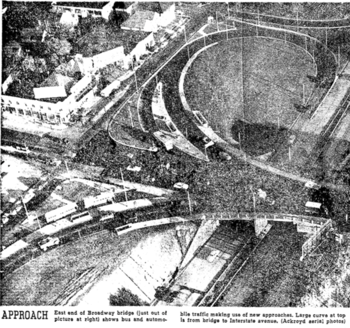
In 1950, the project cost $3,500,000. Inflated by the Engineering News Record’s Construction Cost Index, that’s a project that would cost over $80 million today.
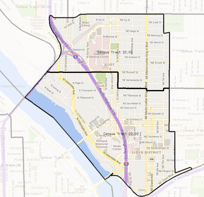
Prior to 1950, the dense neighborhood of Albina ran downhill from NE Grand and Union Avenues all the way to the Willamette River. The neighborhood was a dense network of gridded residential streets, and its two Census Tracts (22 & 23) had more than 14,000 residents. By the time of the 1960 Census, the neighborhood’s population had declined by more than a third, to a little over 9,000. The construction of Interstate Avenue (Highway 99W), an extension of Harbor Drive was just the first of a series of project that systematically demolished most of the housing in the Albina neighborhood. In 1960, the city cleared away housing next to Interstate Avenue in part for the new Memorial Coliseum, but mostly to provide for a swath of surface parking lots around the new arena.
The result of ODOT’s highway construction was to obliterate much of Albina, and to isolate the remaining parts of the neighborhood. Predictably, the neighborhood’s population collapsed between 1950 and 1970, as the area was given over to the automobile.
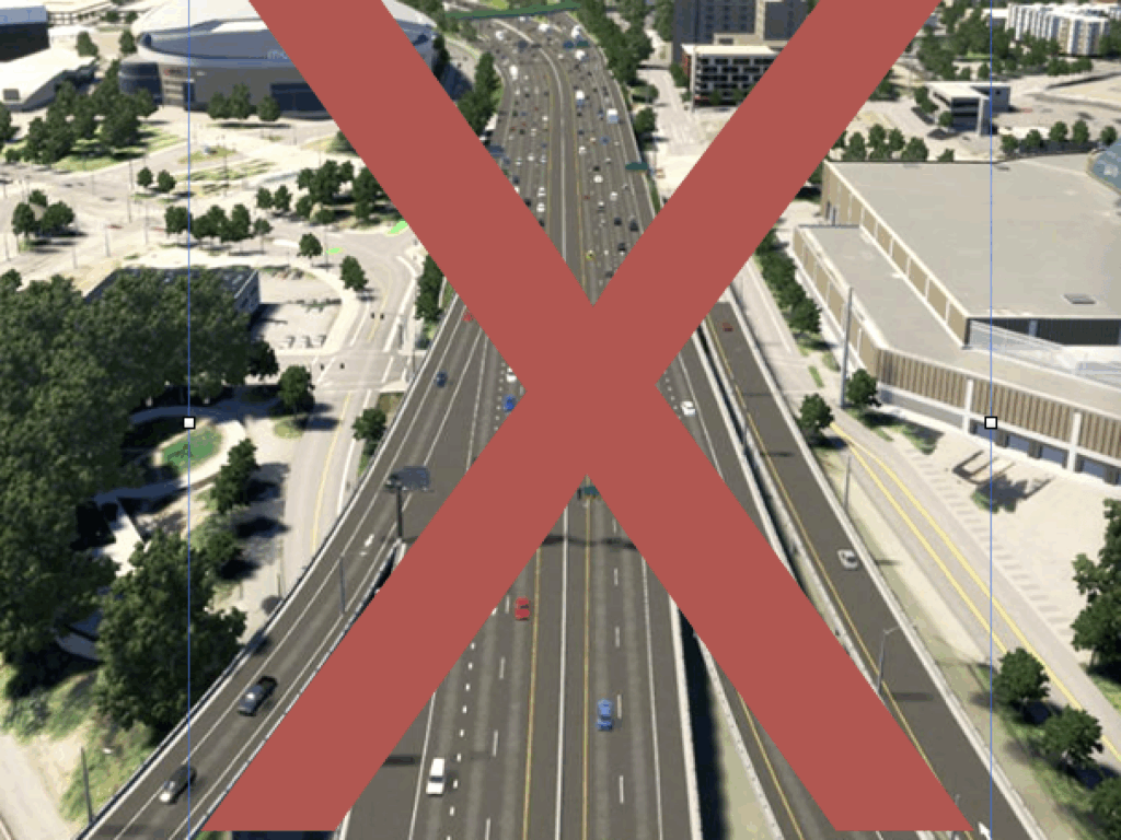
The real problem with the Rose Quarter freeway is not so much that the project increases the freeway’s footprint—which it does, in ways that ODOT has actively concealed—but rather that by adding additional road capacity, the I-5 Rose Quarter freeway widening project injects even more vehicles into this car-dominated environment. The local neighborhood association, has come to exactly that conclusion, and they’re correct: The Eliot Neighborhood Association’s land use chair has written:
The only real change the project would make to the surrounding area would be widening the highway, a car-capacity increase that will barely change travel times through the area. It would also serve to put more cars into our local street network, which has led to renderings showing even wider streets through the area than we have now. This would increase road noise and reduce the value of land around the project area.
* Editor’s Note: The originally published version of this story incorrectly claimed that ODOT’s Rose Quarter analysis had not acknowledged the destruction of housing by the construction of Interstate Avenue in the early 1950s. In fact, one table contained in the project’s environmental justice section concedes that this project demolished at least 80 homes. Thanks to a regular reader who pointed this out. City Observatory regrets this error.

