Where are walkable local shopping districts in your city?
There are just six shopping days left until Christmas; while much of our shopping is done on-line or with at big box stores and national chains, many consumers look to support their local businesses during the holiday season. Where, exactly, can you find the clusters of local shops that representative alternatives to getting malled?
Part of the answer comes from City Observatory’s Storefront Index–we’ve mapped the location of millions of customer-facing retail and service businesses in cities throughout the nation, with an emphasis on identifying clusters of businesses in close proximity to one another–where you could conceivably walk from one establishment to another (or several others). One great feature of the Storefront Index is that it shows the pattern and density of retail activity throughout a metropolitan area.
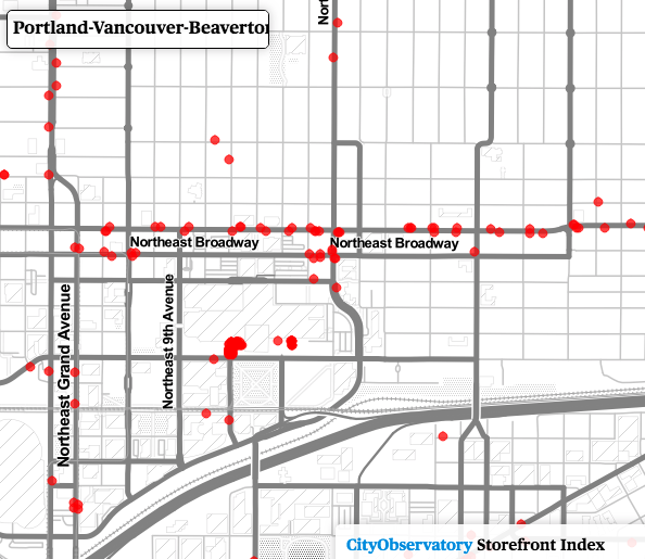
Our Storefront Index includes a series of maps, available for the nation’s 51 largest metropolitan areas, that show the location, size, and intensity of neighborhood business clusters down to the street level. Here’s an example for Portland, Oregon. On this map, each dot represents one storefront business. This maps shows storefront businesses throughout the metropolitan area. In downtown Portland, there is a high concentration of storefronts; as one moves further out towards the suburbs, the number of storefronts diminishes, and storefronts are increasingly found arrayed only along major arterials.

A key message of the index is that retail businesses, especially small, local ones, don’t do well in isolation. They thrive when they’re part of an environment that combines public spaces and private establishments in a dense, and mutually reinforcing array. A local book store, like Portland’s Broadway Books, is more likely to flourish if its located–as it is, near to restaurants, coffee shops, bakeries, florists, and other establishments that generate foot traffic and create a lively and enjoyable place to walk.
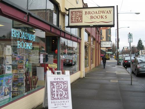
Broadway Books is located in one of these thriving l neighborhood business districts: Northeast Broadway. We can use the Storefront Index map to zoom in to the local area to see the array of businesses lined up along both sides of the street, a walkable string of pearls for shoppers.
 ,
,
As Jane Jacobs so eloquently described it in The Death and Life of American Cities, much of the essence of urban living is reflected in the “sidewalk ballet” of people going about their daily errands, wandering along the margins of public spaces (streets, sidewalks, parks and squares) and in and out of quasi-private spaces (stores, salons, bars, boutiques, bars and restaurants). These urban street spaces are especially active this time of year, when the usual flow of customers is swelled by holiday shoppers.
You can use the Storefront Index to zoom in to any neighborhood in any of of the fifty largest metropolitan areas in the US; it will show you which places have a diverse array of storefronts in close proximity to one another, and which places have a paucity of such concentrations.
Maps of the Storefront Index for the nation’s 51 largest metropolitan areas are available online here. You can drill down to specific neighborhoods to examine the pattern of commercial clustering at the street level.
We also use the Storefront Index to track change over time, looking at the growth of businesses and street level activity in a rebounding neighborhood in Portland. There’s also strong evidence to suggest that concentrations of storefront businesses provide a conducive environment for walking. We’ve overlaid the storefront index clusters on a heat map of Walk Scores for selected metropolitan areas to explore the relationship between these two measures. While Walk Score includes destinations like parks and schools, as well as businesses, it also measures walkability from the standpoint of home-based origins, while our Storefront Index shows the concentration of commercial destinations.
City Observatory has developed the Storefront Index as a freely available tool for urbanists and city planners to use in their communities. The index material is licensed under a Creative Commons Attribution license (as is all City Observatory material), and a shape file containing storefront index information is available here.
